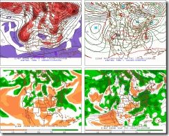
Thursday we will see a Clipper pulling out of the Great Lakes, at the same time there will be a storm forming over the Gulf States and start to move northeast. As for a storm, everything will hinge on how much the northern and Southern systems interact with each other. So, depending on how this all intensifies we could see a significant snowstorm. The Euro is still holding its ground and showing a major snowstorm. The Euro has been very consistent over several runs showing phasing of the northern and southern streams. If the Jets phase it keeps things cold and allows southern moisture to move farther north. Which makes for a big snowstorm.
Until last night the other models weren't agreeing with the Euro's assessment. That changed when the models moved toward the Euro's idea of what this storm would be like. The 00 and 06 GFS took a fairly major step towards the Euro. The GFS has moved north as have other models like the Canadian.

Euro for Friday


Euro for Saturday


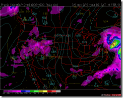
GFS for Friday


GFS for Saturday


GFS Ensemble for Friday
The Euro and GFS are showing a large moisture plume into Northern NYS and NE.
So we all should see a widespread snow event. depending on the track, we could several inches in northern areas of the Northeast. Right now the track looks to be east of Cape Cod.....
The GFS shows a significant snowstorm for Eastern New England, with western New England and eastern NYS seeing at least a moderate snow event. The Euro is showing an even bigger snowstorm. A track east of Cape Cod would place the western Adirondacks, western Mohawk Valley, and Tug Hill on the fringe of the disturbance, which would mean light snow....Just a few inches at most. The situation is very fluid and can / well change over the next few days. Depending on the exact track this could be a major hit for all of us, some of us, or none of us.
Still watching the possibly of a Valentine's Day storm. There looks to be a bit of warming to start next week then we will see things start to cool off.....mid to end of the week, which would correlate with the storm moving into the region....but before we can talk about next week, let's get though this coming Friday first.
That’s it…I will have more later…I will post some updates on the blog and others on my weather page.
Rebecca

No comments:
Post a Comment
Thank you for taking the time to comment, I will answer as soon as I can.