The Tropics in the
Atlantic Basin are quiet, and look to
stay that way for at least the next five
days. The reason is strong wind shear
and dry stable air. When you have this kind of setup the tropical
waves moving off of Africa heading across eastern and the central Atlantic have no chance of
forming tropical cyclones.
El Nino is still
missing in action. But the teleconnections and sea surface temperatures (
SST's) show a good likelihood of El Nino.
The Climate Prediction Center (CPC) still has the chances for El Nino at
70% for later this Summer and up to 80% for the Fall. As I've been saying, I think it will happen later this Fall. Some are calling for a strong El Nino. But I don't think its going to be that strong.... more likely weak to maybe moderate. As I've said in many blog post and on my
accompanying Facebook page...eastern based El Nino's cause wind shear to
increase over the tropical Atlantic Ocean.
So with the Setup in the Pacific still strongly pointing toward El Nino,
it is really no surprise to see all the wind shear over the Atlantic.
I've also mentioned
quite a few times that Saharan Dust
inhibits tropical formation as well. It typically brings dry air that is not
conducive to storm development, and some studies have suggested the dust itself
has an effect on cloud formation, dust that is suspended in the wind absorbs
and scatters solar radiation. This means less sunlight reaches the ocean
surface, resulting in cooler temperatures
in the tropical Atlantic Ocean, therefore cutting off the fuel supply to any
waves moving over the tropical Atlantic, and inhibits development of tropical
cyclones. Just remember inhibits doesn't
mean excludes tropical cyclone formation in the Atlantic Basin.
Any tropical waves
that do make it into the Caribbean and Gulf; they can become tropical Storms
and hurricanes. As was the case of Arthur.
Because of the setup over the Atlantic Basin, the East and Gulf Coast
are more at risk for land falling tropical systems.
This coming week is
going to see an old friend return. That being the Polar Vortex. I'm sure most of us can remember the havoc
the polar vortex caused last winter..........
Next week
unseasonable very chilly air looks to move into the Midwest and Northeast. The
vortex is going to allow a very cool air out of the Gulf of Alaska to
plunge into the northern tier of the U.S. typhoon Neoguri that just hit Japan,
is going to play a huge role in the pattern, by amplifying the area of low pressure over Alaska. The west
coast trough will act like a slide giving a clear path for the cooler air to
the south. Right now it looks like the
Midwest will take the brunt of the cold. However the Northeast will see temps
10-20 degrees below average, especially in the northern parts of New York and
New England. I expect to see
record lows set this coming week.
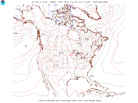
Current surface chart, note the low in the Gulf of Alaska.
Here is the position of the vortex on Monday.
For Tuesday
And for Wednesday.
We had a very volatile
Winter....The Spring saw the same
type of validity... I expect Summer of 2014 to continue the same theme ...long
range teleconnections and models are showing a pattern of wild temperature
swings and possibly an active severe season this Summer. One only has to look
back to this past Tuesday to see just how severe it could get.......


No comments:
Post a Comment
Thank you for taking the time to comment, I will answer as soon as I can.