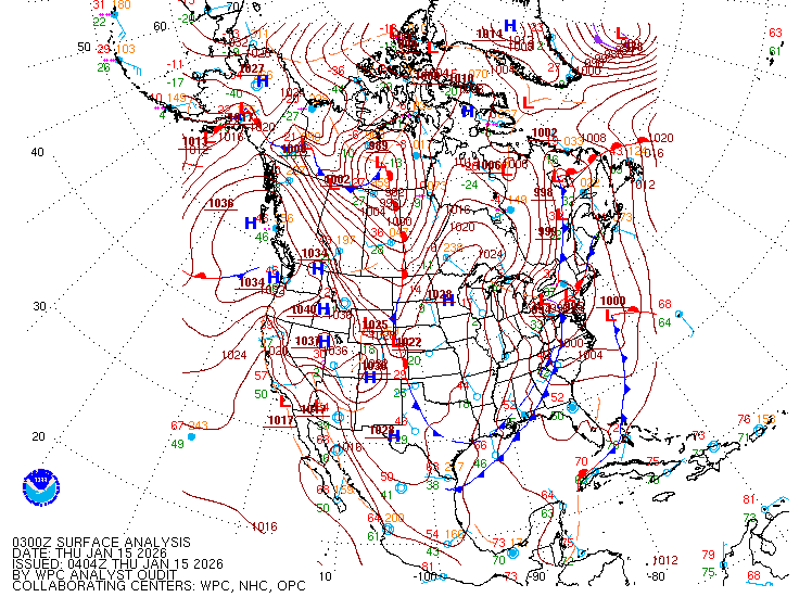
Today in the Northeast U.S. it is Sunny with seasonal temperatures winds are gusty with gust of 20-30 mph possible. We do have a weak cold front dropping through. Tonight, thru tomorrow rain will track northwest to southeast. The air coming in is going to be well below average. So northern parts of New York State and New England will see mixed precipitation with the higher elevations seeing some wet snow. The highest elevations of New York State, Vermont, New Hampshire, and Maine, could end up with a few inches. Next week is going to be very cool and blustery. Monday is looking wet, with scattered rain/snow showers hanging around for Tuesday and Wednesday.
This front
is going to continue to drop south during the upcoming week, making it all the
way into Florida. This dip in the Jet Stream, will keep any tropical systems
out of the northern Gulf of Mexico and the Atlantic north of the Main
Development Region. The Atlantic Basin has been incredibly busy the last couple
of weeks, so this is a welcome reprieve. Speaking of the tropics…
Tropical
Write Up
The season
started out very busy then we had a 3-week break, after that the Atlantic got very
busy again. So far there have been five landfalling hurricanes on the US
mainland.
Leslie
Post Tropical
Storm Leslie is in the open center Atlantic, with sustained winds of 50 mph and
a central pressure of 1000mb, she is racing northeast at 31 mph. she might pass
close to the Azores.
A Tropical
Disturbance dubbed Invest 94L is in the Eastern Atlantic. The conditions for
development are favorable so this could become a tropical depression in a few
days. The National Hurricane Center is giving this 2 day and 7 day develop odds
of 30%. This is generally tracking west,
and could be near the Lesser Antilles end of next week. The pattern over the US
should keep anything away from the CONUS for the next 7 to day days. But this
is still something to keep an eye on.
There is a
chance we could see something try and form later next week in the southwest
Caribbean. The GFS model is the most bullish on this developing, with the other
models less so. Again, this is something to keep an eye on. If anything does
develop it would likely become an issue for Central America.
Image Credit Wikipedia
This has
been a strange hurricane season. The overall number of tropical cyclones this year
have been slightly above average. But the numbers of hurricanes and major
hurricanes have been well above average. As of now, there have been 13 total
storms, with 9 of then becoming hurricanes, and 4 of them becoming major
hurricanes. There is still 7 weeks left
in the season, with the SST in the Atlantic Basin (especially in the Main
Development Region) being exceptionally warm there is still a chance for more
late season activity. This will depend on how favorable the atmospheric
conditions remain. The official hurricane season ends on November 30th,
but it is possible we could see tropical disturbances develop past that date.


Thank you Rebecca!
ReplyDeleteYou're welcome
Delete