
We are now in meteorological summer and the 2025 hurricane season in the Atlantic has officially started.
It's been quite chilly and rainy but all of that is about to change. The surface chart shows high pressure in the Ohio Valley, that is going to work its way towards the coast.

The trough that caused all the cool and windy conditions over the weekend is starting to lift out. As the high pressure continues to build east we're going to see a western Atlantic high pressure ridge start to develop. But for today we're still close enough to the departing trough that it is going to affect our temperatures a little bit today We will see slightly below average temperatures across the region during the day but we still should have mostly sunny But hazy skies with a few isolated showers over Maine. Winds will be out of the west northwest at 10-15 mph.

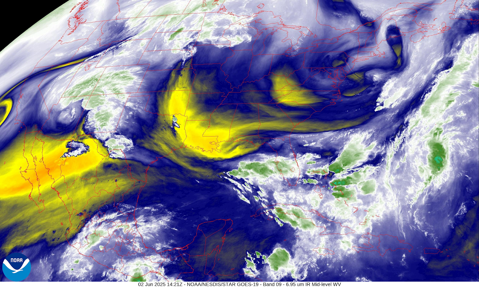
The water vapor satellite image shows all this very well.
The haze is being caused by Canadian wildfire smoke that is being directed into New York, Pennsylvania and northern Middle Atlantic. The vast amount of the smoke isn't reaching the ground. But there could be enough that those extremely sensitive could have some breathing issues.

We should be out from under the influence of the trough tomorrow; as the high pressure continues to develop. Tomorrow should see plenty of sun and dry conditions with temperatures that are going to be seasonal.
The infrared satellite image shows we have mainly clear skies all the way towards the Rockies.

As we get into midweek, we're going to see a decent upper level ridge developed over the eastern United States. The high pressure is going to be off the coast of the Carolinas The southern flow around this area of high pressure is going to allow southern heat and humidity to move north into our region here in the Northeast and northern Middle Atlantic. All of this is going to really allow our heat and humidity to climb for Wednesday and Thursday making it feel very summer like. This will be our 1st taste Of true heat and high humidity.

On the above chart we can see a cold front approaching from the west. The models are at odds on how fast this will move through the region. The EURO is a little faster and the GFS is a little slower. Right now it looks like the frontal boundary is going to try to approach on Thursday across New York State and Pennsylvania. This will set off scattered rain showers and thunderstorms Some of these thunderstorms could be strong severe during the afternoon into the evening. As all this tries to move east it looks slow down weaken and dissipate. So as this approaches New England and New Jersey Showers and storms should become more isolated. Thursday night and Friday The front should start to slide through providing more rain showers and thunderstorms again some of these could be strong to severe as everything moves through that muggy air mass. The cold front will continue rolling through friday night into Saturday. We should see clearing developing west to east across the region Friday night and on Saturday. High pressure will be sitting overhead on Sunday providing mainly sunny skies and lower humidity our temperatures should fall back to around seasonal. Monday will see the high pressure start to drift east as another system approaches from the west.
Hopefully we stay out of the rain for a while,The ground is saturated to the point that when you walk in the yard your foot squeezes the water up.Some spots have water above the grass.
ReplyDeleteSo now is your time of the year, Hurricane's and other Severe Storms.Have a Great day.
The lousy heat and humidity had to show up sooner or later. I'm just hoping for an early and cool Autumn.
ReplyDelete