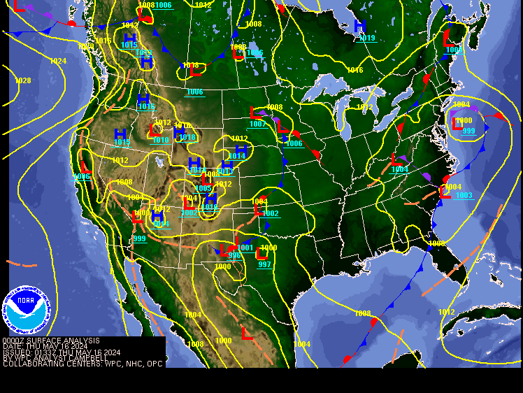
Todays Northeast weather discussion…
The high pressure that has brought all the beautiful weather, is starting to exit stage right; as a cold front approaches the region out of the Great Lakes and Ohio Valley. The front will bring rain showers and cooler temperatures.
Clouds will
be increasing west to east across the region, with scattered rain showers moving
into our western areas this evening. More in the way of widespread scattered
rain will be closer to the Canadian Border as the low pressure will be moving
across southern Canada into the Saint Lawrence Valley; the farther south you
are the more in the way of isolated rain showers you will see. Winds ahead of
the front will become breezy.
The front
will be a quick mover, so the rain will be pushing away during the overnight into
tomorrow. The rain should end over eastern New England tomorrow morning. Behind
the front winds will become northernly which will bring in much cooler air to
the region. The rain that is coming won’t be near enough to reverse the drought
conditions parts of our region are experiencing.
Tomorrow
afternoon into next mid-week skies will be mostly sunny and mostly dry. Friday
night into Saturday morning another cold front will push through, most of us
will stay dry, but this will bring the chance for a few rain/snow showers. Those
in far northern New York State Vermont, New Hampshire and especially northern
Maine will have a better chance of seeing the rain and higher elevation snow
showers. Friday into Wednesday will see seasonal to seasonally cool. The high
pressure should keep the bulk of the region dry during that time. Later Wednesday
we will see the high pressure start to give way to another frontal system,
approaching from the west. This system
will move through late Wednesday and Thursday, bring back the chance for rain
and snow showers.
The Tropical Atlantic...
What's left of Oscar is heading away from the U.S. East Coast toward Bermuda and then Atlantic Canada late Thursday/Thursday night. He will bring strong winds of around 40 to near 60 mph ( 60-90 km/hr.) and a lot of rain to parts of Newfoundland. There will be a risk for localized flooding. Currently the rest of the Atlantic Basin is quiet. This should last for the next 7 to 10 days. But then the Atlantic Basin should wake back up as we get near Halloween into the first half of November. As I said the other day, I still think Patty is out there.


No comments:
Post a Comment
Thank you for taking the time to comment, I will answer as soon as I can.