
Welcome to another day of extreme Northeast heat, high humidity and lots of sun. As we're under this bubble of high heat, many of us are going to break record highs for this point in the year. The high heat and uncomfortable humidity is making for very high heat indexes. Already heat indexes are in the 90s°F to low 100s °F; It will only get hotter as the day goes on.
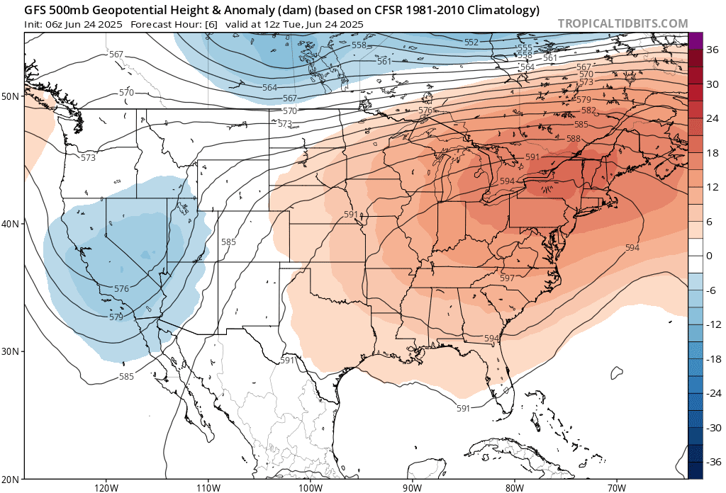
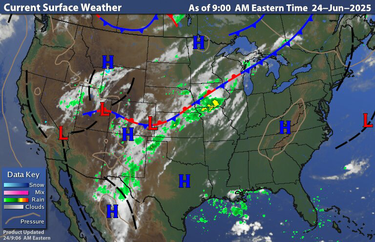
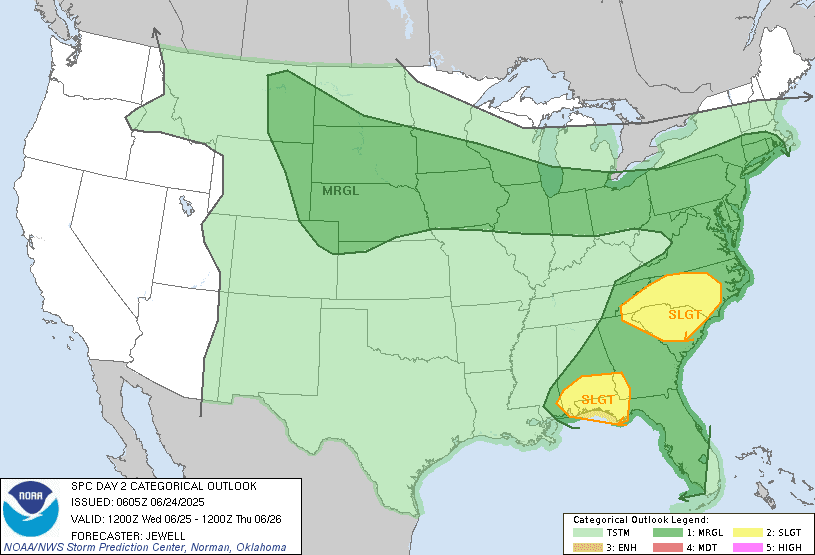
The surface chart shows the high pressure ridge That stretches over half of night states is centered right over our region. Radar shows no rain at the moment. Under the heat dome rain is going to be very isolated with perhaps a chance for isolated thunderstorms here or there.Those closer to the edge of the dome will have a better chance for isolated thunderstorms today. Any thunderstorm will be capable of heavy downpours, frequent lightning and gusty winds. There is a chance for strong to severe thunderstorms late this afternoon into the evening. Especially across New York State into northern and central New England. These storms will be capable of damaging winds, medium to isolated large hail and heavy downpours. Tonight will be another uncomfortable night for sleeping if you don't have an air conditioner.

Tomorrow is going to be another very hot day as a cold front approaches the region from the north. Temperatures Will be a degree or two lower, than they are today. As the front gets closer we will see scattered rain showers and thunderstorms during the afternoon into the evening. Some of the thunderstorms in the afternoon and evening could be strong to severe with damaging winds moderate to isolated large hail and heavy downpours. Those with the greatest chance of seeing any severe storms will be across Pennsylvania, southern New England into the northern Middle Atlantic. Tomorrow night will still be another very warm night, with uncomfortable humidity ahead of the front. The cold front will continue to slowly push south Tomorrow night and on Thursday. Temperatures For Thursday and Friday will be cooler than they have been. What temperatures will still be above the seasonal average for this time of year.
Thursday night the cold front is going to stall. Then for Friday Saturday and Sunday We will still be under the influence of the frontal boundary continuing the chances for rain showers and scattered thunderstorms.
Over the weekend into next week Temperatures will start to climb again But they won't be as hot as they Word for Monday through Wednesday. A cold front will approach the region next Tuesday.
Thank you.
ReplyDelete