Welcome to the last day of April!
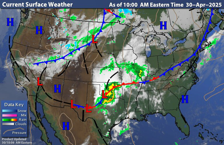
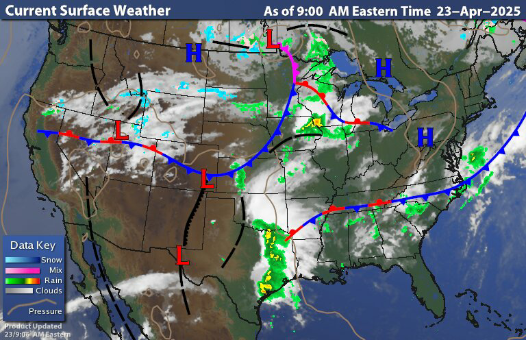
The current frontal chart shows the cold front pushing east currently sitting over new England back into the northern middle Atlantic Behind this we have high pressure building into the region We do have some low pressure along the front down in Texas that is going to bring them some severe weather today.

Radar and satellite show some rain down over the cape and off-shore islands with clearing moving in from the west we do have some cloudiness coming in off the Great Lakes but for the most part today will be cool but fairly sunny. Tonight will be clear or almost clear skies, this will lead to temperatures getting very chilly for the end of April. Some parts of New York state and New England could even see some frost so keep that in mind if you have sensitive plants outside.
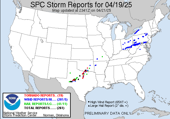
That system over Texas and Oklahoma will start to play a role in our weather on friday As a warm front lifts into the region ahead of this there could be some scattered showers this could set off some scattered showers and maybe a few thunderstorms
This high pressure will be with us tomorrow morning. So we should be dry with lots of sun during much of the day. We will have low pressure moving into the Great Lakes heading into Canada Ahead of this we will have a warm front approaching our region This will allow us to warm up a bit for tomorrow. The warm front could bring some showers to western parts of the region including a few isolated thunderstorms tomorrow later morning into the afternoon. A couple of these could be on the strong side. The showers and possible thunderstorms will work east across New York State and Pennsylvania during the day.
For friday the warm front will continue to move across the region with the chance of showers and thunderstorms moving along with it during the day. With the frontal passage Our temperatures will once again become above average. Though in the warm sector Thunderstorms will have a greater chance of more in the way of widespread thunderstorms Some of these thunderstorms could be strong to severe. Saturday we'll see the cold front slide through the region We will find widespread rain showers and isolated thunderstorms. Some of these thunderstorms could be on the strong to severe side.

For Sunday Into next week things will get a little more complex as we will have low pressure coming out of the midwest that's gonna drop south and east and looks become cut off from the overall flow. We're also going to have another cutoff load developed off over the southwest US. To the north of these cut off lows we're gonna have strong ridging up over Canada. This type of pattern this called a high over low pattern, It's kind of a blocking pattern. Our weather will depend on where these cut off lows end up setting up; if they migrate further south we would have more influence from that high pressure and have more in way of dry weather and more sun. If the cutoff low is farther north, we could come under the influence of the precipitation rotating around the low, leading to more in the way of rain for at least southern parts of the region. The farther north you are away from the center of low pressure, the less rain you will see. For now the weekend is looking to be a bit chilly and it looks like it will be unsettled with chances for showers Sunday through maybe Wednesday; but again all that will depend on where that cut off low ends up setting up.
Many times the month of May can experience a pattern that is slow to change. If the pattern I talked about above persist the lack of strong net flow could leave the same general pattern holding on into at least the middle of May. The second part of May could become quite active with severe weather. I'm basing this on how the pattern looks to evolve. So we will see.

Looking more at the pattern, we do have the neutral El Nino Southern Oscillation (ENSO) in the pacific and we have those cold temperatures in the main development region of the tropical Atlantic , both of these will have a big impact on the Atlantic hurricane season. I will be posting a hurricane outlook later in May. One thing we're gonna have to watch is how the Pacific Decadal Oscillation (PDO) and the Pacific Merdional Mode ( PMM) teleconnections end up evolving. If they end up going negative, which means we have colder Sea Surface Temperatures (SSTS) off the West Coast up into the Gulf of Alaska. This set up would mean a general pattern of a prominent ridge in the Plains into the Midwest, which would mean a lot of heat and lack of rain there. For the East Coast, we would see more in the way of troughing, which means we could see more pronounced rain in the Southeast into the Middle Atlantic. northern parts of our region could see overall precipitation closer to average. We could also end up being cooler overall when it comes to summer temperatures across the region. I touched on all of this when I was released the summer general outlook several weeks ago. We will just have to wait and see how this impacts our summer.


 @NWSSPC