
Here 's a look at The current surface chart.

We can see the occluded, warm front and cold fronts attached to that low pressure in Canada, pushing east over New England, most of the rain is off the coast but there is a little bit of rain up over Maine. Behind all of this we have a mixture of sun and clouds As high pressure starts to build into the region. As the frontal system continues to push east we will see skies continue to become clearer.

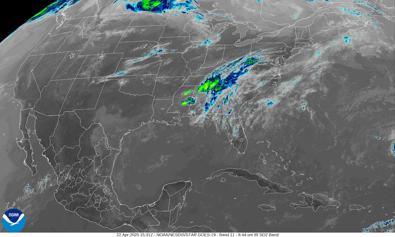
This all shows up clearly on the visible and infrared satellite images. The disturbance in the south is gonna continue to push east and won't impact our weather here in the northeast, we do have a cold front out in the Plains and Upper Midwest, This is going to lift north towards the great lakes and not have much of an impact on our region.
We're gonna be under the influence of high pressure for the next few days. This will lead to a warming trend during the entire work week. For tonight and tomorrow we should have clear skies With lighter winds and it should be dry This will make it good to go out and try to view the meteor shower and a chance to view the Northern lights. Thursday we're going to have a disturbance to our north that's going to pull a warm front into and through the region, southern winds will usher in very mild air across the region, most should stay dry, but there is a chance for a few isolated showers, this will be especially true over northern New York into northern new England. Friday we will see the high pressure start to slide east as a low pressure frontal system approaches from the west, Friday will continue to be mild, but as the cold front approaches we will see clouds increase with the chance for a few rain showers late in the day for western parts of the region. The cold front will slide through on Saturday; we will see widespread showers and thunderstorms, some of these thunderstorms could be strong to severe. Right now it looks like the those are the greatest chance of seeing severe weather will be across eastern New York state down into the northern midland into western new England we will see how the timing of all this works out as we move closer. Behind the front Sunday will be noticeably cooler, With improving conditions, as high pressure approaches The high pressure will be overhead on Monday providing dry and sunny conditions Then on Tuesday This area high pressure starts to shift east, as another system approaches.
Thank you!
ReplyDeleteI have read some info from National Weather Services that mentions the ocean current could be changing - they pointed to the Indian Ocean changes. in temperature in the Eastern and Western parts and speculated what it could be for the normal currents that we use for El Nino and La Nina predictions. Any thoughts on weather changes with dramatic current or temperature changes?
ReplyDelete