The sight of low ominous clouds in the summer is fairly common. During a storm people often take very impressive pictures; these pictures are often sent into TV stations and blog sites accompanied with the question “was this a tornado?” This post will discuss things that are often misidentified as tornadoes. If you’ve been guilty of this in the past, don’t feel bad, even experienced spotters can make the same mistake.
Fractus Clouds:
These are the clouds that are most often mistakenly thought to be a funnel cloud or even a tornado itself. Fractus clouds are also known as scud clouds.
Scud clouds are created when the cooler outflow is interacting with the warm air ahead of the storm. when this warm, moist air is lifted upwards. The environment is such that the rising moist air is quickly cooled which forms a cloud. When this happens in front of a thunderstorm, the wind can push the clouds away from an updraft, causing the clouds to away from the storm. This gives the clouds a ragged and wispy look. Scud’s can change shape rapidly. If the scud’s are in a outflow they can move fairly quickly. If they’re caught in an updraft they normally rise and may even show some lateral movement.
Scud clouds are not dangerous taken by themselves. However, their presence often is a good indictor that strong gusty winds are in and around the storm.
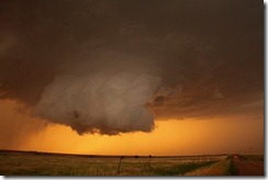
Fractus clouds are also mistaken for wall clouds.

This is a picture showing what a wall cloud. Wall clouds can take on many forms but normally they look like this. From looking at it, you can see why shelf clouds are sometimes mistaken for a wall cloud. The presence of a wall cloud can be an indication of a mesocyclone but not always. usually a shelf cloud is on the leading edge of a storm. Whereas a wall cloud is seen more or less at the rear of a storm.
 Photo by CWG photographer Ian Livingston
Wall clouds are often associated with tornadic thunderstorms but not always, and many wall clouds do not rotate. However, the presence of one is more often than not a sign of a mature severe thunderstorm. When the wall cloud is rotating a tornado could drop down. The wall cloud aids in tornado development because it brings the base of the cloud much closer to the ground.

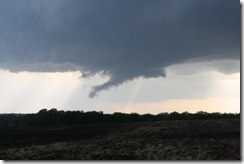
Is this a wall cloud? No this is just a scud. But you can see how the mistake could occur.

A wall cloud accompanied by a tail cloud. The low-hanging, tapering feature at right is called a tail cloud, and is an inflow feature. A tail clouds often forms between the low level mesocyclone and the forward-flank core. A tail cloud forms below the level of the main cloud base. Tail clouds sometimes have very fast, horizontally tilted rising motions. Because they can hang so low, look a lot like a funnel, and contain rapid cloud movement, they are sometimes mistaken for tornadoes. The key with suspicious cloud features is to look for rapid rotation, and evidence of spinning debris under the cloud base.
NOAA Photo Library, NOAA Central Library; OAR/ERL/National Severe Storms Laboratory (NSSL)
Precipitation shafts:
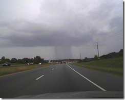
These are areas of rain and/or hail under a storm. A precipitation shaft can fool people into thinking there’s a tornado. The best way to tell what you’re looking at is to watch the motion around the area Most of the time in a precipitation shaft you will see a downward motion. Whereas if it's a tornado you will notice a rapid rotational motion. A tornado will change shape very quickly, while the area of precipitation in a shaft will change shape very slowly.

Here is a picture of a rain shaft. In this picture there is a very thin but intense rain shaft. This kind of thing can fool untrained people or inexperienced spotters can be fooled into reporting a tornado. In this type of situation you should always look for signs of rotation or power flashes. But sometimes rain shafts can look so much like a tornado that even veterans spotters are fooled. This type of misidentification is especially true if the storm is a few miles away; because it’s is near imposable to tell if it’s rotating. But in the heat of the moment it’s always best to call in a specious lowering.
Before I close I will show you a few more pictures of scud clouds.

A very impressive scud cloud


Here is a picture I snagged from the NWS Morristown, TN. This photo was taken my Bean Station. It’s one of the most impressive pictures of a tornado lookalikes I’ve ever seen.As is the case of all pictures it hard to tell if this is a tornado because it’s very hard to tell if there is any rotation. Also it's hard to tell which direction the storm is moving. But there are other clues in the picture that tell us it’s not a tornado. If you look at the pictures of wall clouds above, you will notice there isn’t a wall cloud in this picture (not all tornadoes are accompanied with a wall cloud. However, most tornadoes are associated with a wall cloud). What you’re seeing is a shelf cloud (the arched blue line). Rain is always behind the gusty winds under the shelf cloud. So now we know the direction the storm is moving (shown with the yellow arrow). Now the scud cloud (red arch) is being pushed in the direction of the strong winds. This shows why you should always look for all the clues you can in trying to determine if you’re seeing a tornado or not. Because as this picture shows scud clouds can be convincing enough to fool even highly trained individuals.
As I said in my last post, things like downburst,Rear Flank Downdraft, Roll clouds, and Shelf clouds are also misidentified as tornadoes. The main things to look for when you think you see a tornado are: rapid rotation, power flashes, and debris in the air.
Here a two links to post I’ve done on Tornadoes and severe weather.
The Tornado
Clouds associated with severe weather
I hope you enjoyed this post. As always I will be happy to answer any questions you may have.
Rebecca.

No comments:
Post a Comment
Thank you for taking the time to comment, I will answer as soon as I can.