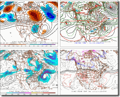
GFS for tomorrow

GFS for Thursday

Friday’s GFS

Saturday’s GFS, it’s still dry in the Northeast. But, the model is showing something trying to from off the Southeast Coast.
Looking out a bit farther, We should have a storm trying to get its act together off the Southeast Coast late this weekend or early next week. The NAO is forecast to go back to the negative side around the same time this storm is forming. Right now, the feel I get from the models and other things I look at. The storm looks to be moderate (at least at this time). If you can gather from my wording, I do believe a storm will form. The question is what track will it take and how strong will it be.
The ingredients for all of this to happen look to be in place.
1) We will have an strong high over eastern Canada and part of New England.
2) The jet stream will help things along.
We will have a split flow; this will help to get something started off the Southeast Coast. Most of the models are showing a storm forming late Sunday or Monday. The storm won't be a fast mover (again at this time) So it will have time to deepen as it moves up the East Coast.

Euro for Thanksgiving
If you read my winter outlook. You know forecasters look at a lot of things: ENSO, NAO, AO, jet stream, and the polar vortex (this is just a big area of low pressure sitting over the North Pole). The vortex is key to when and how strong our cold outbreaks occur here in the Northeast. like I said in my outlook. This winter will see swings between warm ups and cool downs. Where am I going with all of this you ask......fair enough......The biggest fly in the ointment, will be cold air. Right now, our air temps next week look moderate for a snow event in the Northeast. And like I said in my outlook, Snowstorms will depend on the timing between the storms and the cold outbreaks.
That's about all I can say about it now, We will have to see if a storm starts to form Saturday or Sunday off the Southeast Coast. We have over a week for things to get sorted out.........
Rebecca

No comments:
Post a Comment
Thank you for taking the time to comment, I will answer as soon as I can.