
The Atlantic hurricane season is almost here. The season will start on June 1. So here are my thoughts on this year's hurricane season which will run until November 30.
Remember, a hurricane outlook tries to come up with the overall level of hurricane activity during the season. It'll look at things like sea surface temperatures, past seasons, look at teleconnections patterns. Using these things the outlook will try to project the overall number of named storms and if any of them might become hurricanes or even major hurricanes. It is important to remember it's not a specific forecast, rather it's an overall look at how the season might transpire.
My outlook last season was very accurate! We will see how this one does.
In past years I have posted my hurricane outlooks in three parts. But due to the fact that the page just isn't getting the views I would like to have. I don't want to invest the time and all the work necessary to do that. So this outlook will be my final hurricane outlook for 2025.
A few things I want to go over:
I want to point out that the Atlantic Basin includes the entire Atlantic Ocean, the Gulf of Mexico and the Caribbean.
Currently there's not a lot happening in the tropical regions of the Atlantic basin; which would be expected for this time of year But I do want to point out that from 2015-2023, the season saw their first tropical cyclones before June 1. 2024 broke that pattern with the 1st storm happening after June 1. Based on this the odds favor Seeing the 1st Tropical cyclone of the season could be in just 2-3 weeks. We'll have to see if that happens.
Teleconnections:
The El Nino Southern Oscillation (ENSO) is currently neutral. When we look at the model predictions they show the ENSO staying neutral for at least the first half of the hurricane season. Then as we get into the second half of the season the ENSO looks like it could take a dip towards a weak La Nina. If this does happen we could see the second half of the hurricane season become quite active. Time will tell!

Image credit international research institute for climate and society.
Sea surface temperatures (SSTs)

Credit Tropical Tidbit.

Credit mike's weather page.
As I just showed, the Equatorial Pacific is currently ENSO neutral. SSTs In the eastern pacific are running a cool neutral ENSO. If you've been following my hurricane outlooks Then you know that the ENSO has a warm and a cool phase. The warm phase where temperatures in equatorial pacific are running warmer than average Is called El Nino. Then we have the La Nina where equatorial pacific SSTs are running cooler than average. During El Nino we see increased wind shear over the Atlantic basin. This leads to a general disruption to storms and tends to lead to lower numbers of tropical cyclones. When we have La Nina the opposite is true, we see reduced wind shear which leads to a better chance for increased tropical activity in the Atlantic. When were under ENSO neutral conditions equatorial Pacific water temperatures don't have as much effect on the global pattern. Typically during neutral conditions we don't see the jet stream as wavy. This allows other factors to influence the season and also places more emphasis on regional patterns to influence events. La Nina seasons tend to be the most active of the ENSO patterns, with El Nino typically being the least active. Allowing neutral conditions to be somewhere in the middle.
Overall the SSTs in the Atlantic basin are running above The 1991-2020 average.
The tropical Atlantic main development region west of Africa and around the Cape Verde islands into the central tropical Atlantic is slightly below average for this time of year. With parts of the eastern Atlantic main development region running nearly 2°F below what it was last season at this time. Westward across the rest of the Atlantic temperatures do warm up. Once we get into the western Atlantic; we see SSTs are slightly above average. Then off the the northern Mid Atlantic Coast, the Southern Caribbean as well as the western Gulf SSTs are above average; with the area off the Southeast Coast, northern and central Caribbean back into the western and central Gulf Of Mexico being a bit warmer than that. Those cooler waters in the eastern Atlantic should warm up as we get deeper into the hurricane season.

Image credit Tropical tidbits.
The cool waters in a large part of the main development region is unusual compared to the last few years, that saw record warmth at this time of the preseason. The main reason for these cooler waters has to do with the Bermuda High's location over the last couple of months It has allowed for strengthening easterly trades which is helping to push the warm surface water west and allowing cooler water under the surface to upwell to the top. If the surface temperatures don't warm as we move through June into July that could delay the start up of any significant tropical activity.
The Bermuda High will play a big part in the hurricane tracks this season to start the season the Bermuda High will be out in the central and eastern Atlantic; but as the season progresses the Bermuda high is going to shift west. This will increase the risk for hurricanes and tropical storms to travel into the Caribbean and Gulf Of Mexico. These storms could also move up the east coast, depending on the pattern that will be over the US at the time.
The first couple months of the hurricane season will be under the influence of Saharan dust and dry air. This will reduce the chances for tropical cyclone development for June and July. During this time wind shear looks to be slightly above average. So these conditions will make for a hostile environment for the tropical waves heading west from Africa. But later in the season I expect that dust and dry air to slowly clear. So for the heart of the season we could see quite a bit of activity. If we do see another weak La Nina develop. We very well could see below average wind shear over the Atlantic. The end of September during October into November could see the hurricane season become much more active and the chance for strong damaging hurricanes could increase.
Some other factors that will play into this year's hurricane season will be the African monsoon and tropical plumes. The West Africa monsoon season runs from June through to September. La Nina will likely influence the monsoon patterns. The amount of Saharan dust transport over the Atlantic can influence hurricane development. Strong Saharan dust outbreaks can greatly reduce tropical activity. If we see a large amount of rainfall Over west Africa this could possibly cut down on the amount of Saharan dust that ejects into the Atlantic. Last season Saharan dust transport fell within what is considered average for a season The pattern this year that looks be setting up over Africa looks to support the idea of slightly below average amounts of Saharan dust out over the Atlantic. Tropical plums like the Amazon-Orinoco river plume can have an effect on hurricane formation and intensification. Just as Saharan dust can drastically affect tropical storm formation intensification and reduction in precipitation amounts. These river plumes can intensify storms by creating layers of warm water vapor in the atmosphere. Research I read, from Johna Rudzin, a Ph.D. graduate from the University of Miami's Rosenstiel School of Marine and Atmospheric Science, in this she showed that a positive feedback in tropical cyclones occurred as they moved over these plumes, where they would reduce the amount of sea surface temperature cooling effect on the tropical cyclone and instead provide significant heat and moisture to help the storm intensify.
Lower than average amounts of dry Saharan air over the Atlantic could help overcome the slightly cooler SSTs from last year. Which is one of the reasons why I think this season's activity could be close to what we saw last season.
Analog Years:
1971,1974,1975, 2011, and 2012 these are the closest match for the pattern that looks to develop. 2019 is a contender for an analog year. 2019 started with the eastern and central Atlantic around average as far as SSTs go. Then SSTs during August and September the SSTs in the MDR quickly warmed. 2019 started out as an El Nino but then it turned to ENSO neutral. The other 5 years I have listed had more in common with what we're seeing this year, than what we saw in 2019.
As we get into the hurricane season I do expect to see the SSTs in the western Atlantic basin really heat up a lot. Due to those easterly trade winds pushing all that warm water closer to the Caribbean and the US Coast. These SST could be well above average once we get into the heart of the hurricane season. As I alluded to above, I do expect the eastern and central main development region to warm up; it could even become slightly above average by August.
Based on the factors I listed one hotspot this year for tropical systems is going to be the Caribbean into the eastern and central Gulf of Mexico. The Southeast up into the Middle Atlantic is also going to be at an enhanced risk for possible impacts from tropical cyclones. Something to take note of one of the analog years is 2012. That was the year of Sandy; so we have to keep her in mind. With the above average SSTs up the East Coast, New England and parts of the Northeast are at a slightly heightened risk for impacts from tropical cyclones. New England is way past due for a hurricane strike. Can't say this will be the year, but it could be! With all of this said, the area of the United States I'm most worried about For possible tropical landfalls and tropical impacts is going to be the Southeast US.

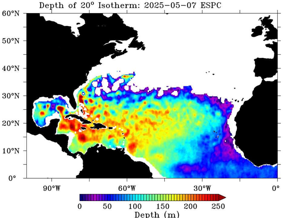
Image credit for both images Mike's Weather Page.
Speaking of hotspots when we look at the ocean heat content map; we can see there's a lot of oceanic heat in the western Caribbean. This area could not only possibly have some tropical trouble for the preseason If this area is left to its own devices it could become a major issue during the season, As the water warms even more allowing for even deeper ocean heat content underneath the surface. Which would help fuel tropical systems into potential hurricanes. Another area of concern is the warm waters off the East Coast of the United States in the western Atlantic. Depending on the ridge pattern over the United States and how the western ridge situates itself along with the position and strength of the Bermuda high. We could see quite a bit of activity slam into the Southeast United States. This time of year, preseason and early season tropical cyclones can form along old frontal boundaries that come off the US mainland heading into the Gulf and into Caribbean. Sometimes area of low pressure can develop along these boundaries if the conditions are favorable they can turn into tropical cyclones. Another way for preseason or early season activity to form, is when we see moisture from the Pacific setting up a broad area of low pressure over Central America into Columbia. This is typically referred to as an Central American Gyre. This large area of spinning low pressure can be a very huge source of tropical rainfall that can lead to lots of flooding and landslides for Central America and northern South America Into the western Caribbean. Once in a while we can see low pressure form within the larger circulation that can turn into tropical cyclones. Currently the pattern does suggest the possibility of a Gyre forming during the second half of May.
Thinking back to what I said about the odds favoring preseason activity. Right now, we could see a tropical wave in the vicinity of Trinidad and Barbados, some of the models particularly the GFS want to blow this up into some kind of low pressure system that could develop. We also look to see a tropical wave develop near Central America given the conditions along with the possibility of having a Gyre, there is a possibility that as this wave moves north and east we could see something tropical develop out of it. Of the two possibilities I think the one in the far western Caribbean has the best chance of developing. The time frame looks to be from around May 13 into around May 20. I guess we will see.
Looking back at the idea of tropical plumes and with the Gulf and Caribbean looking to be ground zero this season. It will be interesting to see if the river plume leeds to several rapidly intensifying hurricanes if they pass over this region.
The hurricane setup this season is going to favor homegrown systems close to the US. As well as an increased risk of rapidly intensifying tropical cyclones in the Caribbean and eastern Gulf. Past seasons show how incredibly dangerous this kind of setup can be.
The first named storm of the 2025 season will be Andrea. Here is an image showing the hurricane names for 2025.

Image credit the Weather Network.
Projected seasonal activity:
The long-term average (1951-2023) average of named storms is 11. With the more recent average (1994-2024) being 15 named storms.
The 2025 Atlantic hurricane season will likely be a little less active than last season But, I do think it's going to be close.
By the numbers:
Colorado state university Is forecasting 17 named storms 9 of which will become hurricanes and 4 of which will reach major hurricane status of category 3 or stronger.
North Carolina university is predicting 12-15 named storms 6-8 of these will become hurricanes with the possibility of 2-3 storms becoming major hurricanes.
My Call
13-16 named systems
7-10 Hurricanes.
3-5 Major hurricanes
The 2024 hurricane season saw five tropical cyclones make landfall on the Continental United States. While this season might not see quite as many landfalls; It still looks to be a slightly above average season. I base this on those extremely warm SST temperatures that look to set up in the Caribbean, Gulf of Mexico and along the East Coast of the United States.
With the pattern that looks to be setting up I expect to see at least a few landfalling tropical cyclones on the United States, My thought is for at least 1-2 making a landfall, with at least 1 being a hurricane.
This is the time of year where those along the coast and even further inland have to start thinking about hurricanes It is time to start making plans, having escape routes figured out and having emergency preparedness kits. All it takes is one hurricane to change your life forever.
Well that's it I do hope you found this an enjoyable and educational read If you have any questions I will be happy to answer them.
Are there significant changes in ocean currents that the analogy years may not be valid?
ReplyDeleteThere is never a perfect matchup when looking at analog years But generally I don't see any significant differences from the 5 years I mentioned when compared to this year As is always the case, these kind of outlooks can go sideways, when unexpected things pop up. Right now, it'll just be a waiting game to see what happens.
DeleteThank you. I have friends in the paths of these horrific storms and I’m always so concerned for them.
ReplyDeleteYou're welcome. During the season I do post updates on every storm it forms So feel free to share with them the link To this site.
DeleteThanks.
ReplyDeleteYou're welcome
Delete