With the high pressure building in and a southwest flow.....we will see fairly warm temps going into the upcoming weekend....Tomorrow we will see a strong low pressure center in Canada....it will cause the wind to be bit breezy and gusty wind gust could be in the strong breeze slot on the beaufort wind scale 25-31 mph. There could be a little precipitation over the Tug Hill, Adirondacks, and northern Greens. Some of this could be in the form of snow...but accumulations will be light. Then Thursday night, we will have another system approach the region. The Euro is running a little slower on timing then the GFS, Canadian, and Nam So any precipitation should be late. During the overnight, the precipitation could fall as freezing rain and sleet. The precipitation on Friday should be mainly rain. Temperatures on Saturday will be in the 40's and perhaps low 50's.
OK let's get to the arctic cold outbreak for midmonth.
As I’ve been saying there are several signals pointing at a dynamic cold air outbreak.
Polar vortex:
If you look polar vortex (PV) you will see something like this; the large scale cyclonic circulation in the middle and upper troposphere located near the polar regions. in other words it's a strong wind flowing around a low-pressure system normally present over the Arctic in winter. I think that reads a little easier. The PV is analyzed at 500 millibar level of the atmosphere. It can often be located over Canada or Siberia since the coldest surface air is often found over these regions.
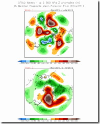
Here's a look at the 500 mb chart showing the PV
How does the polar vortex influence our weather?
Strong Polar Vortex:
Strong is the more common state of the polar vortex. When the polar vortex is strong, this creates strong low pressure in the Arctic region. Because of the pressure difference between the Arctic and mid-latitudes, air flows into low pressure and this confines the cold air to high latitudes closer to the Arctic. Therefore it is often mild across the Eastern US, Europe and East Asia during winters when the polar vortex is strong.
During strong polar vortex, the air flow is fast and in a direction from west to east.
Low pressure in the Arctic region is referred to as the positive phase of the Arctic Oscillation AO and the North Atlantic Oscillation NAO.
Weak Polar Vortex:
When the polar vortex is weak or “perturbed”, the flow of air is weaker and meanders north and south (rather than west to east). This allows a redistribution of air masses where cold air from the Arctic spills into the mid-latitudes and warm air from the subtropics is carried into the Arctic. This mixing of air masses also favors more storms and snow in the mid-latitudes.
During a weak polar vortex, high pressure occurs in the Arctic region and is referred to as the negative phase of the AO and NAO. Air flows away from the high pressure Arctic. The north to south direction of the polar vortex carries cold Arctic air into the mid-latitudes of Eastern US, Europe and East Asia. Therefore it is cold across the Eastern US, Europe and East Asia during winters when the polar vortex is weak.
Here’s a look at the NAO and AO are forecast to be.


As you can see they are positive now ...but they will be negative by midmonth
Here are the current and the next weeks Euro 30 Hpa geopotential height.

In the image for next week you can see the vortex over Canada and the Northern U.S. If we see a negative NAO and AO this could mean we will see near record cold around mid month into the end of January.

I saw a blog post today where they were talking about the arctic air outbreak of January 1985. So I wanted to compare and show you how the two might stack up. Here is an image from January 1985.

If you look at the Euro forecast for next week and compare it to the one from 1985. you will notice that they look very similar. The arctic outbreak in 1985 also was accumulated by a negative NAO and AO. The arctic outbreak 28 years ago was record breaking. This outbreak was the result of a shifting of the polar vortex farther south than is normally seen. Much the same as the potential outbreak beyond midmonth looks to be. Back in 1985 hundreds of cities in the United States saw record low temperature readings. The cold encompassed the entire Eastern Seaboard, Midwest down into Texas and the Gulf Coast. In fact the West Coast was cold too. Here is a temperature map from January 21, 1985. one other interesting fact is it was unusually warm weather in the eastern U.S. in December 1984, suggesting that there was a build-up of cold air that was suddenly released from the Arctic. Sounds a lot like the Summer of 2012. I'm not saying that this January 2013 outbreak. But you had to admits there are a lots of similarities, between this year and January, 1985.
Here’s a temperature map from January 21, 1985.


Sudden stratospheric warming:
Something known as a sudden stratospheric warming has occurred in the Northern Hemisphere arctic region over the last few days. This most likely the same thing that happened back in 1985.
what is a sudden stratospheric warming ( SSW)? This is when the winds in the PV slow down or reverse from the normally westerly direction. Frequently when a SSW takes place, it displaces cold air in the mid and upper levels and then build in the lowest layer of the atmosphere; once this happens it will move southward into the continental U.S.


As you can see from the image above that there was a another burst of cold at 150hpa giving the extra momentum. I see it nearing the end of its rule so will be looking for effect from that warming to reach further down through the stratosphere.
The outbreak will most likely move into the Northwest U.S and into the northern Plains. From here it will gradually move south and east. We could have storms impacting the East Coast. Because of this, the Cold could take awhile to build into the Northeast and the rest of the East Coast. Right now, most likely reaching the Northeast around the 23 to the 26th. We will see several waves of cold air move out of Canada, each one colder than the last. Once the arctic air reaches the Northeast it could take awhile for it to leave...it could be longer than ten days. It's too early to know if we will see storms during the outbreak...but we could very well see storms ride along with the cold air.
That’s it for now. I just wanted to give you the latest information.
Rebecca.

