Monday, December 6, 2010

Hello Winter!

Over the next 7 to 10 days the Northeast States look to be locked into a wintry weather pattern. This week is going to start off cold and blustery with bouts of Lake-effect snow (LES) impacting central and eastern New York State (NYS) as well as some enhanced upslope snow showers across the higher terrain of easternmost NYS and western New England (WNE).

Today's activity is pretty impressive for LES across eastern NYS and WNE. By this evening additional accumulations are expected:


on top of what you may have already received in your locality:

PUBLIC INFORMATION STATEMENT
SPOTTER REPORTS
NATIONAL WEATHER SERVICE ALBANY NY
648 AM EST MON DEC 6 2010

THE FOLLOWING ARE UNOFFICIAL OBSERVATIONS TAKEN DURING THE
PAST 3 HOURS FOR THE STORM THAT HAS BEEN AFFECTING
OUR REGION.  APPRECIATION IS EXTENDED
TO HIGHWAY DEPARTMENTS...COOPERATIVE OBSERVERS...SKYWARN SPOTTERS
AND MEDIA FOR THESE REPORTS.  THIS SUMMARY IS ALSO AVAILABLE ON OUR
HOME PAGE AT WEATHER.GOV/ALBANY

********************STORM TOTAL SNOWFALL********************

LOCATION          STORM TOTAL    TIME/DATE    COMMENTS
                     SNOWFALL       OF
                     (INCHES)   MEASUREMENT


MASSACHUSETTS

...BERKSHIRE COUNTY...
   NORTH OTIS             1.0   450 AM  12/6 SPOTTER

NEW YORK

...ALBANY COUNTY...
   KNOX                   2.0   642 AM  12/6 WXNET 6
   VOORHEESVILLE          0.9   600 AM  12/6 NWS EMPLOYEE
   SOUTH BERNE            0.5   542 AM  12/6 WXNET 6
   VOORHEESVILLE          0.4   644 AM  12/6 WXNET 6

...GREENE COUNTY...
   ASHLAND                4.0   622 AM  12/6 WXNET 6
   ELKA PARK              3.0   519 AM  12/6 SPOTTER
   HAINES FALLS           2.0   524 AM  12/6 SPOTTER
   HALCOTT CENTER         2.0   644 AM  12/6 WXNET 6
   HALCOTT                1.0   356 AM  12/6 SPOTTER

...MONTGOMERY COUNTY...
   PALATINE BRIDGE        2.0   610 AM  12/6 WXNET 6
   GLEN                   1.0   617 AM  12/6 WXNET 6

...SCHENECTADY COUNTY...
   PRINCETOWN             1.3   553 AM  12/6 WXNET 6
   DUANESBURG             1.0   626 AM  12/6 WXNET 6

...SCHOHARIE COUNTY...
   JEFFERSON              5.8   428 AM  12/6 WXNET 6
   GILBOA                 2.0   620 AM  12/6 SPOTTER
   RICHMONDVILLE          1.5   530 AM  12/6 WXNET 6

...ULSTER COUNTY...
   SAUGERTIES               T   410 AM  12/6 WXNET 6

VERMONT

...BENNINGTON COUNTY...
   WOODFORD               3.5   553 AM  12/6 WXNET 6
With winds varying between West and Northwest through tomorrow these areas of LES
and upslope snow will likely persist but the bands of heavier 
vary in their location.
During Wednesday and Thursday of this week a shot of BELOW normal cold will move 
down across the Northeast. On these days it looks like temperatures will be near 
10 degrees below normal for the daytime highs; this means for Albany afternoon 
temperatures will stay below freezing for the highs (upper 20s)
On Friday a low pressure system coming in from the northwest(we call 
this a "Clipper" system)will pose the threat for some periods of light snow
and snow showers. There is a chance that a secondary are of low pressure may
try to form near the east tip if Long Island or over southeast New England. 
While the possibility of this development appears to be slight at this time and 
if it were to occur it would be a weak system,it could nonetheless result in a 
period of steady snow for a few hours during the afternoon and evening time from 
Albany east across Western New England. This might result in a few inches of snow.
 
By Friday though the weekend, temperatures will be moderating some getting back
to almost normal. 
By later Sunday into Early next week another storm threat looms and this one could be 
a significant winter storm for many of us. Its way too early to start to talk about specifics just know 
that there is at least a threat for such an event to occur. 
 
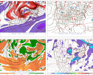
Below are images from some of the longer range weather data for Sunday and Monday of next week.

This is the weather model known as the EC and this chart shows the expected conditions 
for next Sunday evening 12 Dec for 7pm at night. 
The upper right map is a forecast for the surface (showing areas of high and low pressure.)  
 
This chart is valid for Monday evening, 7pm the 13th of December: 
This is data from the GFS (weather model): 
The forecast is valid for Sunday (12 Dec) evening 7pm:
The above map is valid for Monday afternoon the 13th (1pm).

Both look nasty for sure thus our concern.
More updates to follow over the upcoming days....

Saturday, November 20, 2010

Update on the Thanksgiving Day and Posy Holiday Weather

The models are starting to show less divergent solutions in the Wednesday Night through Black Friday period as it relates to the TGD weather pattern.

I do like that the GFS is similar to its GEFS mean. There is some similarity amongst the GFS/UK/NAM in one camp with the EC the outlier on the track of the low through the Great Lakes around the holiday though the GFS may be too deep on both the pressure of the surface LP as well as the H500 low's height.

Most of the models continue show rather strong confluent flow across the NEUS during the Wed-TGD period. The forecast 850 temperature field from both the EC:

and GFS

 continue to show a cold air damming (CAD) signature across East-central NYS to Western New England ,I would think that the probability of frozen precip at the start of the event is quite good for a sizable portion of NYS. I would expect the southern periphery to extend from from WNY (the NY/PA border) to the Catskills and Hudson Valley around Albany then towards S VT. Right now I would think that the start of any precip would be late afternoon to sunset over the west and around 2-6 am in the east. Areas from about ART to GFL may not see the precip arrive until during TGD while areas to the north and northeast of this line may see little if any precip at all.With the system looking like it is occluding over the Great Lakes on TGD and with this CAD signature remaining in place on both models (GFS being the strongest). There should be some sort of at least a weak LP development (if not two) east of the primary. I would favor one on the warm front with a second possible LP development on the triple-point (TP). Looking at the 12z GFS data in WINGRIDDS and running a macro that I like to use that shows where LP (secondary) LP development might occur it is pointing towards a weak secondary on the warm front LI/LI Sound/SNE Coastal Waters (west of Block Island's) longitude. This also fits well with synoptic climatology that indicates when a closed H700 hPA low tracks along and north of a Chicago-Cleveland-Montreal line any secondary development tends to occur along the coast to the east through northeast of the primary surface cyclone.

Looking at the ageostrophic winds the forecast data continues to show N-NE ageostrophic flow of around 10-15 kts for the NE corner of NYS from about Ogdensburg to Gloversville-Glens Falls-Rutland on Thursday :


So I would think that within this area either all snow or a mix would occur. BUFKIT temperature tool indicates a fairly sharp temperature gradient pretty much N-S oriented with coldest temps near the US/CAN border and warmest heading south.

On the other hand owing to how the pattern looks (SW-WSW flow aloft and confluent flow) I think QP will average around or less than 1/3 rd of an inch; some isolated near ½ inch amounts may occur south Albany in the HV and maybe across the Western Adirondacks where some orographic enhancement in the SW to WSW flow may occur. In general I would think that there will be north-south gradient to the qpf with lesser amounts to the NW-N of the above area and more along and south to southeast of the above area.

As for the post-holiday weather: It still looks like a good (significant LES) event but a colleague and friend of mine may be right in that it may not be as long a duration event as some (including myself) were thinking.

In addition the bands may shift around during the Friday thru Sunday period and I think that both the belts to the east of LO and LE will be vying for who gets the most. I'm beginning to think it will be a good competition but I'm starting to think that LE snowbelts MAY actually win out over the LO ones.

(Though my caveat is that it it is still too far away to really commit to a definite forecast). I'll address this in a separate update as we get closer to the expected event.I can envision some of my flow meteorologist and knowledgeable weather hobbyists getting involved in this update.

Thanksgiving Day Weather for Albany, NY & My Reminisces of Working on TGD

A brief climatology of Thanksgiving Day (TGD) weather for Albany, NY:

The warmest 1883 a high of 68 degrees and a low of 56, giving the warmest daily mean of 62.
The coldest was 1901 with a maximum temperature of  19 degrees, as well as, the coldest daily mean temperature of 15 degrees. The lowest minimum temperature was 5 degrees set in 1972.

The wettest TGD for Albany: 1886 - 1.77 inches of liquid equivalent precipitation ( 8" of snow was observed on this day).

Not too far behind this  particular TGD was 1971 with its 1.64 inches of melted precipitation which on this holiday was all snow and the most for Albany for TGD: 21.8 inches! (The snow actually started on Thanksgiving Eve ( the night of the 24th) thus the storm total was 22.5".)

Looking at the 20 greatest snowstorms of all-time for Albany this snowstorm  ranks as the 8th greatest single snowfall amount from one storm and for November's top 10  snowstorms it ranks as #1.


First let me say, I usually work most Thanksgiving Days  and I really don't mind it either. I'll work my "normal" shift that entails me doing NEWS10 in the Morning and NEWS10 at Noon then home for TGD dinner in the afternoon.

The "joke" about working TGD is that as far as the weather goes its an every other year thing, that is on alternating years the weather is either "active" or "benign".  (Last year's TGD weather was "benign" this year's may be "active" or at the very least not the best weather for the holiday.  I'll be updating this blog a lot over this weekend and upcoming days about this year's holiday and post holiday weather as it does look "interesting" for sure.)

Now for a bit of reminiscing on what had to be one of the wildest days that I ever have worked at WTEN . It was on Thanksgiving Day 2004!

The morning was warm and muggy for late November and I remembered driving in to work through areas of patchy dense fog and I also remember leaving early to get into work because there was the chance that it could prove to be a busy day.

Here's a bit of a clue as to why: The high temperature that TGD was 64 degrees (the 2nd warmest TGD on record for Albany) the low later that day was 30!

In a nutshell a strong area of low pressure and its associated cold front moves across Eastern NY State and Western New England resulting in a high wind and severe weather event late that Thanksgiving Day morning.
I remember saying on air that early morning to those who were watching that "I am not crazy but there is the chance for severe thunderstorm's this TGD!"

All told nearly 60,000 + customer lost power that day after the severe squalls moved through. Especially hardest hit were Saratoga, Washington and Rensselaer Counties in NY State. The power interruption became th big news story of the day: Folks whose homes were all electric scrambling to find a place to either cook their TGD dinner or somewhere to eat.

Below is a map from SPC on the severe weather reports  for that day along with a list of the reports and a "loop" of the hourly surface reports from that day.


SPC Storm Reports
1200 UTC November 25, 2004 - 1159 UTC November 26, 2004
20041125's Storm Reports

Note: All data are considered preliminary
Tornado Reports (in CSV format)
No reports received
Hail Reports (in CSV format)
Time Size LocationCountyStateLatLonComments
1320 75 OLD FORGE LACKAWANNA PA4137 7574 (BGM)
1512 75 GALWAY SARATOGA NY4302 7403 PENNY SIZE HAIL AT PROVIDENCE (ALY)
Wind Reports (in CSV format)
Time Speed LocationCountyStateLatLonComments
1340UNK CARBONDALE LACKAWANNA PA4157 7551 NUMEROUS TREES AND WIRES DOWN (BGM)
1345UNK BEACH LAKE WAYNE PA4160 7515 TREES AND WIRES DOWN (BGM)
1345UNK EQUINUNK WAYNE PA4185 7522 TREES AND WIRES DOWN. TRAILER FLIPPED. (BGM)
1420UNK JEFFERSONVILLE SULLIVAN NY4178 7493 TREES AND WIRES DOWN ACROSS WESTERN AND NORTHERN PARTS OF THE COUNTY (BGM)
1430UNK HANCOCK DELAWARE NY4195 7528 TREE DOWN (BGM)
1512UNK HURLEY ULSTER NY4191 7406 TREES AND WIRES DOWN (ALY)
1512UNK HARDENBURG ULSTER NY4200 7467 TREES AND WIRES DOWN (ALY)
1512UNK MALTA SARATOGA NY4297 7379 TREES AND WIRES DOWN (ALY)
1540UNK TAGHKANIC COLUMBIA NY4214 7368 TREES DOWN. (ALY)
1545UNK SALT POINT DUTCHESS NY4181 7379 TREES AND WIRES DOWN (ALY)
1600UNK SADDLE BROOK BERGEN NJ4090 7410 TREES DOWN CAUSING DAMAGE TO PRIVATE HOMES (OKX)
1605UNK SCHODACK CENTER RENSSELAER NY4255 7368 TREES DOWN (ALY)
1635UNK CLARENDON RUTLAND VT4352 7297 RUTLAND STATE POLICE REPORTED TREES AND POWER LINES DOWN IN CLARENDON AND SHREWSBURY. (BTV)
1635 59 RUTLAND RUTLAND VT4361 7298 (BTV)
1641UNK LANESBOROUGH BERKSHIRE MA4252 7323 WIRES DOWN (ALY)
1645UNK GOSHEN ORANGE NY4140 7433 TREES AND BILLBOARDS DOWN ON RT.17 AND HARRIMAN DRIVE CAUSING DAMAGE TO COMMERCIAL BUILDINGS (OKX)
1715UNK CABOT WASHINGTON VT4441 7231 MIDDLEBURY STATE POLICE REPORTED NUMEROUS TREES AND POWER LINES DOWN NEAR CABOT AND MARSHFIELD. (BTV)
1810UNK 3 SW LISBON GRAFTON NH4418 7195 LIMBS AND POWERLINES BLOWN DOWN ON MOSES CLARK ROAD. (GYX)
1815UNK 1 NW LITTLETON GRAFTON NH4432 7178 TREES BLOWN DOWN ON NORTH LITTLETON ROAD. (GYX)
Full report in comma-separated values (CSV) format
Fields marked UNK are unknown
All Times UTC
Wind Gusts in MPH
Hail Sizes in 1/100 of an Inch (75 = 0.75")   


Java Loop of surface reports for TGD 2004

An excellent write-up on the severe weather of that day was done by Tom Wasula a meteorologist at the NWSFO in Albany, NY. Here is a link to his write-up: Wind and Severe Wx Event from TGD 2004

In the wake of the severe weather strong NW to W winds prompted wind advisories to be issued for the afternoon and evening hours of that day and to top it all off, after the morning warmth and severe weather many locations across Eastern New York and Western New England saw brief snow showers or flurries that TGD night!

Well its time to check the latest Saturday AM data to see what will or won't happen this upcoming TGD. I'll likely have another blog update later today (probably late tonight).

Friday, November 19, 2010

A Cornucopia of Weather for Thanksgiving Week for Eastern NY State

Interesting possibilities in our weather for next week especially as we gear up for the Thanksgiving Holiday period along with all the travel that goes along with this time of year.

(Note of advice: When a weatherman or meteorologist uses "interesting" with an upcoming forecast it could mean not "so" good weather is heading our way).

A very active jetstream across the Western US this weekend will give rise to bouts of stormy weather across the country as we head towards the holiday period. Initially the worst weather will be across the Rockies and Plains States this weekend through Monday then these areas will likely see a turn to much colder air. As a matter of fact the first incursion of Arctic air will spill down across the Rockies and Northern Plains by late Monday through Wednesday.

As this arctic air plunges south and southeastwards early next week the active storm pattern and cold will begin to shift east towards the Eastern US by Wednesday through Thanksgiving Day (TGD). The cold front will advance east and reach the Eastern Great Lakes  and Ohio Valley on Tuesday. Ahead of this cold front mild air and clouds will start off the week for Eastern Upstate New York. There could be some showers on both Monday and Tuesday (especially on Tuesday) as the cold front gets closer and moves through.

This cold front is expected to move off the Northeast coast by late Tuesday/early Wednesday with colder air filtering in behind. The front is also forecast to stall during Wednesday along a line from the offshore waters of the Mid-Atlantic States across Southern Virginia to northern Texas. It is along this front that a series of low pressure systems will form and move east-northeast to northeast across the Eastern Great Lakes or perhaps New England.

For Wednesday, the "big" travel day before the holiday, most of the day now looks like it will be colder and mostly cloudy but dry. By Wednesday late afternoon/evening time it looks like the first wave of low pressure will be moving to southwest PA and this could spread an initial period of light precipitation across the Southern Tier of NY to Albany. With colder air over these locations this precipitation could very well be a wintry mix of sleet and snow perhaps even some pockets of freezing rain. This precipitation could last into early TGD morning, perhaps even nudging north by then into the Mohawk Valley, Adirondacks and Lake George regions where it could fall as a light snow.

A second more potent low pressure system is then forecast to follow this initial one during the TGD and track across the Eastern Great Lakes. This second low will result in a steadier precipitation to overspread all of interior NY State during the holiday. Initially it could be of a wintry variety but with a low track across Western New NY State a change to rain should occur.

However, if a secondary area of low pressure develops along the Delmarva Peninsula (and this is a very distinct possibility) then colder air could remain locked in along and north of the Mohawk Valley-Albany-Southern Vermont line, keeping the precipitation either a wintry mix or perhaps even all snow!

Our weather prediction computer models are offering a variety of possibilities and scenarios to the holiday period weather. So all that I can say as of right now, I'll be updating this this blog  so make sure to follow it as well as your local weather forecasts, too. We should be able to get a better grip on what will happen as we get closer to the event.

Another thing to watch out for over the TGD weekend is the potential for the seasons first significant "lake-effect" snows to develop downwind of  Lakes Erie and Ontario. I believe the potential is there for some locally very heavy snow to fall across the "favored" snowbelts of NY State. This will likely be the subject of another blog update later in the week.

Tuesday, October 26, 2010

An Historic or Epic Storm for The Upper Midwest & Great Lakes.

An intense storm system is moving across Minnesota and Wisconsin this morning. A way to gauge the intensity of a storm is by how low the barometric pressure gets in the center of the storm.

In simplicity, the lower the central pressure of the storm, the stronger or more intense the storm is.

This storm will likely be an historic one for sure by the time it begins to wind down.

A very knowledgeable and savvy weatherlady  passed this information on to me:

The storm is forecast to reach a pressure of 28.35 inches. If it reaches that pressure it will be second most severe system to strike the Great Lakes.

Probably the most famous storm was the storm that sank the Edmund Fitzgerald back in 1975, that storm reached a central pressure of 28.95 inches.

However the strongest storm ever recorded was the January 1978 "Great Ohio Blizzard" which reached a central pressure of 28.05 inches.

In order to put a little scale here for comparison when Hurricane Earl (from this year) reached Category 3 strength its lowest pressure that was recorded was 28.20 inches.


This storm will be one for the history books that is for sure, if not epic.

As I mentioned in my last blog post Indian Summer and The Gales of November come Early this storm will produce  a widespread swath of high winds from the Dakotas and Plains east through the Great Lakes states and Ohio along with blizzard conditions for parts of the Dakotas
National Weather Hazards

Note the large swath of the Plains and Great Lakes States all under High wind Watches or Warnings on the National Hazards Map.

While for the Lower Great Lakes States and Midwest a major severe weather threat:
Today's Severe Weather Outlook


A final note, many national media outlets are dubbing this a "Midwest Cyclone". The word cyclone is a broad  word that applies to ANY type of low pressure system; thus a Nor'easter, hurricane, low pressure system, even a tornado is a cyclone.

Sunday, October 24, 2010

Indian Summer and the Gales of November Come Early

A very "interesting" synoptic weather setup appears in store for the U.S. this upcoming week from the East Slopes of the Rockies to the Eastern Seaboard.

The "interesting" weather will be caused by, for late October standards, an intense storm that is forecast to form over the Central Rockies then move across the middle-half of the country. East of the storms path Indian Summer balminess while to the west the "Cold Miser" will be strutting a bit "too much".

A strong jet stream and upper-air trough is poised to push across the Pacific Northwest region of the Western U.S. today. Here is this evenings 300 hectopascal (hPa) chart:


Over the upper left-hand corner of the chart is where this strong jetstream is located. It is forecast to move towards the east and southeast through Monday and aid in the development of a complex storm system over Rockies. One storm appears to form over Southeastern Colorado or the Panhandle Region of Texas and Oklahoma with the second low pressure system developing over the Northern Rockies (Montana). Here is the 36 hour forecast map from the UK model forecasting this storm development by Monday morning, 25 October.

The low pressure (LP) area over Colorado is then forecast to strengthen into a significant storm and move northeastward to Minnesota and Northwest Wisconsin by Tuesday night (26 October) becoming a powerful storm as it moves along its projected path.


  Strong winds will be a big feature with this storm as it moves across the Plains and on the northwest side of the storm, as colder air gets pulled down out of Canada there could be some accumulating snow in places. Initially by Tuesday through early Wednesday the "best" chances for some accumulating snow will be across the Western Dakotas and by later Wednesday perhaps across parts of Minnesota and Wisconsin.

To the southeast of the storm severe weather potential exists from the Southern Plains to the Mid-Mississippi region.

Farther east for the Upstate of New York and New England the large circulation associated with this storm combined with the circulation of a large area of high pressure area off the East Coast of the U.S. will produce a warm South to Southwest flow of air resulting in a spell of Indian Summer warmth.


For the Monday through Wednesday period of this week, I'm expecting temperatures for Eastern Upstate New York and New England to be 10-12 degrees above normal. The normal high for Albany, NY is in the mid 50s, so this means that we have a good chance to see some mid to upper 60s during this time.

In addition there will also be one or two days with temperatures close to 20 degrees above normal, too! This means high temperatures near 75 degrees on Tuesday and/or Wednesday.  Record highs for Albany for the middle of this week are in the upper 70s and for Glens Falls they are in the mid 70s; perhaps we can take a run at a record or two this week at either one or both of these locations.

Wednesday, October 13, 2010

Get ready for another high impact coastal storm tomorrow through Friday!


First, let's talk about tonight's weather – it's easy: quiet, dry and chilly weather for all with some frost possible again in the Hudson Valley. Thus a FROST ADVISORY is posted from Albany southwards down the valley, as well as, for the Southern parts of Washington and Berkshire county. This said frost may not happen tonight because of clouds gradually increasing which could prevent temperatures from getting cold enough to allow for frost to form.

The clouds coming in tonight are part of the impending storm that will affect us tomorrow through Friday.
The storm has yet to form. But the various sets of weather data that I have been looking at are starting to show some consensus or agreement on its development, strength and track. Here's what I'm expecting: the low pressure system will form over the Virginia Capes Thursday morning and begin to move northeastward, rapidly strengthening enroute to moving across east-central New England by Friday morning. The rate of deepening on the storm is going to be of an explosive nature so a very strong and powerful Nor'easter is expected. By late Friday through the weekend the storm will slow down as it moves across the Gulf of Maine to New Brunswick Province or Nova Scotia.
This storm is expected to be a multi-impact event for us.

The primary threat will be the potential for heavy rain. It looks like at least 1-2 inches could fall across the region especially from around the Hudson Valley west, as well as for the Southern Adirondack east to Warren County. Depending on the precise storm track, the wind flow around the storm could cause higher amounts of rain over the more mountainous areas of New York State especially over the Catskills to the Adirondacks. Since we have had a bit of wet spell this month, the ground is saturated and this means that additional heavy rain could cause some flooding. Because of this flood threat a FLOOD WATCH is posted for the Adirondacks, Mohawk valley and Catskills from late Thursday through Saturday morning.
The next threat is WIND: Once again potentially strong winds could rake the region later tomorrow and Friday. Tomorrow's wind threat may be confined to the Taconics, Greens and Berkshires where strong ESE to E winds could gust to 40 mph if not more.

On Friday as the storm begins to move over the Gulf of Maine much of the region could be buffeted by strong NW to W winds potentially up to 50 mph (if not more). Currently no wind watches, warnings or advisories are hoisted but this will probably change. If the strong winds do materialize (and they will) we could be looking at power outages.

There is yet another threat from this storm. Sorry folks! There could be some wet snow, especially over the higher terrain. Right now the snow threat appears to be limited to elevations at or above 1400 feet and at the moment the Eastern Catskills, Southern ‘Dacks and Southern Greens appear to have the better chance to see some flakes at least mixing in, if not get a period of all wet snow, especially by late Friday. The snow threat is problematic it all depends on a number of factors including how much in the way of colder air can work into the storm's circulation, whether or not (and if they do)  where any stronger bands of precipitation and lift form and again the precise storm track. As of right now these mesoscale features (banding and lift) cannot be forecast this far out.

In the wake of the storm the weekend will remain blustery to windy and chilly, too along with the threat for some scattered sprinkles or showers.

Tuesday, October 12, 2010

Another Possible Fall Nor'easter for Thursday-Friday of this week?

Once again another interesting weather scenario appears to be in store for Upstate New York (and probably all of the Northeast U.S. for that matter) for Thursday through Friday (14th-15th October) of this week. Well, at least from this forecaster's perspective it is interesting.

After a cool start to the weather for the first almost two weeks of this month the pattern across the Lower 48 appears to be undergoing a change: For much of this month (even going back to the end of September) the jetstream has been rather active and strong as well as having many "dips" in its flow as it work blows across the Northern Hemisphere. These "dips", also known as troughs (which are areas of lower pressure aloft), have resulted in low pressure systems at the surface of the earth to move across the Northeast U.S. bringing much needed rainfall. With the passing of these lows cooler than normal air has followed with many areas, especially across interior Eastern New York State experiencing temperatures averaging below normal along with nighttime frosts and or freezes for many locales.

By the end of this upcoming weekend and into the start of next week it looks like the jetstream will be having less in the way of significant "dips" in it. It will likely be blow in a fairly west to east flow pattern (called a zonal flow). This sort of a jetstream tends to result in weak and fast moving weather systems. Temperatures tend to be closer to normal if not somewhat above normal, especially during the daytime hours.

As often happens when there is a pattern change or the jetstream transitions from one state (like the current one with the "dips")  to the forecast one ('zonal" flow for next week), the atmosphere tends to "react" to this change with a storm development.

Latest data is indicating that this storm development will likely be along the East Coast of the U.S., however the question is where? Anywhere from the NJ coast to the Virginia Capes is possible.

The next question is once the storm does develop what track will it take? Here too data is indicating mixed signals: Tracks vary with the data tracking the storm either across Western New England to Northern Maine or moving it east and passing across Eastern Massachusetts to the Gulf of Maine and Nova Scotia.

Newer data will be coming in throughout the day and I'll post some more tonight, work permitting.

Sunday, October 10, 2010

Growing Season is Over for Many Upstate New Yorkers....

How cold did it get last night across Upstate New York?

Well for starters many locations across Eastern NY State reported frost on the ground. AT my house the low temperature was 32.7. Oh so close to a freeze !

Here are some other selected low temperatures across Central and Eastern NY state for the morning of October 10th:

Albany:             34
Binghamton:      34
Glens Falls:       29
Lake Placid:      25
Plattsburgh:       32
Poughkeepsie:   32
Rome (Griffiss): 30

Syracuse:          36

Here is a list from the Albany National Weather Service Office of some low temperatures from some cooperative observing sites (I have highlighted all the temperatures that were at or below 32 degrees):

DAILY HYDROMETEOROLOGICAL DATA SUMMARY
NATIONAL WEATHER SERVICE ALBANY, NY
920 AM EDT SUN OCT 10 2010

                              TEMPS        SNOW
 LOCATION           PCPN   MAX MIN OBS   NEW  TTL

  EASTERN NEW YORK...ALBANY COUNTY
ALBANY AIRPORT      0.00    64  34  37
ALCOVE DAM          0.00    60  36  39
 
EASTERN NEW YORK...COLUMBIA COUNTY
COPAKE              0.00    62  31  32
LIVINGSTON                  65  31  37
 
EASTERN NEW YORK...DUTCHESS COUNTY
BEACON HILLS        0.00    71  36  43
MILLBROOK           0.00    65  30  33
POUGHKEEPSIE AP     0.00    70  32  36
RHINEBECK           0.00    70  29  29 
 
EASTERN NEW YORK...HAMILTON COUNTY
LAKE PLEASANT               54  36  39  
 
EASTERN NEW YORK...HERKIMER COUNTY
OLD FORGE           0.00    53  28  28
STILLWATER RESVR    0.00    53  29  30 
 
EASTERN NEW YORK...ONEIDA COUNTY
BOONVILLE           0.00    57  32  32   0.0    0
ROME                0.00    61  30  32
 
EASTERN NEW YORK...RENSSELAER COUNTY
BRUNSWICK           0.00    62  36  38
BUSKIRK             0.00    60  30  30   0.0    0
EAST GREENBUSH      0.00    61  36  37
STEPHENTOWN         0.02    62  28  29
TROY                0.00    66  37  38
 
EASTERN NEW YORK...SARATOGA COUNTY
CONKLINGVILLE       0.00    62  35  35
HADLEY              0.00        33  34
MALTA               0.00    62  32  33
ROUND LAKE          0.00    61  35  35   0.0    0
SARATOGA SPRINGS    0.00    68  32  33
SARATOGA NHP        0.00    67  34  34
  
EASTERN NEW YORK...SCHENECTADY COUNTY
DUANESBURG          0.00    61  31  38


EASTERN NEW YORK...SCHOHARIE COUNTY
CHARLOTTEVILLE      0.00    58  24  24
COBLESKILL          0.00    59  35  36
SCHOHARIE           0.00    64  35  35
SHARON SPRINGS              56  35  41
 
EASTERN NEW YORK...ULSTER COUNTY
PHOENICIA           0.00    69  33  34 
SLIDE MOUNTAIN      0.00    58  32  35
WEST SHOKAN                 69  36  37   0.0    0 
 
EASTERN NEW YORK...WARREN COUNTY
GLENS FALLS         0.00    61  29  33
NORTH CREEK         0.00    57  29  32
 
EASTERN NEW YORK...WASHINGTON COUNTY
EASTON              0.00    61  40  42
NORTH HEBRON        0.00    56  35  39
WHITEHALL           0.00    56  34  40

  VERMONT...BENNINGTON COUNTY
BENNINGTON AIRPORT  0.00    60  29  32
PERU                0.00    64  31  31
POWNAL              0.00    57  32  33   0.0
SEARSBURG           0.00    53  32  33
SUNDERLAND          0.00    59  28  29

  VERMONT...WINDHAM COUNTY
BRATTLEBORO                 62  31  31
GRAFTON             0.00    54  30  34
MARLBORO            0.00    58  30  32
MOUNT SNOW          0.00    53  37  43 
MASSACHUSETTS...BERKSHIRE COUNTY
NORTH ADAMS         0.00    62  30  34
PITTSFIELD          0.00    61  36  41
SAVOY                       56  32  42
WEST OTIS

  CONNECTICUT...LITCHFIELD COUNTY
BAKERSVILLE         0.00    63  35  38
BLACK ROCK LAKE     0.00    63  31  36
FALLS VILLAGE       0.00    63  31  33
NORFOLK                     59  33  40
Because of the number of hours below freezing in may locations across Eastern NY State the 
Growing Season has come to an end in may locations:
 PUBLIC INFORMATION STATEMENT
NATIONAL WEATHER SERVICE ALBANY NY
1200 PM EDT SUN OCT 10 2010

...PUBLIC INFORMATION STATEMENT...

THE GROWING SEASON HAS COME TO AN END ACROSS THE SOUTHERN
ADIRONDACKS...LAKE GEORGE REGION...EASTERN CATSKILLS AND TACONICS
IN NEW YORK...SOUTHERN VERMONT AND THE NORTHERN BERKSHIRES.

TEMPERATURES FELL INTO THE MID 20S TO LOWER 30S AT MANY LOCATIONS
ACROSS THESE AREAS LAST NIGHT INTO EARLY THIS MORNING...RESULTING
IN A WIDESPREAD KILLING FROST...WHICH ENDED THE GROWING SEASON.

FREEZE WARNINGS AND OR FROST ADVISORIES WILL NOT BE ISSUED AGAIN
UNTIL THE START OF THE GROWING SEASON NEXT YEAR IN THE SOUTHERN
ADIRONDACKS...LAKE GEORGE REGION...EASTERN CATSKILLS AND TACONICS
IN NEW YORK...SOUTHERN VERMONT AND THE NORTHERN BERKSHIRES.
 

Saturday, October 9, 2010

What is Indian Summer?

Indian summer is a weather phenomena that occurs during the autumn months across the  United States. It is often a period of weather marked by sunny or hazy sunshine during the afternoon and accompanied by mild temperatures.


Unlike a heat wave (as defined for the Northern U.S. which is a period of 3 or more consecutive days that have a maximum temperature of 90 degrees Fahrenheit or higher), Indian Summer has no true definition as to what defines it.


Some meteorologists say the daytime temperature must be at or above 70 degrees. The only problem with this "condition" is that e.g. for Albany, NY in November the average maximum temperature for  November 1st is 53 degrees, by mid-month its in the mid 40s and by the last day its 41 degrees. My personal preference and again this is my preference is that if the daily high temperature is 10 degrees or more above normal, I consider it to be Indian Summer.

Perhaps the only truism regarding Indian Summer is that it is the first "spell" of mild weather that follows the first widespread hard frost or freeze (some also say the leaves must also have turned color, too) and it occurs before the first snowfall. Thus usually the period from around mid-October through November can see Indian Summer or Indian Summers (more than one such period of balmy weather). Some years can also have no Indian Summer either.

Why am I writing about Indian Summer?

Well, tonight appears as if we will experience our first widespread frost across interior sections o eastern NY State and in some of the lower elevations (of the Upper Hudson and Northern Mohawk Valley) a hard frost or freeze might occur. 

If this frost and freeze does materialize then the next spell of warmer than normal temperature(s) could be Indian Summer.

But wait!

The leaves have yet to completely turn!

Tuesday, March 23, 2010

Some Software for Weather Geeks

For those who may be die-hard amateur or professional forecasters or just true "weather geeks" here is a list of a few weather programs (software) that I use and enjoy.

First in the forecasting category we have WINGRIDDS and BUFKIT.

WINGRIDDS stands for WINdows based GRidded Interactive Display and Diagnostic System.

From the WINGRIDDS Webpage : ( WINGRIDDS ) : 
   "WINGRIDDS is a software package that allows the user to view meteorologically significant fields of gridded observation analysis and numerical weather prediction model output (GRIB files). The fields are displayed in either contour or vector format, whichever is appropriate for a particular field. This package also allows the user to extract a variety of information from numerous meteorological diagnostic parameters computed from the gridded data fields.


   The flexibility of WINGRIDDS allows the package to meet the needs of users with a wide range of skills and requirements. The novice can quickly learn to display a wide variety of predefined products using the WINGRIDDS Menu system. More advanced users can develop specialized products to meet their individual needs using the programmable WINGRIDDS Command language, including the creation of customized menu options to meet specific user needs."

WINGRIDDS can be downloaded (its free, too this is a direct link to the software) from: WINGRIDDS Version 3.1 Installation File

BUFKIT is a tool kit that aids in the visualization and analysis of vertical profiles in the atmosphere for a particular "point" or location. These profiles are useful in the forecasting of daily (maximum or High) temperatures, severe weather potential, wind speed and gusts, precipitation type, etc. The latest version (go to:  BUFKIT ) comes with training videos. Once again this software is free.

While WINGRIDDS does also allow for the plotting and analyzing of real-time weather observations for surface and upper-air locations one of my favorite programs for such plotting and analysis of this type of weather data is from Weathergraphics.

The software that I still use is called weathergafix and can be downloaded here:  WXgrafix . This program is an old "dos" version that can still be run on a windows system; ( I use dosbox to run it).

If you find this program not to your liking or don't want to install dosbox to get it to run then may I suggest you look into Digital Atmosphere (either the personal or professional version from Weathergraphics). This software is not free; depending on what "flavor" you like or want determines what you pay.

Another analysis tool/software that I also like (and do have) is called RAOB. This software is not free either but it very good for analyzing atmospheric profiles for various upper-air sites. It also allows for cross and time section analysis, forecasting temperatures, precipitation, etc.  Like Digital Atmosphere depending on what flavor you want or like determines the cost of the software (there are various "modules" that one can purchase to add to the "base" module).  The website for RAOB is : RAOB .

Now here is another neat program for downloading and archiving satellite imagery from NASA-Ghcc website. Go to GhccSat.html . At the bottom of the page there is a zip file to download.

Radar data is also useful in forecasting and this data can be analyzed and looped with another really cool program that is both free but has some additional enhancements for a very small fee. This program is called The Weather Radar Toolkit. Go to Astroscan's homepage to download. The cool thing about this program is that it uses data from local NWS radars and allows you to use this data in many ways ranging from constructing an analysis of the data.

Just a note: With all this software that I have written about, I am not endorsing it nor am I responsible for any negative impacts that it may have on your particular system SO if you install it and or use any of it it is done at your own risk and you assume all responsibilities and liabilities as it relates to the use and installation of this software.


Enjoy!

Tuesday, February 9, 2010

Upper Hudson Valley West Mountain Special for Cape Coral


For GFL favorable uvm in/close to snow growth region.


Similar chart except for data from today's 2-09-10 18z NAM. The UVM is removed from the best SGZ. Doesn't look too good. Right?

WRONG!

Look at the winds AOB below 850 hPa from both the 12z and 18z NAM: From the NNE. Now look at the winds around 700 hPA for both times from the NAM ESE-SE now look at the winds AOA 700 hPa more of the same ESE flow. Nice signature AOA approximately 700 hPA for both divergence (lift).

Surprise lingering snowfall many hours after what computer models "say" plus better uvm then what they are forecasting.

Could I be wrong sure. But confidence is high that I will not be as I have seen this signal before over the past couple of years. Pattern recognition counts for something!

Enjoy!

12z 2-09-2010 UKMET Select Maps


Here are surface forecast maps from today's (09 Feb 2010/12z) UKMET.

The following maps are surface pressure and wind with 850 hPa isotherms in degrees Celsius along with forecast precipitation (QPF).

The first set of maps is for forecasts hours of 06, 12, 18, 24 hours ahead; i.e., thru Wednesday morning 7am/2-10-2010.

Second set is for the following 24 hours though Thursday morning 2-11-2010 same forecast field and parameters.

Third set of maps: Upper left is a 60 hour forecast of the same parameters and the next 3 panels are a forecast vertical temperature, moisture and wind profile for Plymouth, MA. Date and valid times are listed to th upper right of the sounding.

Enjoy!

Sunday, January 24, 2010

Significant Storm For Tonight & Monday

The tranquil weather of the past week or so across Eastern New York State and Western New England will be coming to an end over the next 24 to 36 hours. As a multihazard storm system will affect the region.

A complex storm system moving north and east from the middle of the country will threaten Eastern New York (ENY) State and Western New England (WNE) with the following adverse weather:

Primary Threats
- Heavy Rain causing possible flooding especially in poor drainage areas
- Stream and River Flooding due to heavy rainfall PLUS mild air causing snowmelt (in areas where snowpack exists) adding to the runoff
- Ice Jam flooding potential also due to the mild temperatures that could cause ice to break up and shift/move on streams.

Secondary Threats

- Precipitation may start as a brief period of sleet and/or snow or freezing rain (along and north of I-90) in ENY and WNE

- Possible strong winds later tonight and Monday, especially across higher terrain of ENY and WNE where gusts in excess of 45 mph could occur, especially AOA (At Or Above) elevations of 1500 feet

The complex storm system that will affect us extends from the Western Great Lakes (Wisconsin) south-southeast to the Southeast U.S. (SEUS). Over Wisconsin one storm is located and it moving north-northeast across the U.P. of Michigan. A second storm is developing over the Lower MS Valley Region.

It is this low that will move N-NNE along or just west of the Appalachians with some moderate deepening (strengthening) enroute to Lake Ontario by tomorrow afternoon.

Numerical Weather Data indicates the high likelihood that ENY and WNE will receive 1-2 inches of rain with most of this precipitation falling during the morning through early afternoon of Monday 25 Jan. There will also be locally enhanced rainfall especially over favored upslope areas of the Adirondacks in NYS and across the Taconics and Berkshires where amounts of 3-4 inches are possible.

With the low over the Lower MS Valley this afternoon moving across SE Canada Monday night, its associated cold front will sweep east. Ahead of this front very mild air will surge north followed by a return of seasonably cold air towards Tuesday Morning. As this colder air returns it is possible that there could be a period of snow late Monday night through early Tuesday morning, especially across west facing slopes of the Catskills, Western Adirondacks and more so across the higher terrain east of the Capital District. For locations here there could be some accumulations.

Now we can look at some data for this upcoming event.

The data that we are looking at will be time sections (TSEC) for various locations across ENY and WNE. The TSECS show the following: along the X-axis is the time (increasing from RIGHT to LEFT from 0 hour to 72 hours). The Y-axis is height decreasing UP. Relative humidity is contoured, temperatures in degrees Celsius, wind speed and direction is indicated along each vertical axis. Speed is indicated by barbs and pennants; a full barb is 10 knots of wind, a half barb is five knots; pennants equal 50 knots of wind. Yellow dash lines indicate forecast lift, or vertical motion (called vertical velocity [VVEL] or Upwards Vertical Motion [UVM])

Here is a TSEC for Albany, NY from the 24 Jan 12Z NAM model:


The strongest UVM is centered approximately between approx 5am and 4pm 25 Jan and it is during this time that the heaviest precipitation is expected to fall.

Also note on the TSEC chart during the forecast hours of 42 through 48 hours (1am through 7am Tuesday 26 Jan) another "maximum" of UVM move through with moderate and nearly uniform W-WSW winds from the surface up to just below 700 millibars. This is the cold front moving through with another burst of precipitation possible. With temperatures expected to be decreasing/lowering this few hour period of precip could fall as snow.

Now onto a TSEC for Mount Equinox VT in the Taconics (Manchester, VT):


Mt.Equinox (elevation 3816 feet) has the potential for experiencing strong SSE-S winds from about 9p-10p 24 Jan through 1pm 25 Jan in advance of both the northward moving cold front and the eastward advancing occluded front. Sustained speeds of 20-28 kts are possible across the higher terrain of WNE and extreme ENY. Note the forecast winds centered around 850 millibars - note the barbs and pennants at this height level and during this time period. Using the 85 rule: take the 85% of the 850 millibar wind speeds to get "expected" gusts thus gusts of 50kts or more are possible over the higher terrain.

TSEC for Speculator, NY:


Similarly the TSEC for Speculator indicates the potential for strong SSE-S winds both sustained winds (20-25 kts) with gust potential for 50kts or more.

In both the Speculator and Mt. Equinox TSEC data the best chance or time period when strongest winds occur will probably be in advance of the occluded frontal passage during the afternoon hours of Monday 25 Jan.