The Teleconnections:
The ENSO is now neutral and should stay there for the remainder of the winter of 2012-2013.
The AO:


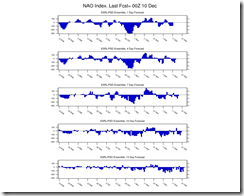
The NAO:


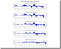
The PNA:

There are signs that the low over the GOA is going to breakdown. The current negative Western Pacific Osculation has been going strong for the last few months. it is gone or almost gone. which has been dominant for a couple of months. Because it is gone and forecast to remain gone. This should allow ridging south of Alaska to shift towards the Aleutians, and pump very cold air into Alaska and western Canada. The PNA is super negative at this time. With the negative WPO over, we should see ridging south of Alaska to shift towards the Aleutians, and pump very cold air into Alaska and western Canada.
The EPO is positive right now. The GFS whats to head the EPO back into negative territory. However the EURO is not showing this to any great degree. I think the Euro has a better handle on the EPO, at this time. The Euro is showing a trough for the East and West Coast; this will imply cold air in the east. Based on this I feel the very warm temperatures we've seen in the first part of December are just about history. The air that will be coming in for the 2nd half of the month won't be super cold. But it will be cold enough for snow. It does look like ridging will try to develop northeast of the region. That would favor interior northeast and Northern New England. It looks like the 2nd half of December will be more stormy than the first half; this will be key if we want snow.
The Euro long range:
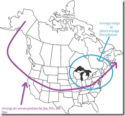
The ECMWF (Euro) model long range forecast for the three months of January, February and March is showing that the temps will be near normal for the Northeast. It is also showing that the winter time precipitation will be above normal. Due to licensing issues I can't show the model runs but I can show you this.
The model is trending toward more in the way of a stormy weather pattern for the Ohio Valley and here in the Northeast for January through March. One thing that did surprise me was the model is forecasting colder temps for the Great Lakes; if this does verify it would start the lake machine cranking up in a big way, given that the lakes are a few degrees above normal for this time of year. As always, this is just one of the models and we're looking out three months. But the Euro has a better track record than the other models when it comes to long range forecasting.
If you what to subscribe to model runs here are a few good sites.
The models:
First of all models are not perfect. So a good forecaster only uses them for guidance. If you've been following what I'm saying on blog post and on my Facebook fan page, then you know I said December was not going to be exciting until the second half. The models are showing increased chances for both cold and snowier weather for the Northeast.
Over the weekend the northern Plains got hammered with a Blizzard. As much as 18 inches of snow fell in parts of Minnesota and Wisconsin. What does this mean for us here in the Northeast, well nothing really. But when the Mid West gets snowstorms in December; the East Coast usually has a good end of December thru February, snowfall wise. why is this? A snowpack in Lower Canada and the Western US allows for the Arctic air to have more staying power. The GFS Ensemble for the 16th of December is showing colder air going into Christmas week.
Christmas week: After a few snow showers and flurries tomorrow morning. We should see 4 or 5 days of cooler but dry weather. The next storm system will likely move through Saturday night and Sunday with a chance of some rain.
Christmas week: After a few snow showers and flurries tomorrow morning. We should see 4 or 5 days of cooler but dry weather. The next storm system will likely move through Saturday night and Sunday with a chance of some rain.
The models overnight have moved towards a solution and are showing two potential significant events. The first one is the low pressure area for December 15th, which looks like it's going to track up through the Northern Plains. The Second and potentially bigger event would be the first major winter storm the season on or around December 18. With the low pressure area tracking up from Arkansas through Tennessee Eastern Kentucky Eastern Ohio West Virginia and up into the Northeast. The Euro has had it for several runs. The 18 Z GFS is showing activity that could bring snow into the Northeast. I think the Euro is overdoing it a bit, but it's still a possibility. I feel the Euro will shift toward the GFS. The GFS might come a little more to the west for the 18ht. I do think there is a good chance for a mid-Atlantic/Northeast winter storm early next week.
The GFS showing the 17th.

Winter time precipitation looks to be above average for January, February and March . But remember, This is going to be ENSO neutral, neutral years tend to be see saws as far as temperatures go, with swings between warm outbreaks and cold outbreaks. And since cold air is needed for snow, snow storms would depend on cold air. I can't guarantee which storms will be snowstorms. But if the Euro is right and the next three months in the northeast will be colder and wetter on average. Then I feel it's safe to say snow should end up above average for the winter of 2012-2013. So don't abandon the ship just yet....winter will come.
Rebecca


No comments:
Post a Comment
Thank you for taking the time to comment, I will answer as soon as I can.