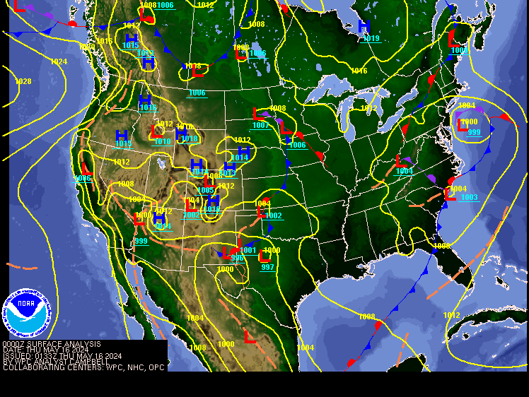
Looking at the surface chart we see high pressure is still overhead, meaning the cool mornings and warm afternoons with lots of sunshine will continue. These conditions are going to continue into later Wednesday, when a trough of low pressure currently over the western Plains works its way to our region.
Wednesday we
will have a cold front approaching, the center of low pressure will be moving
over southeast Canada into the Saint Lawrence Valley. Wednesday evening/night
the cold front will be coming through, with scattered showers. The farther
north you are the better your chance of seeing rain. The front will bring
cooler temperatures back for the region.
Thursday the
front will move out, allowing for clearing skies, with breezy conditions. Friday will be cool and looks to be dry. But we will see another cold
front move through for Saturday with more scattered rain showers. Snow showers
are likely for those higher elevations of northern New York State and northern
New England. Sunday will be clear with cool temperatures. Much colder conditions
will be the case for Monday.
Oscar...
Oscar, became a hurricane over the weekend. Yesterday he made a landfall in the southwest Bahamas, then a landfall on eastern Cuba. Currently he is a tropical storm with sustained winds of 45 mph, and a central pressure of 1000mb. The mountains are disrupting his circulation. He is now starting to make a turn to the north. Then he will continue to turn to the northeast, moving back over the Bahamas, as he heads away from the U.S. on his way toward Bermuda, and eventually Eastern Canada.
We have a
cold front that will be moving off the East Coast this is going to shove him
toward Bermuda for later Wednesday. By then he will likely be post tropical. Then the
Bermuda Azores High, will steer him toward Newfoundland in Atlantic Canada
later Thursday/Thursday night.
We coming
into the last part of the Atlantic hurricane season. But the teleconnections are
hinting, that the Atlantic could become somewhat active again as we get into
November, we also still have those warm SST out in the Atlantic Basin. We will
see how this shakes out. But I wouldn’t be surprised to see at least Patty develop
during the first part of November.


Thank you!
ReplyDeleteYou're welcome
DeleteWe will all be on the lookout for Patty. Luckily, my friends and family in Florida, and North Carolina were prepared for the last two and are ok.
ReplyDelete