
Today the Climate Prediction Center / NCEP released this week’s El Nino update.
Global SST Anomaly
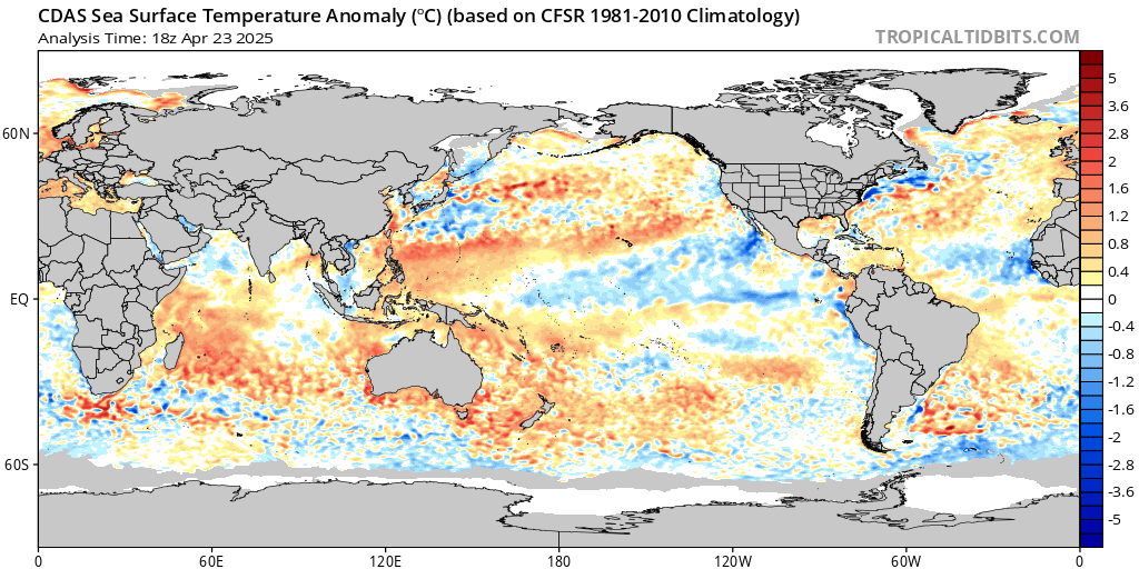
SST Anomaly mean difference
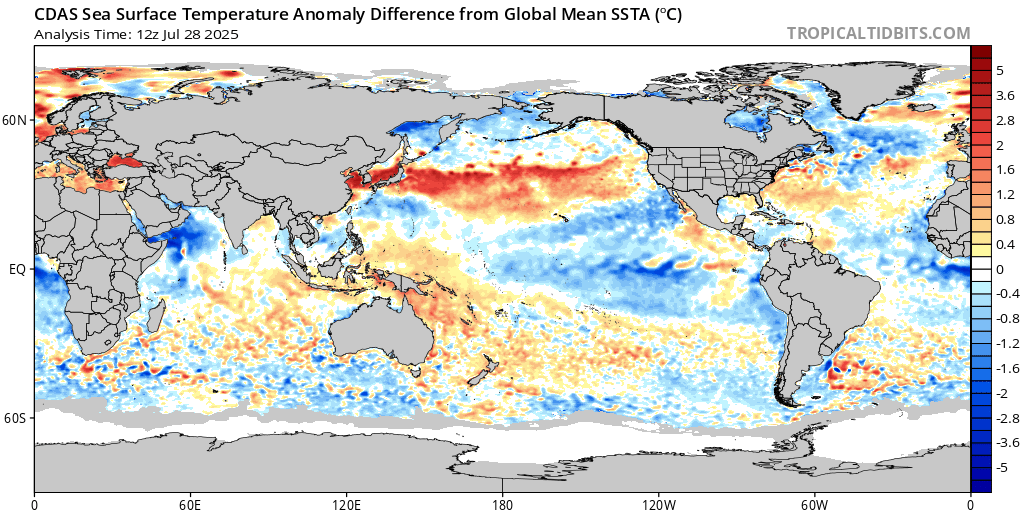
Current Conditions.
SST Anomaly Analysis
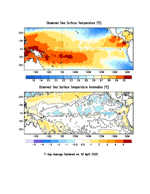
As of today’s update, the Nino region SST departures are
Nino 4 0.1 °C, Nino 3.4 1.8°C, Nino 3 2.7°C and Nino 1+2 is at 3.9°C. While the
Central equatorial Pacific seems to have leveled off; the Eastern equatorial
Pacific continues to get warmer.

National Oceanic and Atmospheric Administration’s (NOAA)
Weather Prediction Center (WPC) El Nino is strengthening, and still says there
is a greater than 90% chance of a very strong event during the Northern
Hemisphere fall and winter 2026-2027.
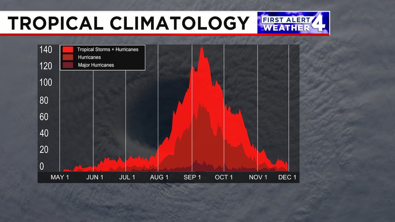
The Atlantic Basin has been seeing a strong impact, with
strong upper-level winds leading to extreme wind shear limiting Atlantic storm
development. The 2026 season is off to its least active start in at least 60
years, continuing to struggle to produce even one well-organized storm. Even
though we're in the heart of the season there hasn’t been an hurricane yet for the
season. Of the five named storms that
have formed this year illustrate the pattern rather than break it. Each reached
tropical storm strength. But due to the strong shear, dry and dusty air sinking
over the tropical Atlantic preventing storms to really get their act together. It is thought that there have been two seasons
with zero hurricanes: 1907 and 1914. But since that was before the satellite era,
there is no real way to know if that is true or not, due to storms that
never reached land or being reported by ships.
SST Anomaly mean difference
That’s it
for this week


I am wondering how the recent volcanic eruption elsewhere on the globe might influence this.
ReplyDeleteLooking back at the February 2022Tonga undersea eruption That ejected material into the troposphere stratosphere and even Mesosphere. This led to huge and local and regional impacts But it's direct impact on triggering El Nino has yet to be fully established. There have been several studies into interactions a major volcanic eruptions like Mount Pinatubo These inject gases and aerosol particles into the stratosphere Which can Which can reflect solar radiation and cool the surface. It is believed that this can strengthen the Madden Julian Oscillation, In this way it can interact with the phases of ENSO, but it's not the soul driver in El Nino development. There is still a lot we don't understand about the volcano ENSO connection.but
Delete