
This is late, had to do a lot to get ready for this evening’s flash freeze.
Today is a
rain/mix/snow mess with much milder temperatures.

We have an
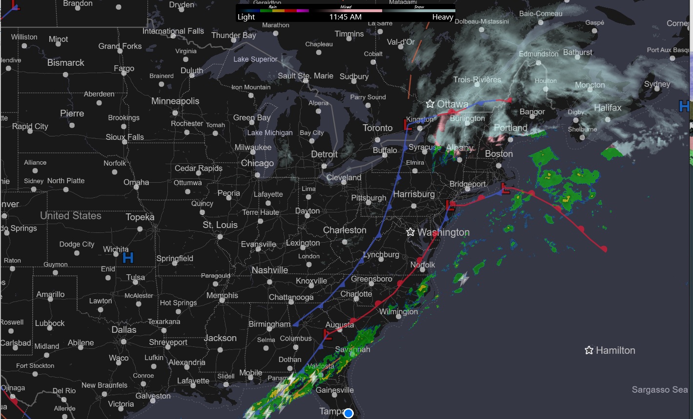
area of low pressure is north of Lake Ontario heading across Southeastern
Canada, attached to the low is a cold front over Western New York State and
Western Pennsylvania, this front will continue to push east today. The radar
shows all the precipitation over Northern New York State and Northern New
England, With the rest of the region clearing out. This north to south clearing
will continue. We also have an area of low pressure over central New Jersey,
with an attached warm front on the Coast. The cold front approaching from the
west will push all of this out of here. Behind the cold front, much colder air will move into the
region, freezing wet and slush covered surfaces. With the front will come very gusty winds.
With the
warm temperatures and melting snow, locally dense fog will be an issue for some
of y’all.
This evening
through Valentine's Day afternoon, lake effect snow will be falling Southeast
of Lake Ontario. The lake snow could be heavy at times. Areas like Syracuse
could see 6-12+ inches under the most persistent bands, with 2 to 6 inches for
areas outside of that. Friday midafternoon into Friday night the lake snow
bands will lift north toward the Tug Hill. The lake effect will be weakening as
it moves north. During Friday high
pressure will be setting up overhead. Providing a quiet day for those away from
the Big Lakes, with mostly sunny skies and seasonable temperatures.
The storm for
this weekend


Saturday
will see that high pressure start to push east, ahead of another approaching
storm.
Low pressure
will form over the southern Plains, and then ride along a dip in the Jet Stream,
moving north and east. Arctic air north and west of the low, will combine with
warm and moist air south and east of the low, allowing the storm to deepen. So
once again severe weather is likely for those areas south of the track, with
snow/mix/rain along and north of the track. As the first low heads toward the Great Lakes,
a second low will form
The precipitation
will move west to east Saturday and will last into Sunday. Snow showers will
start in western parts of our region Saturday morning, some snow will likely be
starting across southern Pennsylvania, and maybe Maryland, Delaware and New
Jersey Saturday morning as well the snow/mix will make it into Eastern New York
State and Western New England around mid-day.
Southern
parts of the region will see a see a quick change to a mix then change to all
rain by the afternoon. So, most of
Pennsylvania, Maryland, Delaware, and Central and Southern New Jersey will see light
(C-1) to no snow before the change to quick mix before going to all rain, these
areas including the middle Atlantic look to see 2-3 inches of rain. Northern
Pennsylvania, the Southern Tier of New York State, including New York City/Long
Island, Southern Connecticut and Northern Rhode Island could see 1-3 inches,
Northern Connecticut, much of Massachusetts, into the Mid-Hudson Valley and
Mohawk Valley could see 3-6 inches of snow. Northern New York State and Northern Massachusetts,
Vermont, New Hampshire and Maine will likely see several inches of snow. That warm nose will continue to move north
Saturday night and Sunday changing snow over to a sleet/freezing rain mix for
much of New York State and Central into Northern New England and then maybe
rain for some of those northern areas. The mix could even make it into coastal Maine.
Winds will be quite gusty Sunday and
Monday, with gust of 45 to 50 mph possible.
Colder air
will come in behind an arctic front as the storm departs. This will kick off
some lake effect snow for Monday into Wednesday for those areas downwind of
Lake Ontario. For the first half of next week will be dealing with an arctic
airmass, so it will be quite cold for mid-February. We will have yet another
storm tracking along and ahead of the Arctic boundary, depending on the
location of the jet stream and where the arctic boundary is sitting, will have
a lot to say on the track and intensity as the storm develops and moves north
and east, the track could be close to or over the Coastal Plain, or it could
track a little more offshore. Too early to go into much detail and snow
amounts, but there is a chance this could bring heavy snow to the mid-Atlantic
and New England, Could Eastern and Northern New York State see significant
snow? Maybe! We will watch and see how things trend.
No comments:
Post a Comment
Thank you for taking the time to comment, I will answer as soon as I can.