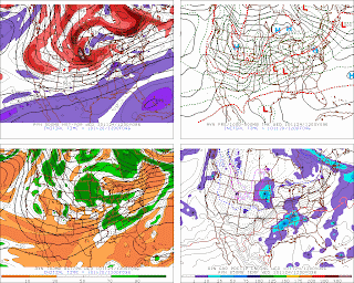
I do like that the GFS is similar to its GEFS mean. There is some similarity amongst the GFS/UK/NAM in one camp with the EC the outlier on the track of the low through the Great Lakes around the holiday though the GFS may be too deep on both the pressure of the surface LP as well as the H500 low's height.
Most of the models continue show rather strong confluent flow across the NEUS during the Wed-TGD period. The forecast 850 temperature field from both the EC:
and GFS
continue to show a cold air damming (CAD) signature across East-central NYS to Western New England ,I would think that the probability of frozen precip at the start of the event is quite good for a sizable portion of NYS. I would expect the southern periphery to extend from from WNY (the NY/PA border) to the Catskills and Hudson Valley around Albany then towards S VT. Right now I would think that the start of any precip would be late afternoon to sunset over the west and around 2-6 am in the east. Areas from about ART to GFL may not see the precip arrive until during TGD while areas to the north and northeast of this line may see little if any precip at all.With the system looking like it is occluding over the Great Lakes on TGD and with this CAD signature remaining in place on both models (GFS being the strongest). There should be some sort of at least a weak LP development (if not two) east of the primary. I would favor one on the warm front with a second possible LP development on the triple-point (TP). Looking at the 12z GFS data in WINGRIDDS and running a macro that I like to use that shows where LP (secondary) LP development might occur it is pointing towards a weak secondary on the warm front LI/LI Sound/SNE Coastal Waters (west of Block Island's) longitude. This also fits well with synoptic climatology that indicates when a closed H700 hPA low tracks along and north of a Chicago-Cleveland-Montreal line any secondary development tends to occur along the coast to the east through northeast of the primary surface cyclone.
Looking at the ageostrophic winds the forecast data continues to show N-NE ageostrophic flow of around 10-15 kts for the NE corner of NYS from about Ogdensburg to Gloversville-Glens Falls-Rutland on Thursday :
So I would think that within this area either all snow or a mix would occur. BUFKIT temperature tool indicates a fairly sharp temperature gradient pretty much N-S oriented with coldest temps near the US/CAN border and warmest heading south.
On the other hand owing to how the pattern looks (SW-WSW flow aloft and confluent flow) I think QP will average around or less than 1/3 rd of an inch; some isolated near ½ inch amounts may occur south Albany in the HV and maybe across the Western Adirondacks where some orographic enhancement in the SW to WSW flow may occur. In general I would think that there will be north-south gradient to the qpf with lesser amounts to the NW-N of the above area and more along and south to southeast of the above area.
As for the post-holiday weather: It still looks like a good (significant LES) event but a colleague and friend of mine may be right in that it may not be as long a duration event as some (including myself) were thinking.
In addition the bands may shift around during the Friday thru Sunday period and I think that both the belts to the east of LO and LE will be vying for who gets the most. I'm beginning to think it will be a good competition but I'm starting to think that LE snowbelts MAY actually win out over the LO ones.
(Though my caveat is that it it is still too far away to really commit to a definite forecast). I'll address this in a separate update as we get closer to the expected event.I can envision some of my flow meteorologist and knowledgeable weather hobbyists getting involved in this update.


any updated thoughts with the secondary or lack there of development ....how bout for well interior SNE and CNE?
ReplyDelete