
We made it to Friday!
The surface chart shows the frontal boundary is down over the virginias. We do have high pressure sitting north and east of our region. Radar is showing the vast majority of region is dry with just a few isolated showers close to that frontal boundary to the south.


The cold front yesterday has swept out the humidity that's been plaguing our region for a while now. Today temperatures are going to be A bit below average for this time of year and the lower humidity is going to make it feel very comfortable outside maybe even a bit cold since we become accustomed to all the heat and humidity.
During the overnight into Saturday The stalled frontal boundary is going to start moving back north as a warm front we are going to see low pressure move along the front. As the front moves into Pennsylvania, Maryland, Delaware and New Jersey, It will create some scattered showers and possibly some thunderstorms. There could be few rogue Strong/ severe storms over far western parts of the region. The area of low pressure should make it off-shore Saturday afternoon allowing for clearing skies west to east. The rest of the region should be dry for Saturday, But I can't rule out the chance for some rogue showers to make it up into Long Island.
Saturday overnight a cold front will be approaching, clouds will be increasing ahead of the front. As the front drops out of the great lakes in Canada we will see a broken line of showers and some thunderstorms dropping into northwestern and western New York State In northern New England during the morning. The front will continue to drop east and south during the day, the line will be making it into the I-95 corridor late in the day.
Over the weekend the severe threat looks to be rather low, but there could be a few storms and a strong side with some gusty winds and heavy rain. The weekend is not going to be a washout. All y'all will see scattered showers isolated thunderstorms so just so don't cancel any outdoor plans just keep an eye on the sky and be prepared to move indoors if something does approach your area.
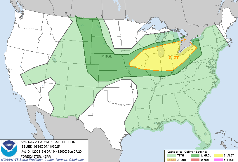
Here's a look at the day 1-3 convective outlook.


Monday behind the cold front temperatures and humidity levels should be similar to what they are today. High pressure should be in the vicinity for Tuesday through Thursday keeping the region mainly dry with only a chance for a few showers and thunderstorms each day. Temperatures and humidity should stay comfortable for Tuesday. But the humidity and temperatures will start to move back up for Wednesday. Our rain chances go up for Thursday night and Friday as another cold front approaches and moves across the region. Ahead of the cold front for the end of the week temperatures and humidity are going to rebound becoming hot and humid once again.
Invest 93L is gone. The rain that was associated will continue to move north and eventually east. It's too soon to know if any of this rain will make it into our region here in the northeast So we'll keep an eye on it.
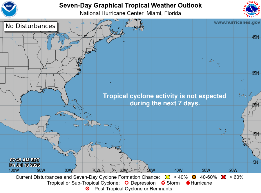
The national hurricane center isn't showing anything developing over the next 7 days. But we do have a couple areas in the Atlantic that are worth keeping an eye on just in case.