
Here's a look at the Atlantic Basin.
Atlantic Tropical Overview

Atlantic Basin Graphical Tropical Outlook

7-Day Graphical Tropical Weather Outlook

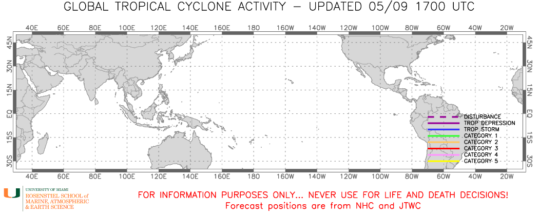
| Global Tropical Cyclone Activity Tracks |
|---|
Current Global Tropical Cyclone Tracks
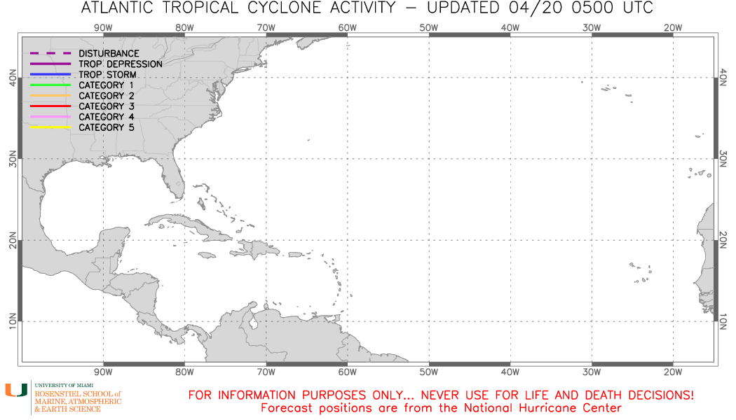
Current Atlantic Tropical Cyclone Tracks
Atlantic Surface Analysis

Satellite Loop

Image of the caribbean, Gulf, and Atlantic Showing Precipitable Water

Atlantic Weather Analysis

Wind Speed Probabilities-Based Tropical Cyclone Danger Graphic

The Global Tropical Hazards Outlook is updated once a week
Global Tropical Hazards Outlook

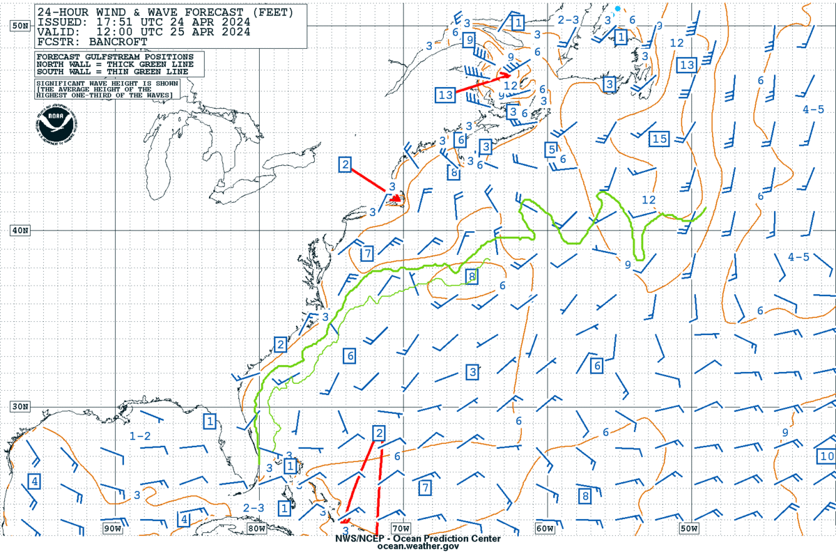
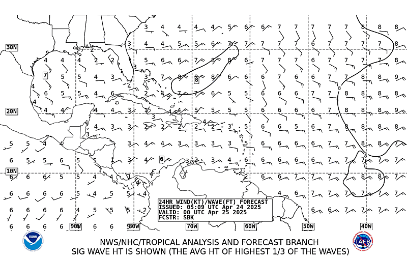
24 Hour Wind/Wave Forecast
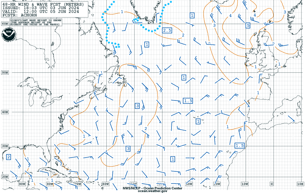
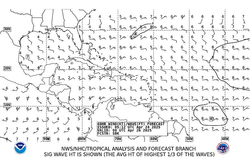
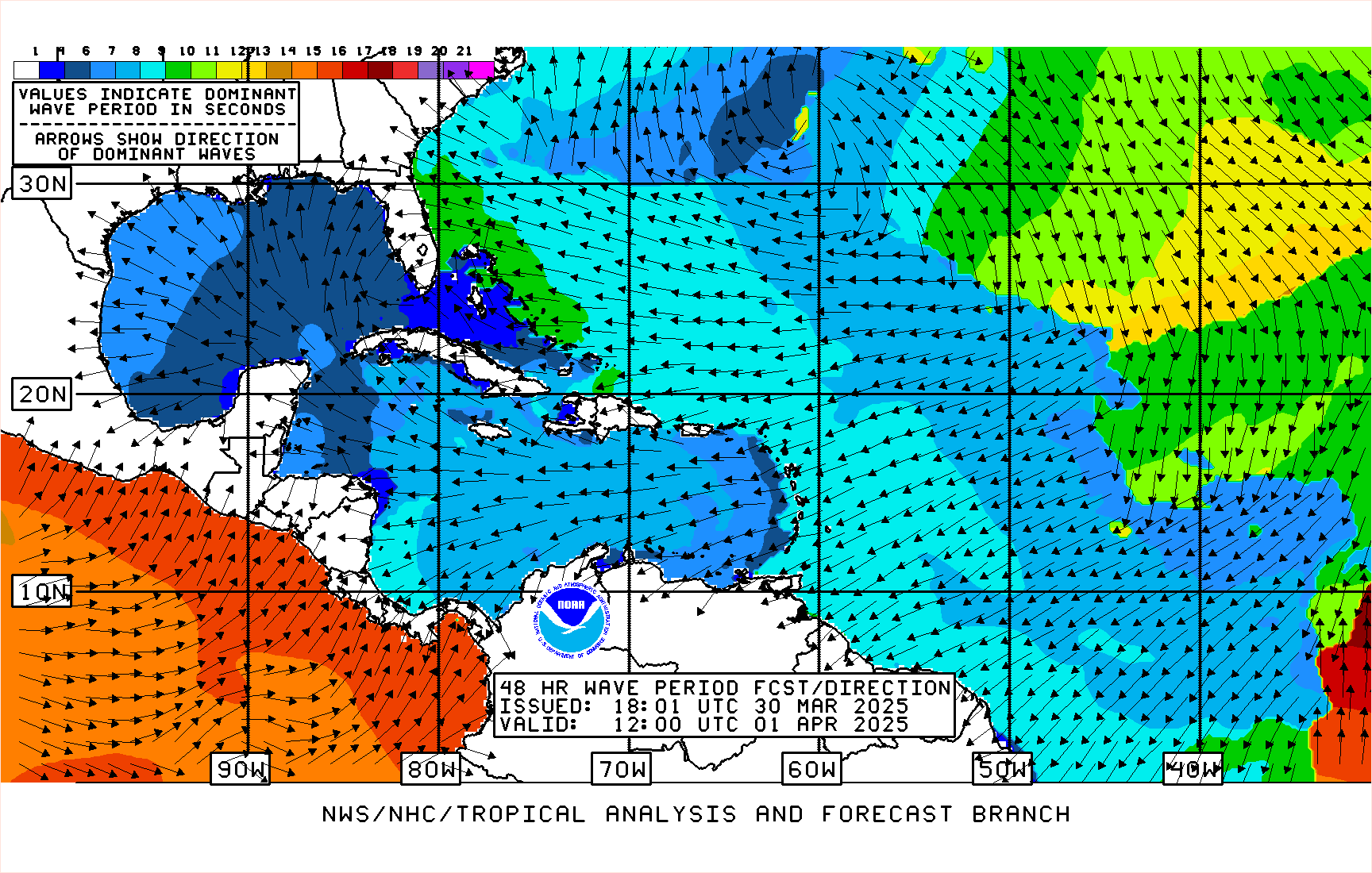
48 Hour Wind/Wave Forecast
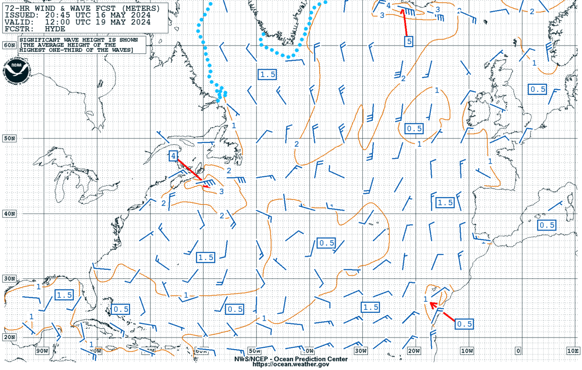
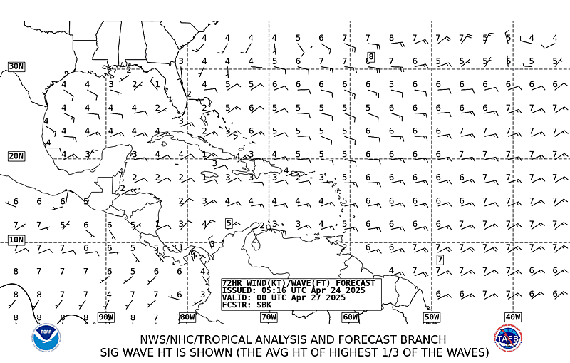
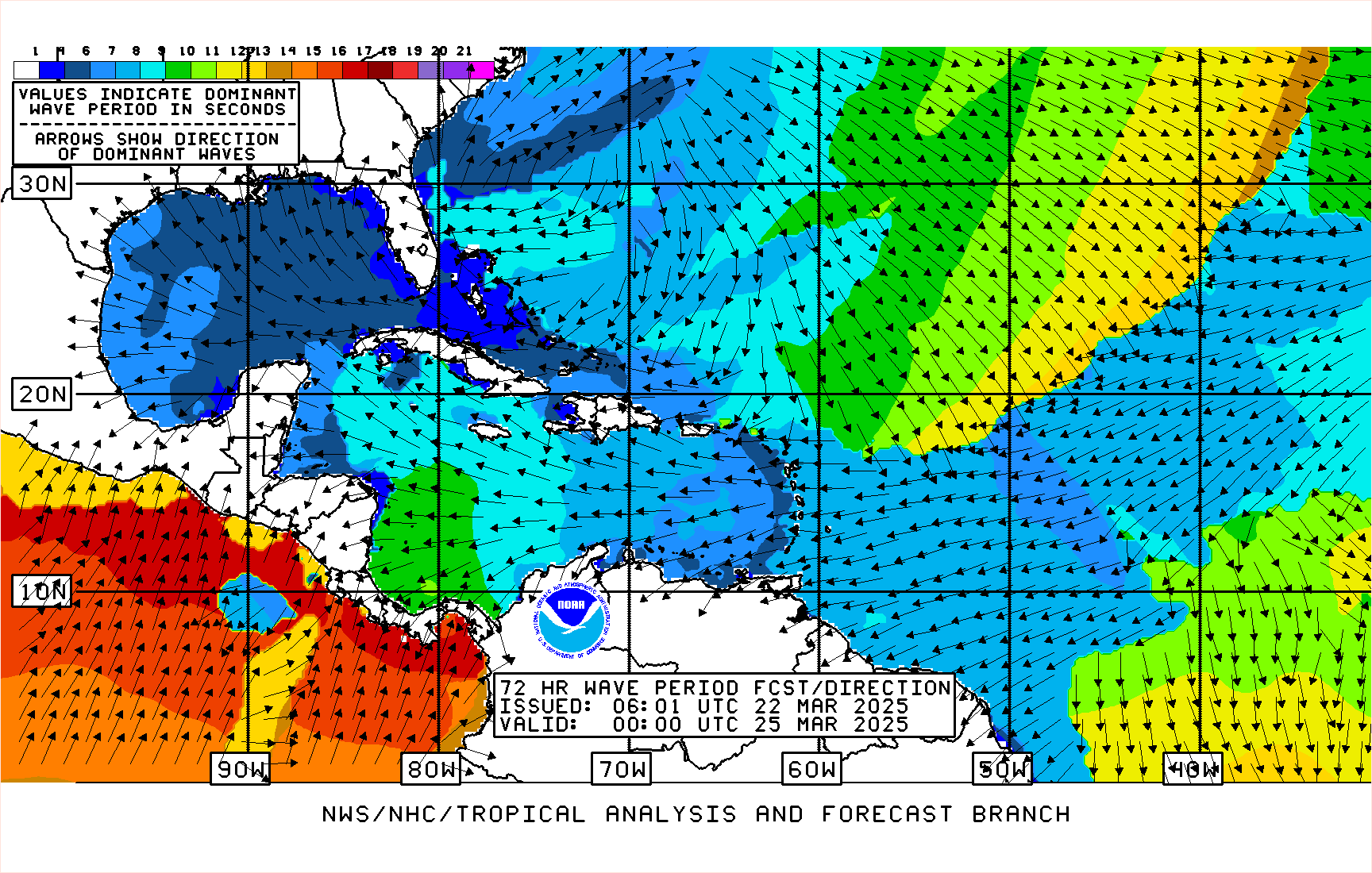
72 Hour Wind/Wave Forecastt
Click on an image for a larger view.
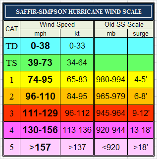
| Tropical Cyclone Heat Potential | MJO Forecast | Saffir Simpson Scale |
 |
 |
 |
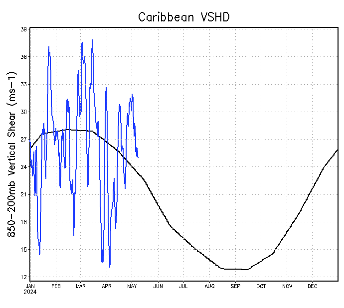
| Tropical Atlantic VSHD | Caribbean VSHD | Significant Short Term Weather Graphic |
 |
 |
 |
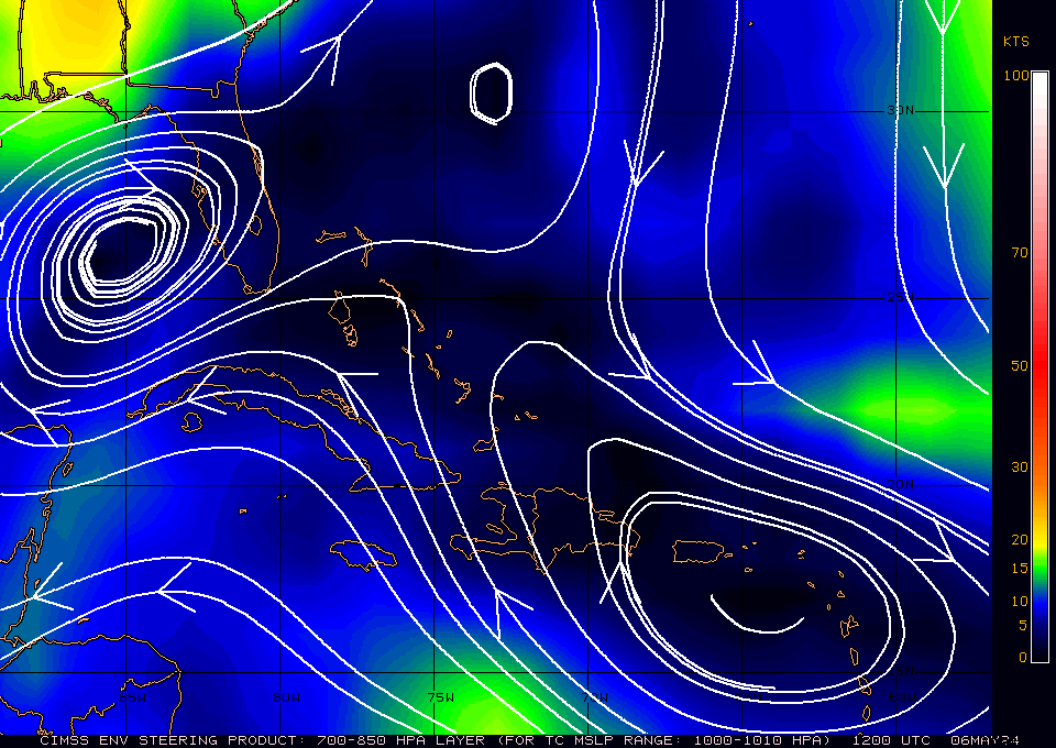
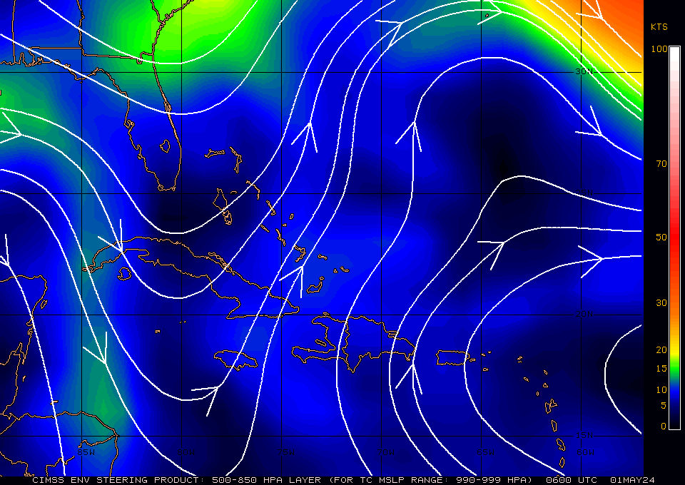
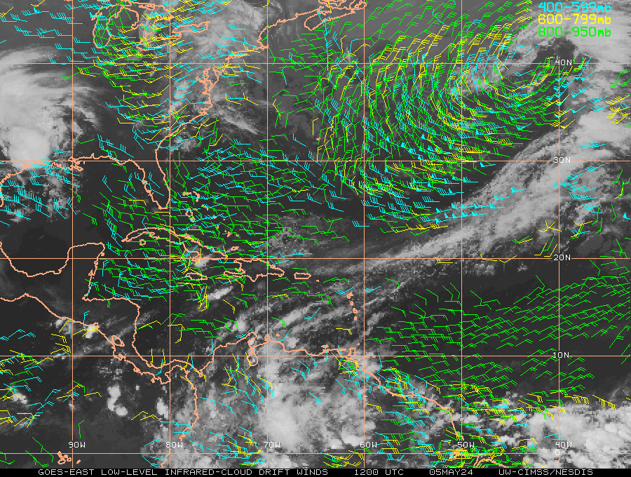
| Atlantic 700-850 mb Wind Analysis | Caribbean 700-850 mb Wind Analysis | Atlantic 500-850 mb Wind Analysis |
 |
 |
 |
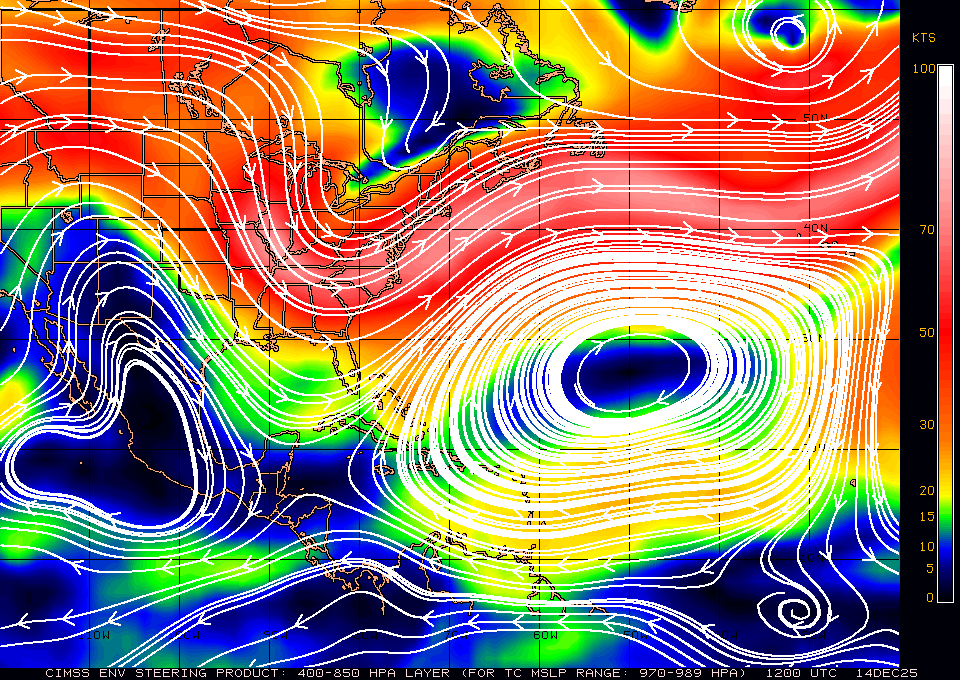
| Caribbean 500-850 mb Wind Analysis | Atlantic 400-850 mb Wind Analysis | Caribbean 400-850 mb Wind Analysis |
 |
 |
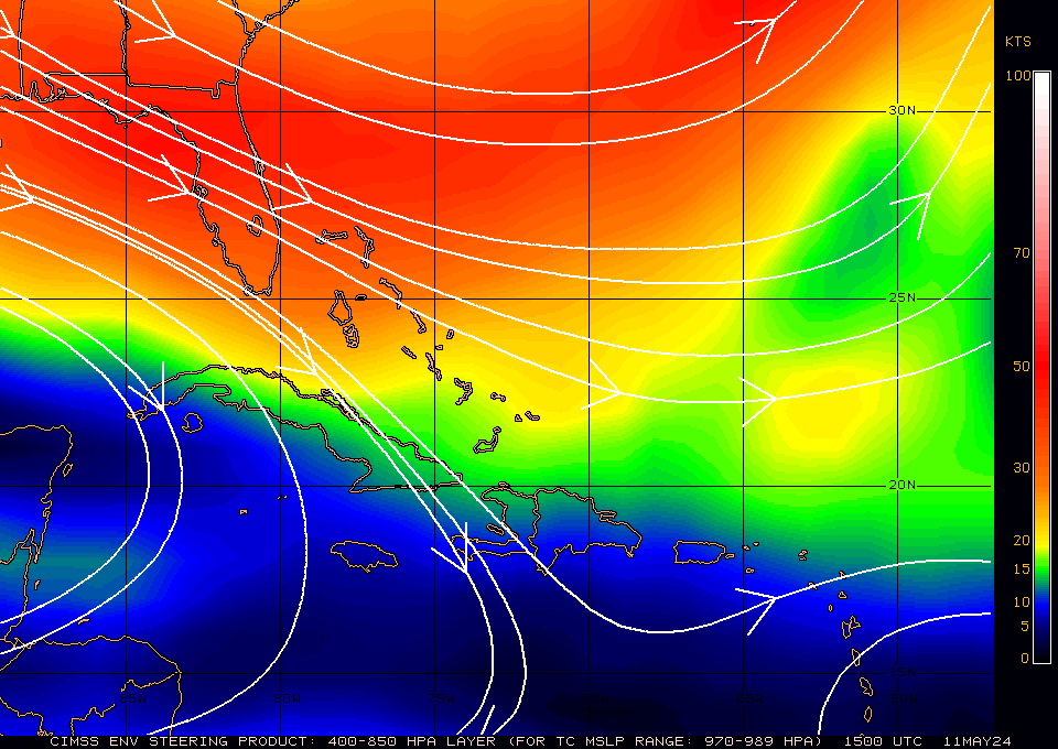 |
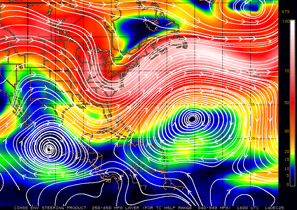
| Atlantic 400-850 mb Wind Analysis | Caribbean 400-850 mb Wind Analysis | Atlantic 300-850 mb Wind Analysis |
|
|
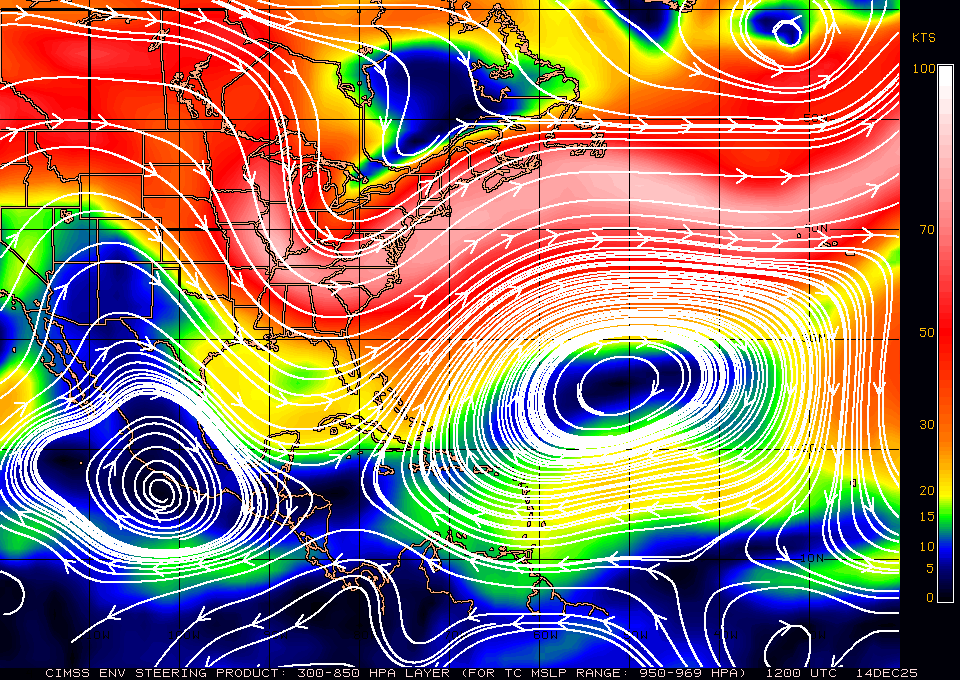 |
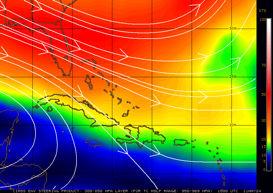
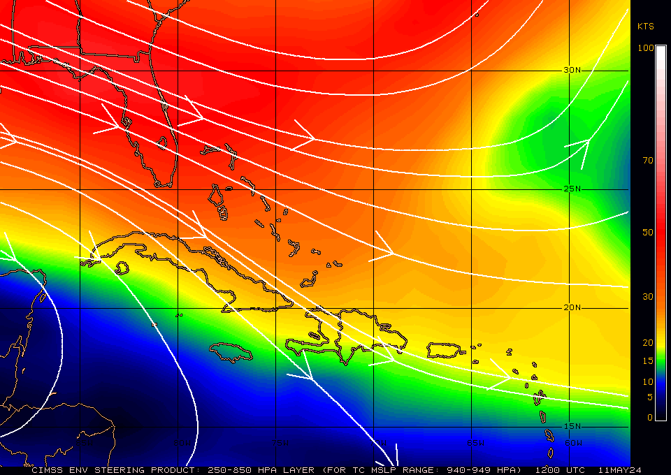
| Caribbean 300-850 mb Wind Analysis | Atlantic 250-850mb Wind Analysis | Caribbean 250-850mb Wind Analysis |
 |
 |
 |
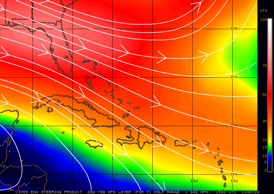
| Atlantic 200-700 mb Wind Analysis | Caribbean 200-700 mb Wind Analysis | Wave Height and Direction |
 |
 |
 |
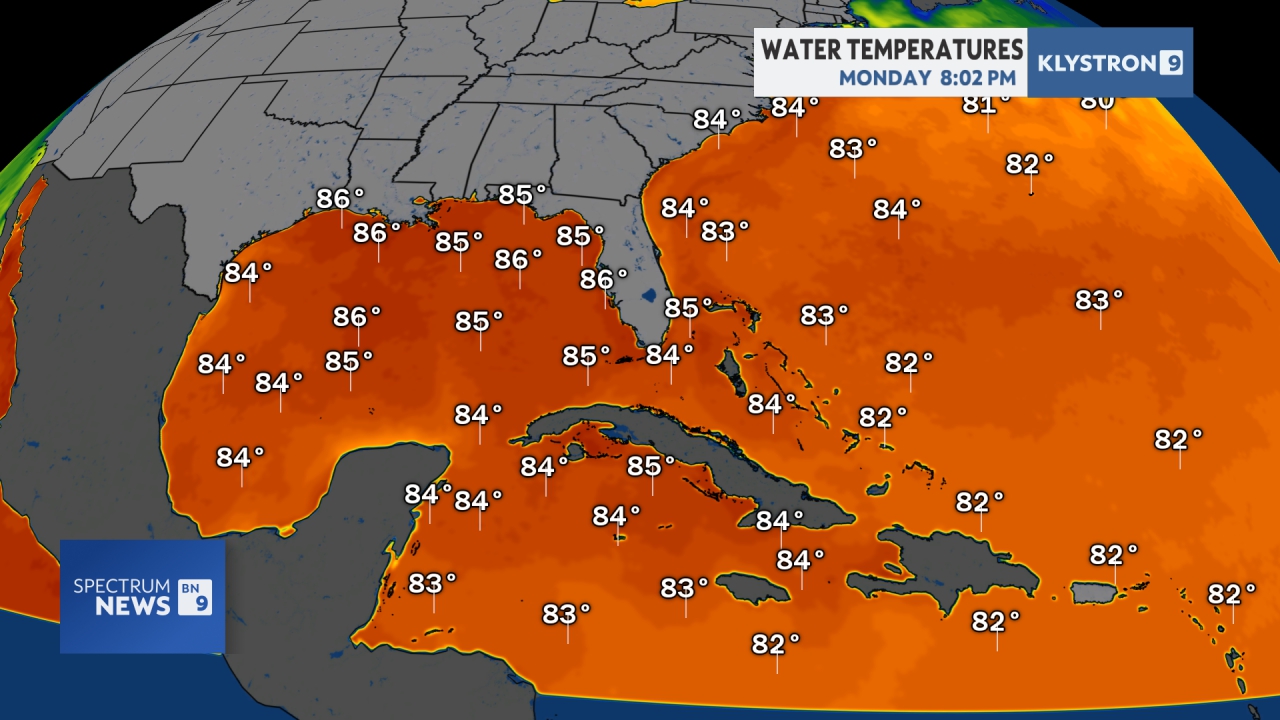
| Tropical Atlantic Surface Analysis | Sea Surface Temperature | Favorable tropical cyclone conditions within 24 hours |
 |
 |
 |
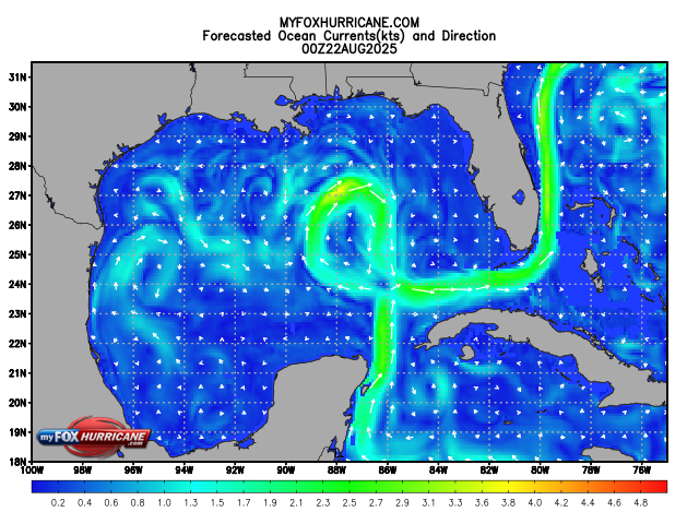
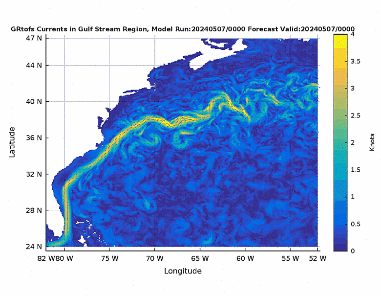
| Tropical Formation Probability 0-48 | Latest Atlantic Geocolor Image | Ocean Currents |
 |
 |
 |
| 850mb Relative Vorticity Analysis | 700mb Relative Vorticity Analysis | 500mb Relative Vorticity Analysis |
 |
 |
 |
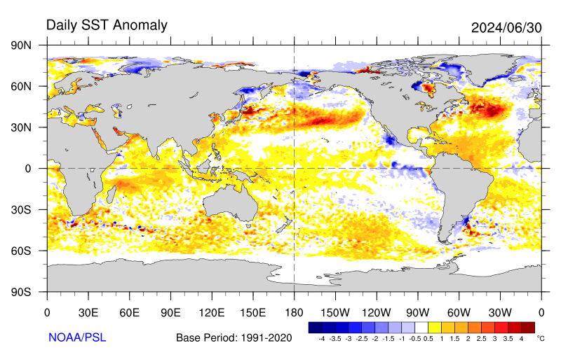
| 200mb Relative Vorticity Analysis | Blended SST temperatures | Atlantic Sea Temperature Anomalies |
 |
 |
 |
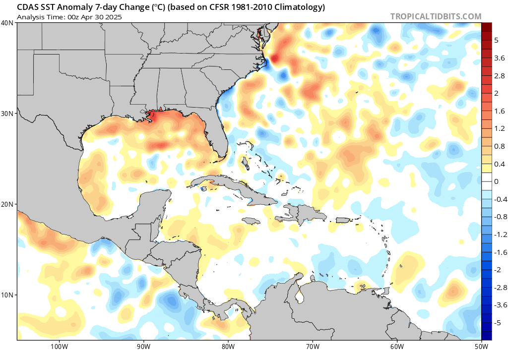
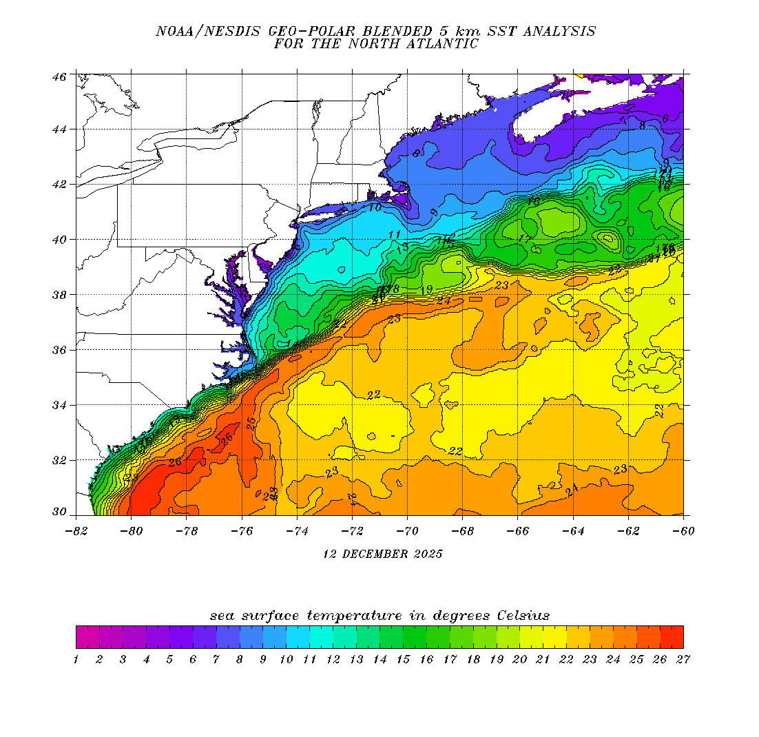
| Blended 5K SST Analysis | Global SST Anomaly – Daily | Weekly SST Anomalies |
 |
 |
 |
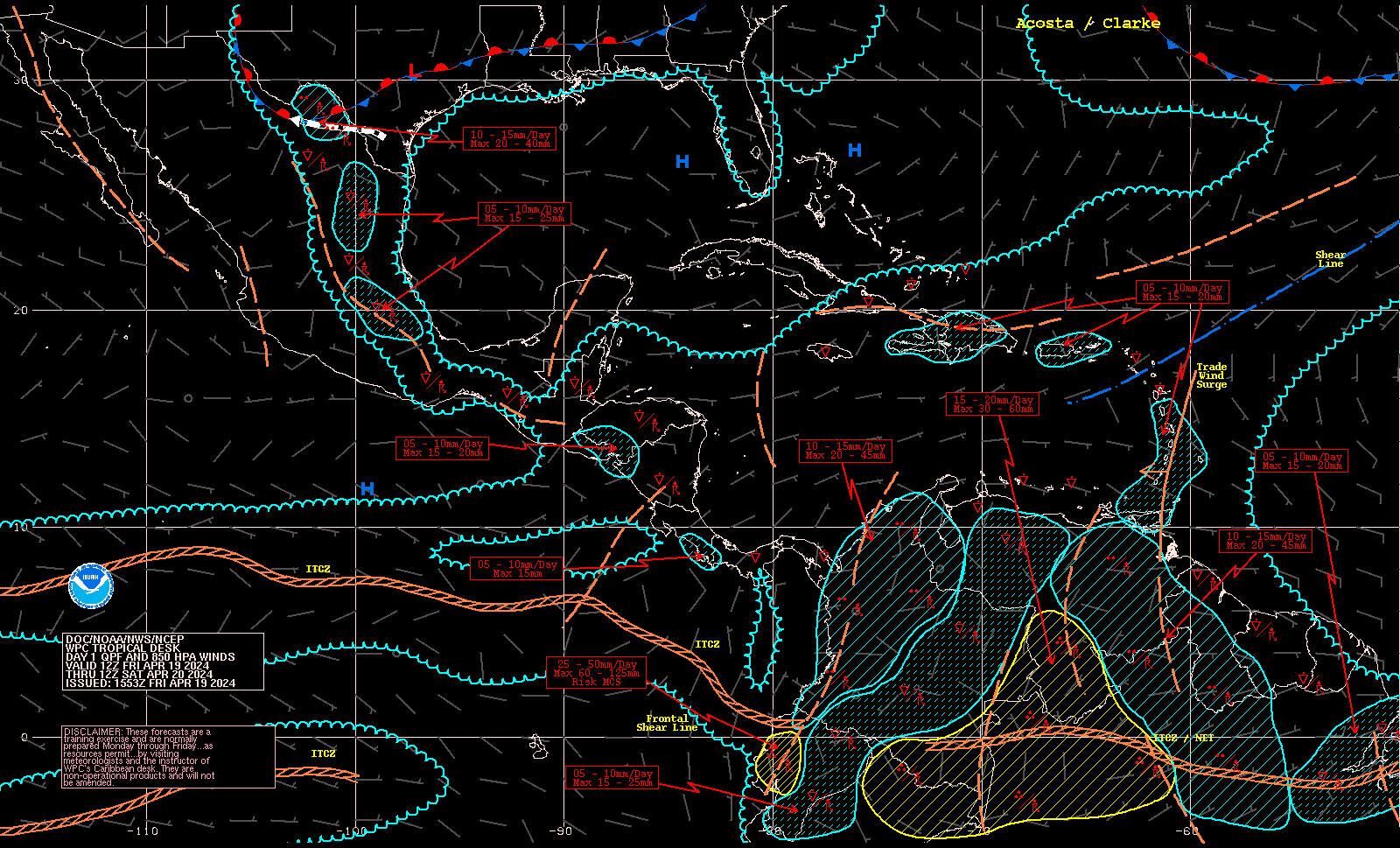
| Saharan Air Layer (SAL) Analysis | Precipitation Forecast | Wind & Wave Analysis |
 |
 |
 |
Click on an image for a larger view
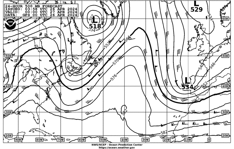
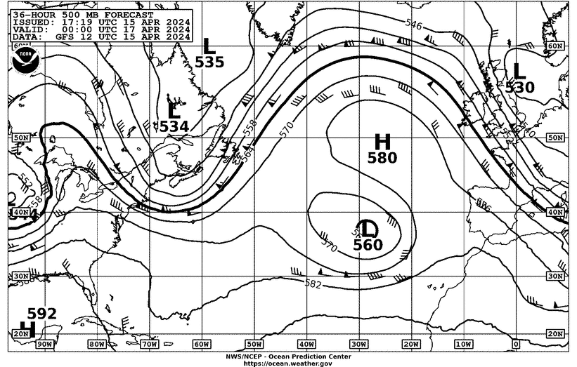
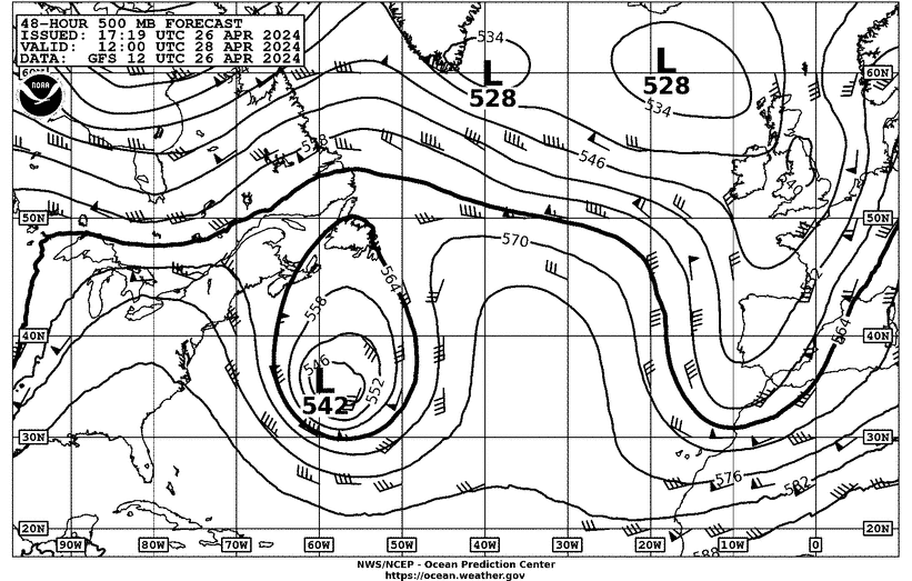
| 24 Hour 500 Millbar Forecast | 36 Hour 500 Millbar Forecast | 48 Hour 500 Millbar Forecast |
 |
 |
 |
Click on an image for a larger view
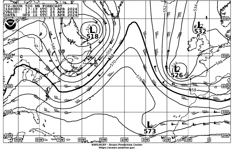
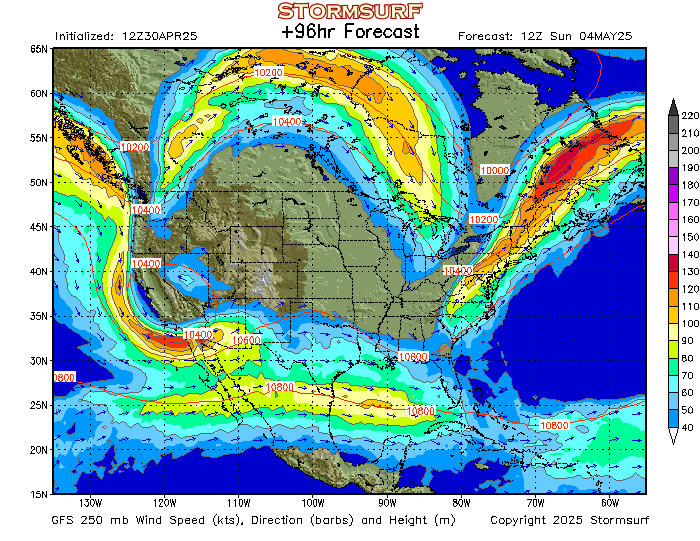
| 72 Hour 500 Millbar Forecast | 96 Hour 300 Millbar Forecast | 24 Hour 200-850 Shear Forecast |
 |
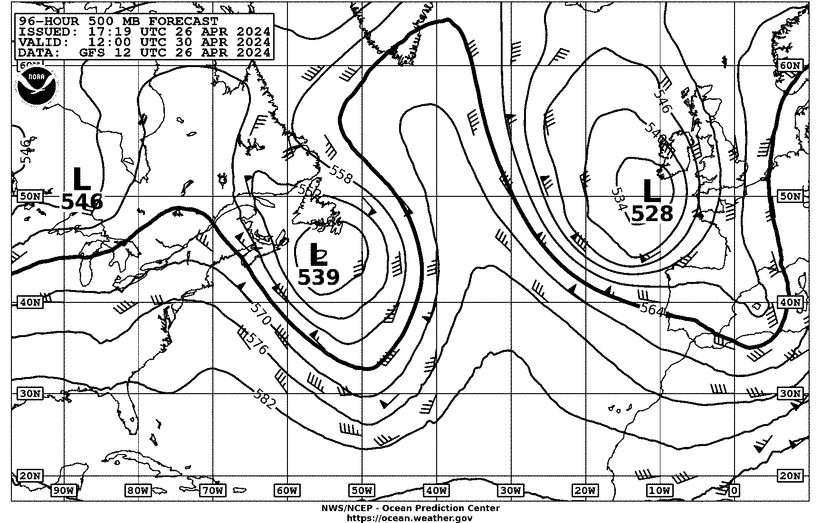 |
 |
Click on an image for a larger view
| 24 Hour NHC Surface Forecast | 48 Hour NHC Surface Forecast | 72 Hour NHC Surface Forecast |
 |
 |
 |
Click on an image for a larger view
| 24 Hour NHC Wind & Wave Forecast | 48 Hour NHC Wind & Wave Forecast | 72 Hour NHC Wind & Wave Forecast |
 |
 |
 |
Click on an image for a larger view
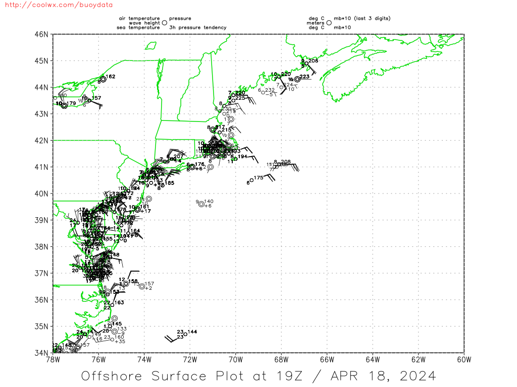
| Northeast US Offshore Surface Plot | Southeast US Offshore Surface Plot | Current Caribbean Surface Analysis |
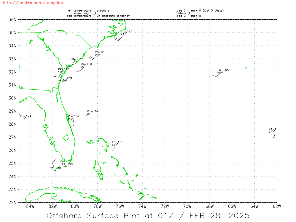
 |
 |
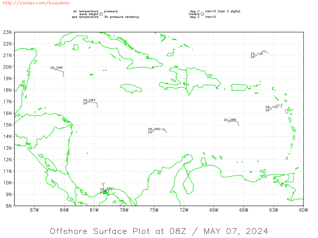
 |
Click on an image for a larger view
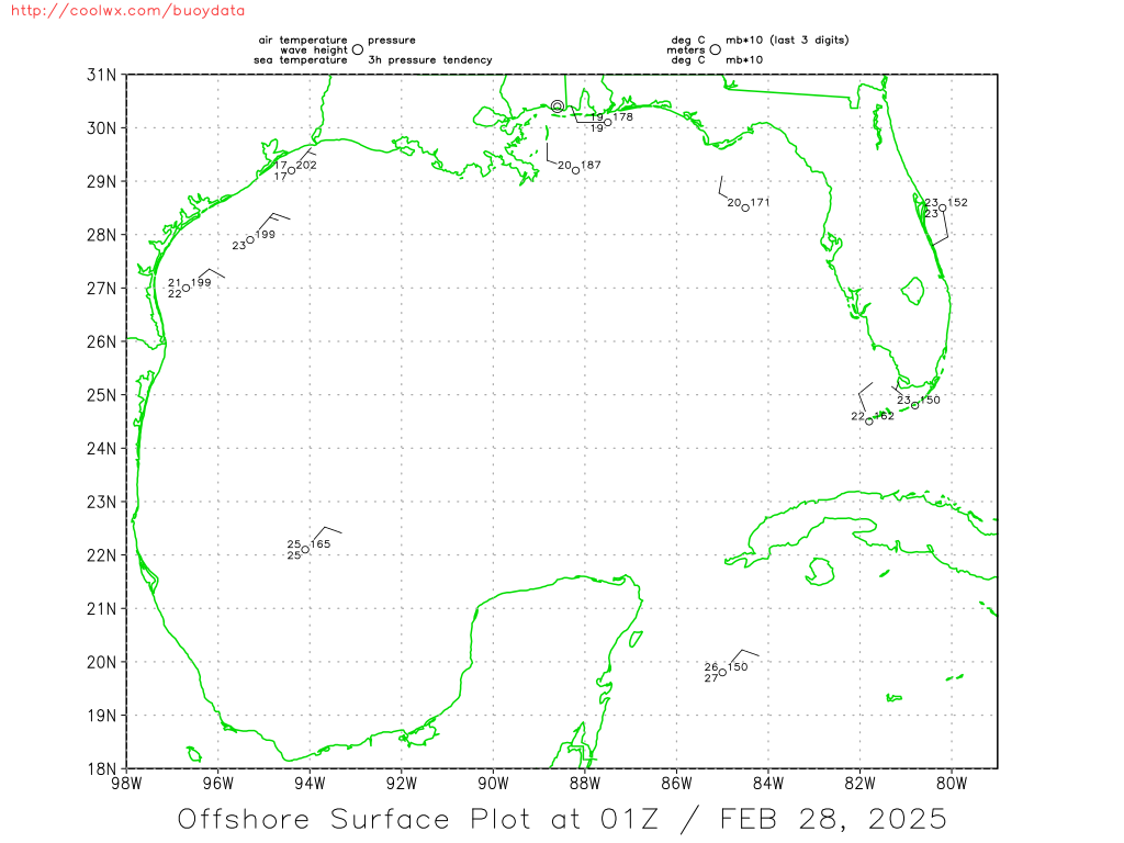
| Current Caribbean Offshore Surface Plot | Current Gulf of Mexico Surface Analysis | Current Gulf Of Mexico Offshore Surface Plot |
 |
 |
 |
Click on an image for a larger view
| Atlantic Sea State Analysis | 96 hr Jet Stream Pattern | 7 day temp change |
 |
 |
 |
Click on an image for a larger view
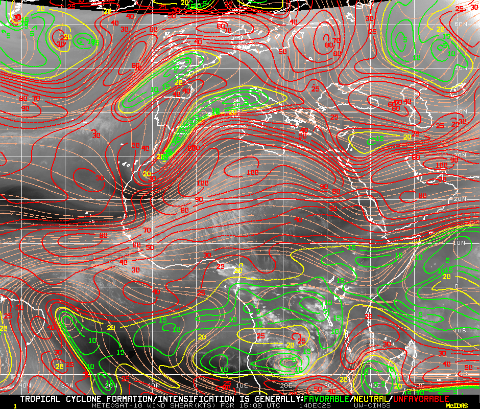
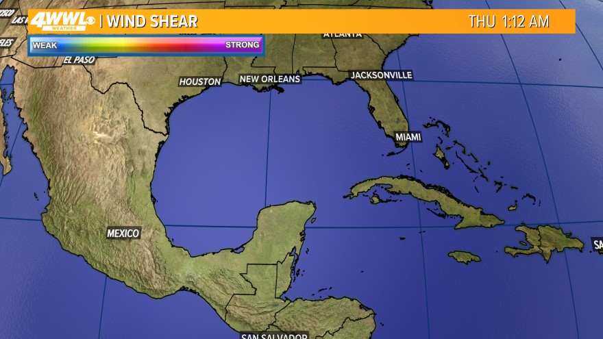
| Atlantic basin wind shear analysis | 24hr shear tendency | Mid Shear |
 |
 |
 |
Click on an image for a larger view
| Eastern Atlantic/African Wind Shear Analysis | Vertical Wind Shear Forecast For The Next 24 Hours | Vertical Wind Shear Forecast For 24 To 48 Hours |
 |
|
 |
Click on an image for a larger view
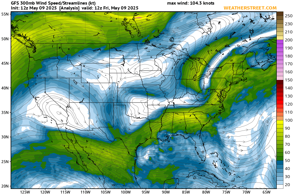
| Jet Stream Analysis | Wind Shear Map | Sea Surface Temperature Anomaly |
 |
 |
 |
Click on an image for a larger view
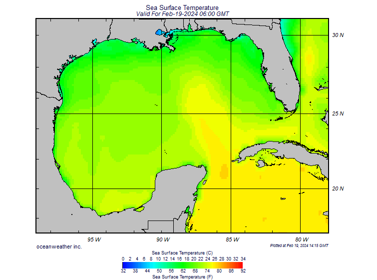
| Northeast Coastal Water Temperatures | Atlantic Sea Surface Temperature | Gulf Sea Surface Temperature |
 |
 |
 |
Click on an image for a larger view
| Current Sea Surface Temperature Analysis | Weekly Sea Surface Temperature Analysis | NE Coast SST Analysis |
 |
 |
|
Click on an image for a larger view
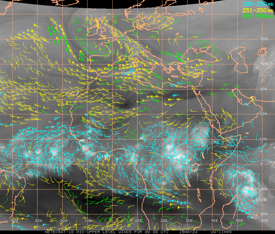
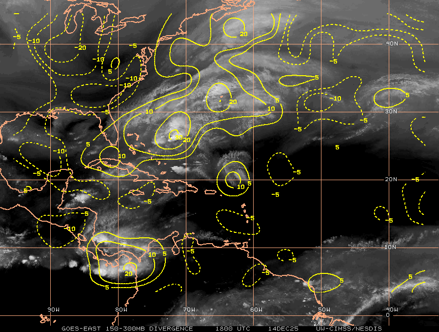
| upper level winds | Lower Level Winds | Upper Level Divergence |
 |
 |
 |
Click on an image for a larger view
| Lower Level Convergence | 48 Hour Peak Wave Period | 72 Hour Peak Wave Period |
 |
 |
 |
Click on an image for a larger view
| Low Resolution Wide Area | Gulf Stream Currents | CONUS 3-7 day forecast |
 |
 |
 |
Click on an image for a larger view
| Northeast Radar | Southeast Radar | Central Gulf Coast Radar |
 |
 |
 |
Click on an image for a larger view
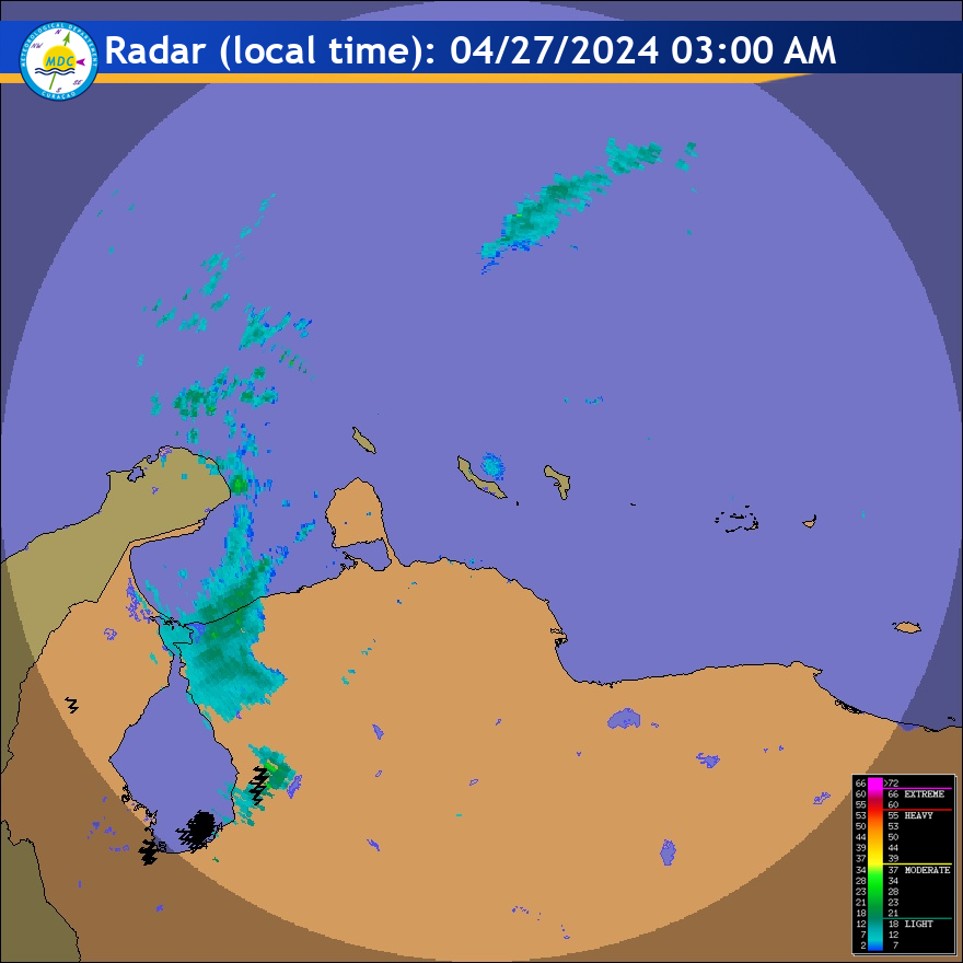
| lesser Antilles Radar | Cuban Radar | Northwest Gulf Radar |
 |
 |
 |
Click on an image for a larger view
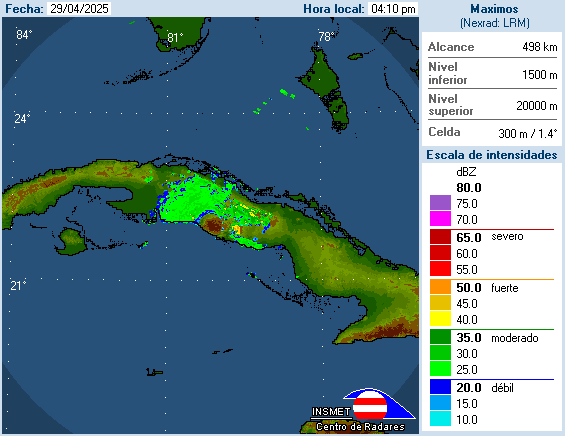
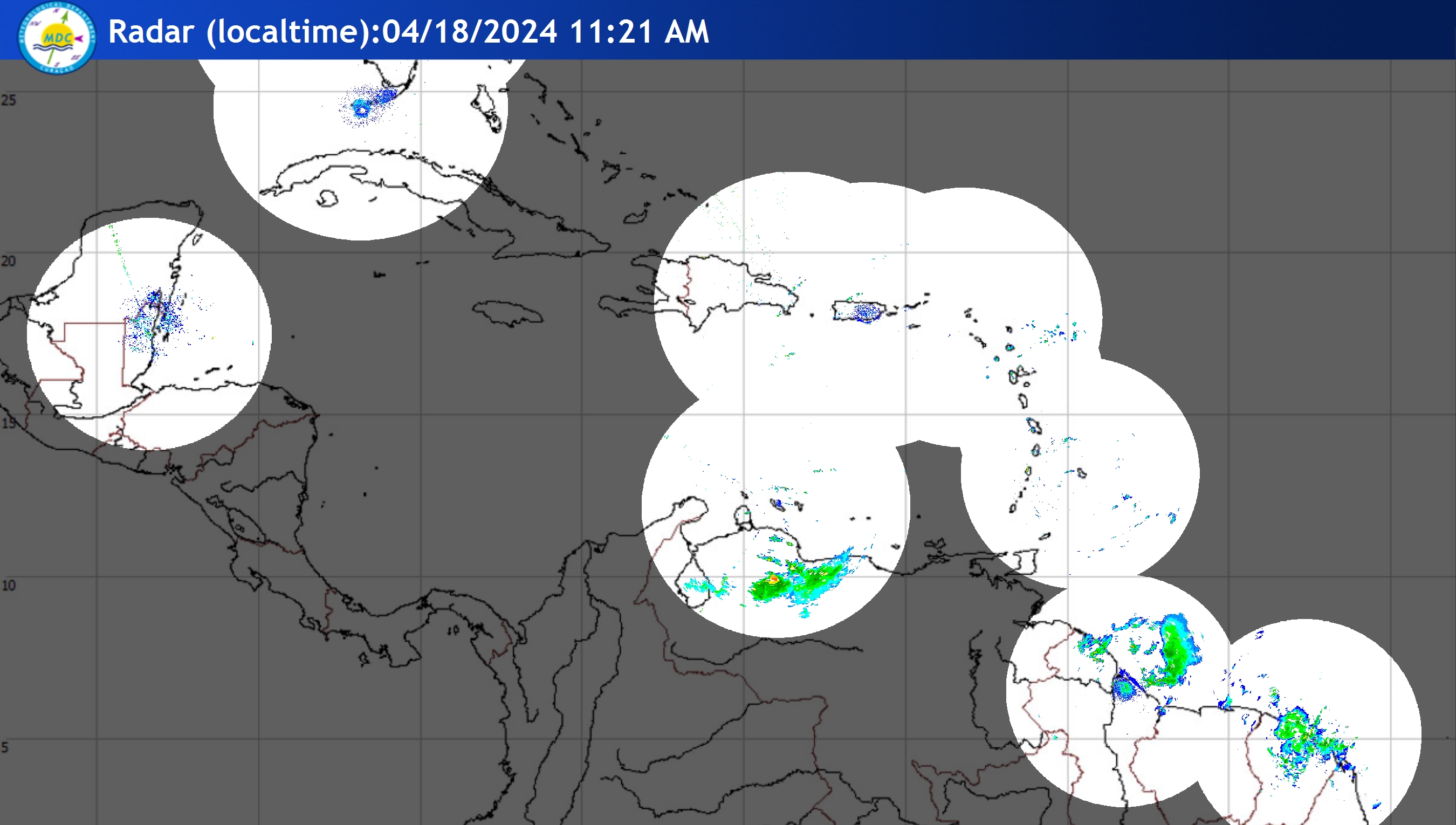
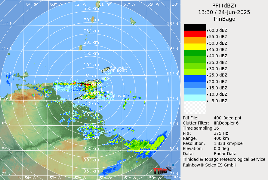
| Caribbean Radar Still | Trinidad and Tobago Radar | Key West Radar |
 |
 |
 |
Click on an image for a larger view
| Tropical Atlantic Wide Visible | Tropical Atlantic Wide Infrared | Tropical Atlantic Wide Water Vapor |
 |
 |
 |
Click on an image for a larger view
| East Coast Visible | Western Atlantic Infrared | Western Atlantic Water Vapor |
 |
 |
 |
Click on an image for a larger view
| Eastern Atlantic Visible | Eastern Atlantic Infrared | Eastern Atlantic Water Vapor |
 |
 |
 |
Click on an image for a larger view
| Gulf Of Mexico Visible | Gulf Of Mexico Infrared | Gulf Of Mexico Water Vapor |
 |
 |
 |
Click on an image for a larger view
| Caribbean Visible | Caribbean Infrared | Caribbean Water Vapor |
 |
 |
 |
Atlantic Tropical Weather Discussion.
Atlantic Tropical Weather Outlook.
Caribbean Weather Discussion.
Atlantic High Seas Forecast.
Web Policies & Notices