
During March, the storm track should shift south, bringing
unsettled conditions to the southern half of the country. The Southern Plains
and Dixie Alley could have a very busy severe season this Spring.
Current Sea Surface Temperatures

Analogue Years:
2012, 2007, 2010, 2003, 1998, 1996, 1988, 1983, 1975, 1966, and
1958.
Temperatures:
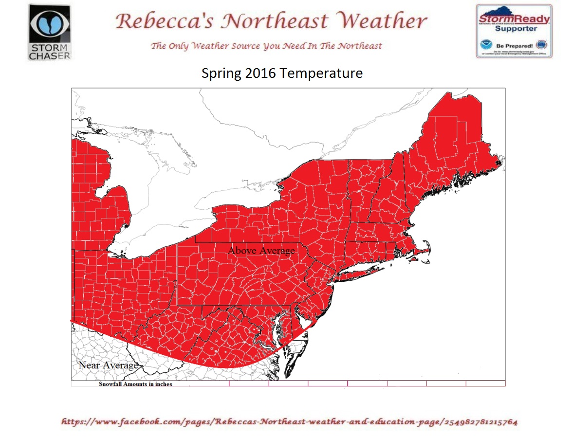
The entire Northeast and northern Mid Atlantic will see warmth. April
into May looks to be on whole warmer than average. The jet will pull north,
allowing for a more zonal flow.
Precipitation:

The pattern will allow for an active southern US storm track.
The Jet Stream orientation would allow some of these storms to move up the East
Coast....bringing Coastal DC to Boston rain. So the Coastal Mid Atlantic and
Coastal southern New England would have a good chance for average to above
average precipitation.
The Great Lakes, western New York State, will see below average precipitation this
spring.
New England, eastern New York State, eastern Pennsylvania, into
the northern Mid Atlantic will see near average precipitation.

Summer2016 Initial Outlook:


Here is a look at the sea surface temperature anomalies from
Environment Canada (CMC).
SST:
Last Summer:

This Summer:

The large area of warm SST in the Gulf of Alaska.....has shrunk
and largely cooled off.
El Nino is fading fast. The current El Nino was nicknamed "Godzilla
El Nino" by the main stream media. So
by this coming fall, will be the time of the King Ghidorah La Nina.

The Scripps Institute Is showing the strength of the coming La
Nina at around +2.6 by winter 2016-2017. If the forecast verifies it would be
the strongest La Nina on record.


With the El Nino fading and the waters off the Pacific Northwest
cooler...it will allow the Midwest, Great Lakes, and Northeast to have a much greater chance for a very warm
and dry summer.
El Niño in 1998 went from a wet spring to a very dry
summer.
The Northeast often sees an increase in severe weather activity,
during a La Nina year. Also, transitional years between El Nino to La Nina, or
La Nina to El Nino gives us a chance for above average severe weather
outbreaks.
Dixie Alley has already seen a few major outbreaks this year.
This is going to continue was we move farther into spring...the Southern Plains
will also see increased activity.
The Northeast back in 1998 saw quite a bit of severe weather.
along with a few tornado outbreaks. We even had two derechos occur on the same day.
1983 was another severe weather year in the Northeast.
If you're a fan of severe weather, this could be your year to
live in the Northeast.
My first thoughts on the 2016 Atlantic Hurricane Outlook:
We are heading into a La Nina Summer and Fall.....On average
Atlantic Hurricanes are more numerous during La Nina years. Also we seem to see
a higher chance of major hurricanes.
The Atlantic Basin looks different than it did last year.
2015

2016

Gulf of Mexico is warm....warmer than 1998
Gulf of Mexico SST for 2015 and 2016 from Roffer's Ocean Fishing
Forecasting Service.


You can see last year we had the loop current extending relatively
far north and west. While in 2016 isn't as far north...sitting more east and
southeast. But SST look to be running 2.0F to 3.0F warmer than they were last
year.
Last year the SST off the West Coast of Africa were cool. Also there was a very cold pool in the North
Atlantic.
This year the SST off the West Coast of Africa are much warmer,
we still have a cold pool in the North Atlantic.
This would allow for less SAL dust over the tropical Atlantic.
So less dust and warmer water, very well could increase the odds for Cape Verde
tropical cyclones.
Even though the SST off the West Coast of South America are cooler than they were last year....they are still warmer than they should be for a big Atlantic Hurricane Season.
Right now, we will have to see how fast those East Pacific SST
cool off.
But for now, Atlantic basin tropical cyclone activity most
likely will be above average. I will
come out with my official Atlantic Hurricane Season Forecast as we get closer
to hurricane season.
That's it for now..................