Tuesday, May 31, 2011

Types of thunderstorms Part 2

          I will continue where I left off the other day. Supercells thunderstorms are truly an awe inspiring sight to see up close and personal; the first time I saw one it took my breath away.  Supercells are the most likely type of thunderstorm to produce long lived violent tornadoes.  As I said, it's the  rotating updraft in a supercell that makes it so very different from all the other types of thunderstorms. Various sections of a supercell consist of different types of precipitation. Medium sized hail exist near the gust front with large to giant sized hail in the central section of the storm. This area of the storm is often called the hail shaft. The region where the flanking line meets the storm is where wall clouds and tornadoes normally develop. A flaking line is a line of cumulus clouds that lead up to the main updraft tower. This will often look like steps leading up into the storm. I will go into this in a lot more detail in the next installment.  Severe weather is almost always associated with supercell thunderstorms. However, not all supercells produce wall clouds or tornadoes; these can  only form when the conditions are perfect.

Types of supercell thunderstorms:

            There are three types of supercell thunderstorms: Classic supercells, HP (high precipitation) supercells, and LP (low precipitation supercells).  The amount of  low  level moisture and the value of precipitable water (Precipitable water is the total amount of atmospheric water vapor in a  column of air) is the main factor that determines which type of supercell will form.

Classic:

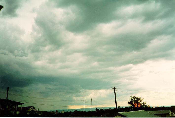
            Most supercell thunderstorms  are this type .  The base of the updraft is very large and normally has a wall cloud. The classic supercell is notable for the dark area of precipitation that it produces, The mesocyclone pulls this behind the wall cloud.  Because of this, storm chasers will often try to attack a classic supercell from the southeast to eastern side of the storm; from this vantage point you can get a clear view of the storm. whereas, the west side of the storm will be hidden behind a curtain of heavy precipitation.  Classic supercells have varying degrees of straight line winds strength,  hail size, and the strength of any tornadoes that are produced.  The next blog post will deal with thunderstorm structure, however a classic supercell has the inflow band in the front,  the rear-flank downdraft at the rear, and the rain-free updraft base in the center.


                                                     A classic supercell

Low-Precipitation Supercell:
            LP supercells are sometimes called  rear flank supercells. This is  because the updraft is located in the rear flank of the cell. Therefore, any precipitation that occurs is away from the updraft. As you can see an LP supercells inflow a lot different than a classic supercell. These cells typically produce very little rain. One thing that makes them particularly dangerous,  they can be hard to identify as supercell storms on radar because of their low amount of precipitation. This type of supercell tends to produce very powerful straight line winds and very large hail. However, tornadoes are generally weaker as compared to other supercell types. This is because the forward flank downdraft and rear flank downdrafts are not as well defined. Storm chasers like the LP supercell, because any tornadoes that do develop are very visible due to the light amount of precipitation.
                                                      Image of an LP supercell
High-Precipitation Supercell:
            This type of supercell is also called a front flank supercell because of the location of the updraft. High precipitation supercells can have so much precipitation that it can surround the updraft as well any accompanying wall cloud. HP supercell are very dangerous to chase, tornadoes are difficult to spot until they are right on top of you. In this type of supercell, hail is normally smaller in association with the other supercell types. However, flash flooding is always a concern due to the tremendous rainfall associated with an HP supercell. The makeup of this type of supercell is very  similar to the classic supercell.


                                                     Image of an HP supercell

          I hope you have learned something from this blog post on supercells.  Supercells are my favorite type  of severe storm; no two ever look the same. Like I said above, the next installment will be on thunderstorm structure. Observing storm structure can be enjoyable. For me, knowing how to read structure is very important, It allows me to know what a storm is doing,  so I don't waste my time chasing the wrong storm. I feel everyone should know how to read structure;  it will help you know what's coming your way, so you can protect yourself.

Rebecca Ladd.

Sunday, May 29, 2011

Types of thunderstorms

     In this segment, I will go into a little more detail on a subject that is on everyone's minds lately... thunderstorms.  There are four main types of thunderstorms, single cell, multicell clusters, squall lines, and the infamous supercell. The difference between the types of thunderstorms has nothing to do with their lifecycle. instead it has to do with the amount of cells in the thunderstorm and how they are positioned.  Now, I'm sure someone is saying ...So what, there are four kinds,  why should I care? I feel having a better understanding of the various types of thunderstorms can help you distinguish between severe and non-severe thunderstorms, this will help you keep yourself and your family safe.

The single-cell

    A single cell thunderstorm also can go by two other names: A pulse thunderstorm or an airmass thunderstorm. This type of storm only has one main updraft.  It's a thunderstorm that goes through  its life cycle and dissipates without creating any other cells, the term "cell" refers to the number of principal updraft points in the storm. Single-cell thunderstorms usually last between 20-30 minutes. They are usually poorly organized and seem to occur at random times and locations, making them difficult to forecast. Single-cells are rarely severe, They may contain heavy rain and can also produce occasional downbursts, small hail, and (rarely) weak tornadoes, storm chasers call these kind of tornadoes landspouts, but these are very rare in single cell storms. However, there is a special class of single cell that is always severe, I will discuss this special class later.


                                                                         Single cell thunderstorm

 
Multicell Cluster Thunderstorms:
     Multicell thunderstorms are groups of cells adjacent to one another that move together, which are all in different stages of the lifecycle.  Because they are in different stages of development they have a much longer life span that a single-cell. In my last blog post I talked about a thunderstorms lifecycle; in a multi-cell it works the same way, with a slight twist. Here's how it works.  As cumulus develop, one of the cumulus begins to grow faster than the other cumulus; eventually it will  produce some light precipitation. As this precipitation and corresponding downdraft descends it cools the air around it (evaporative cooling). The evaporative cooling accelerates the downdraft, as the downdraft hits the ground it spreads outward. Sometimes this outward movement of air can act as a wedge as the colder out flowing air undercuts the warm moist air in the regions surrounding the main cell. This can have the effect of intensifying updrafts in the surrounding cells nearby. In-turn, These cells move into their mature stage as the new cell  sends down precipitation it becomes the dominant cell. Simultaneously, the newer cell produces downdrafts that stops the updraft of the original cell. This cycle will keep going as long as atmospheric conditions allow it. If you've ever watched on radar when there is a lot of thunderstorm; you might have noticed a group of cells will be moving one way, then all of a sudden move in another. This is because of the unusual structure of multicells. This happens, because the developing and dissipating process causes the storm to have a motion veering slightly at an angle to each cells line of motion. On average, multicell cluster storms last for about 20-30 minutes, however the whole line may persist for several hours. Multicell thunderstorms can become severe. All types of severe weather can be experienced from severe multicells including giant hail, severe winds and tornadoes.
                                                                 Image of  multicell cluster thunderstorms


Squall lines:

     Squall line thunderstorms can also be called multicell line storms. These systems of thunderstorms arranged in a line. Sometimes this line can extend laterally for hundreds of miles. At first glance, a squall line looks like a long system of multicell thunderstorms, with cells developing on one end and dissipating on the other. However, the storm looks like on large thunderstorm with a large anvil extending well ahead of the main body. The approach of a squall line is a astounding sight. As it approaches, the observer will normally see a very dark shelf cloud with an extensive precipitation cascade. A shelf cloud is a low, horizontal wedge-shaped cloud. that  is attached to the base of the parent cloud.  If you're facing the squall line a strong warm wind will form at your back, this is the inflow updraft feeding the storm. As the squall line gets close, there will be a  brief lull in the wind soon to be replaced with a sudden blast of wind from the storm in the opposite direction. this is the outflow downdraft. Sometimes Bow echoes can form within squall lines,  bringing with them even higher winds. Bow echoes get their name because of what they look like on weather radar. A bow echo brings with it very high and often damaging winds. An unusually powerful type of squall line is called a derecho, this an very  intense squall line that travels for several hundred miles. There is one more thing I should mention. Some of you  may have heard the term mesoscale convective system (MCS);  an MCS is just a fancy name for is a complex of thunderstorms that becomes very organized on a scale that can impact several states at the same time. squall line systems often form within a  MCS. Now on to the last type of thunderstorm.


                                                                                                                A shelf cloud


                                                                                       Radar image of bow echoes


The Supercell:

                This is the special class of single cell thunderstorm I mentioned above. Supercell thunderstorms are the largest and the most severe of all types of thunderstorms. Most of the large tornadoes and giant hail events you've heard about over the last month were spawned by supercells.  The reason why supercells are the most severe is because of their rotating structure.  when a thunderstorm spins it is called a mesocyclone. A mesocyclone is basically an area of extremely strong updrafts which spin as the air moves upwards.  The supercells are one of nature's most destructive but beautiful constructs.  I think I will stop for today. There are two main types  of supercells that I will explain in the next installment.


                                                                                              A supercell in Oklahoma
 
     I hope you found this post both enjoyable and informative. I feel, the more you understand about the weather; the more you will be able to appreciate the wonder and beauty of nature. Even though thunderstorms can be destructive they are also very beautiful at the same time.
Rebecca Ladd.

Thursday, May 26, 2011

The Thunderstorm Life Cycle

      As promised here is the 2nd installment. We have all seen thunderstorms. But how many of you have actually wondered what makes them tick. This blog post will try to cast some light on this mystifying and sometimes petrifying beast that prowls the skies overhead.  Before I get  into the lifecycle of a thunderstorm, a little attention should be spent on what a thunderstorm is and how it forms.


What is a Thunderstorm:

     Simply put a thunderstorm is just a rainstorm during which you hear thunder. Since thunder comes from lightning, all thunderstorms have lightning. The average thunderstorm is around 10-15 miles in diameter and last 20-30 minutes. In order for a thunderstorm to form, a few basic ingredients must be in place. These are moisture, unstable air, and something to give a nudge, the term for this is a lifting mechanism.  First, as air rises in what is called an updraft, moisture is squeezed out of the air. This moisture forms into small water drops which form clouds. As the air is squeezed it gives off heat, making the air warmer. If you have ever seen a hot air balloon you know warm air rises. The air will continue to rise as long as it's warmer than the surrounding air. Air can be stable, neutral, or unstable. 

Which brings us to our second condition. Instability is when atmospheric conditions  allow air to  rise freely on its own. The more unstable the air the faster the air will rise. Our last condition is lift, Lift is the machinery that starts an updraft in a moist, unstable air mass.  The lifting mechanism can take on several forms. However, the most common is simply the sun heating the ground which warms up the air above it causing it to rise.

The Thunderstorm Life Cycle:

     Most of us have seen how it can go from a clear blue sky to a thunderstorm in less than 30 minutes. But, it has to begin somewhere. All thunderstorms, whether or not they ever became severe, go through a life cycle, this life cycle can be divided into three stages: developing (sometimes known as the cumulus stage), mature stage, and dissipating stage.

The developing stage:
     There is little to no rain during this stage but occasional lightning. The developing stage lasts about 10 minutes. The developing stage  is marked by a cumulus cloud. During the development stage, only the updraft is very dominant. Sometimes the speed at which a cloud builds in height can be shocking (pun intended).  The updraft pushes the the warm moist air within the cloud higher and higher. This process continues and works to form a towering cumulus cloud. After awhile, the cloud gets so high that the water droplets in the cloud coexist with ice crystals in the upper atmosphere.  At this point precipitation starts to fall within the cloud.  Falling precipitation and cool air from the environment start the initiation of cool downdrafts. These downdrafts are the beginning of the next stage of the life cycle.
                  Diagram of how the updraft builds a Cumulus cloud  (Image credit NWS)

                                                              
                                                                Cumulus cloud

The Mature stage:
     The mature stage lasts on average for 10 to 20 minutes, but may persist for longer periods of time if the storm is severe. The thunderstorm at this stage of the cycle has both updrafts and downdrafts within the cloud.  At this stage the cumulus is still growing as the thunderstorm continues to  develop the top of cloud starts to flatten out and forms an anvil shape. At this point the cloud has become a cumulonimbus cloud.   Cloud to ground lightning generally (but not always) begins when the precipitation first falls from the cloud base.  When the downdraft hits the ground, it spreads out in all directions. When this happens, a gust front can form.  A gust front is from the cool air rushing down and out from a thunderstorm. The mature stage is the most likely time for hail, heavy rain, frequent lightning, strong winds, and tornadoes. The storm sometimes has a dark green appearance. Eventually, the downdraft will become the overriding feature in the storm, which will cause the storm to weaken and enter the final stage.
                                                       
                                                           Image credit NWS

                                                       A mature cumulonimbus

The dissipating Stage:
    This stage lasts about 10 minutes. During this stage the rain is pulling air downward, this strengthens the downdraft . During the dissipating stage the downdraft is king. A thunderstorm is a creature of warm moist inflow. As the downdraft hits the ground and pushes away from the storm, it cuts off the updrafts which are feeding it. Since warm moist air can no longer rise, cloud droplets can no longer form. The storm dies out with light rain as the cumulonimbus cloud disappears from bottom to top. Sometimes, the anvil can be left behind and we call this an “orphan” anvil.


                                                           Image credit NWS


                                                    A dissipating cumulonimbus
I feel thunderstorms are one of nature’s most beautiful events. They can come out of nowhere and disappear again within minutes. I hope you found this informative.
Rebecca Ladd

Wednesday, May 25, 2011

How to read and interpret weather radar.

     Hi, my name is Rebecca Ladd, I'm a storm chaser / severe weather enthusiast. Andy has asked me to be a guest host on his blog. How could I turn down such a gracious invitation. I'm going to try something a little different. Over the next few weeks I'm going to have a series of posts that are designed to give you a deeper understanding of different aspects of weather and the tools that are used to forecast it. The installments will build on each other. This is the first installment which will be followed by:

1)  The Thunderstorm Life Cycle
2)  Types of thunderstorms
3)  Visual aspects of thunderstorms (structure)
4)  Wall clouds and other lowering cloud formations.
5)  Non-tornadic severe weather
6)  The Tornado

How to read and interpret weather radar.

     The weather radar you see on WTEN is called Doppler radar. Doppler radar emits beams (Pulses) of microwave energy from a transmitter into the atmosphere. When these beams collide with objects in the atmosphere such as: raindrops, hail stones, snowflakes, birds, or even the ground, the energy is sent back to the radar. Once the receiver get this data it displays it in different ways which will be discussed later. Modern Doppler radar is called WSR-88D the WSR stands for Weather Surveillance Radar. There are 155-159 high-resolution Doppler weather radars operated by the National Weather Service around the United States and other U.S. territories. They are part of a network of Doppler radars called NEXRAD (Next Generation Radar).
.


                                  NEXRAD Doppler Weather Radar. Image credit: NOAA


                                                       The NEXRAD system.

What is NEXRAD Radar?

     NEXRAD was established in 1988 to replace the less capable and reliable WSR-74 system. NEXRAD provides a three-dimensional view of the weather around the radar station. Meteorologist now have the ability of seeing the weather in 3 dimensions, can now better identify severe weather areas, analyze the storm structure vertically and gather upper air wind data. NEXRAD radar has dozens of products, including Base Reflectivity, Base Velocity, Composite Reflectivity, Echo Tops, Total Storm Precipitation.

NEXRAD doppler radar operates in two modes: Clear Air and Precipitation.

Clear Air Mode:

     In this mode, the radar is in its most sensitive operation. This mode has the slowest antenna rotation rate; which allows the radar a longer time to sample the atmosphere. This increased sampling rate increases the radar's sensitivity so it can detect smaller objects in the atmosphere than when it's in precipitation mode. In clear air mode, the radar products update every 10 minutes.

Precipitation Mode:

     When rain is occurring, the radar does not need to be as sensitive as in clear air mode as rain provides plenty of returning signals. In Precipitation Mode, the radar products update every 6 minutes.

     Precipitation intensity can be determined by measuring the strength of the echoes received by the radar antenna. The amount of energy reflected back to the radar is directly proportional to the precipitation intensity. Echo strength is measured in units of DBZ (decibels). In general, DBZ values greater than 15 indicate areas where the precipitation is reaching the ground; DBZ values less than 15 indicates very light precipitation which may be evaporating before it reaches the ground (virga).


     Precipitation intensity is displayed beside an radar image as a colored bar chart. The views in Precipitation Mode are available at four radar "tilt" angles, 0.5°, 1.45°, 2.40°, and 3.35° (these tilt angles are slightly higher when the radar is operated in Clear Air Mode). A tilt angle of 0.5° means that the radar's antenna is tilted 0.5° above the horizon. Viewing multiple tilt angles can help one detect precipitation, evaluate storm structure, locate atmospheric boundaries, and determine hail potential.


NEXRAD radar products:

Base Reflectivity
Composite Reflectivity
Base Radial Velocity
Storm Relative Mean Radial Velocity
Echo Tops
Storm Total Precipitation
1 Hour Running Total Precipitation
                                                 
 Base Reflectivity:

     Base Reflectivity corresponds to the amount of energy that is being reflected back to the antenna. The images are color coded to indicate the strength what the radar is seeing. A strong reflected signal will be colored differently than a lower one. The amount of reflective signal is a relative indicator of rain or hail intensity. The heavier the precipitation intensity, the stronger the downdraft and the updraft are in the thunderstorm. This gives you a general idea of the intensity of the a thunderstorm and the potential for severe weather. The maximum range of the short range Base Reflectivity product is around 143 miles. If you're using long range Base Reflectivity you can see out to about 286 mi.


In the above Image from Weather underground; you can see the intensity of the precipitation. As mentioned above, precipitation intensity is usually monitored by color. The green/yellow represents light precipitation. The orange/red represents heavy rain, and the purple/white represents extremely heavy rain, but more likely hail.

Here's a table showing how precipitation intensity corresponds with dBZ
                         15-30 dBZ = Light Precipitation
                      30-45 dBZ = Moderate Precipitation
                   45 and higher dBZ = Heavy Precipitation

Composite Reflectivity:

     This product is used to reveal the highest reflectivity in all echoes. When compared with Base Reflectivity, the Composite Reflectivity can reveal important storm structure features and intensity trends of storms.

Base Radial Velocity:


Storm-Relative Radial Velocity:

     This product is the same as Base Velocity only with the average motion of the storm subtracted out. Storm-Relative Radial Velocity can be useful in finding circulation in a thunderstorm. This product is available for four radar "tilt" angles, 0.5°, 1.45°, 2.40°, and 3.35°.


The above Velocity scan shows a tornado heading toward Holly Springs NC. The tornado is located where you see the bright green wrapping around the bright red in the middle of the image.

Echo Tops:

     The Echo Tops product shows the height above sea level of the precipitation echoes as it extend up to in the atmosphere. One thing to keep in mind, Echo Tops are not the cloud tops, usually the top of the cloud will be somewhat higher than the top of the precipitation echoes. The lowest detectable tops are those at 5,000 feet, while the highest detectable tops are at heights of 70,000 feet. Echo Top readings are extremely valuable they give information about individual thunderstorms and their potential for producing severe weather. For example, echo tops can help identify areas of strong updrafts. The higher the echo tops, generally speaking, the stronger the updrafts within the thunderstorm.

Storm Total Precipitation:

     This product shows the estimated accumulated rainfall, continuously updated, since the last one-hour break in precipitation. This product is used to locate flood potential over urban or rural areas, estimate total basin runoff and provide rainfall accumulations for the duration of the event.

1 Hour Running Total Precipitation:

     This product show an estimate of one-hour precipitation accumulation. it is very useful for evaluating rainfall intensities for the possibility of flash floods.

     I hope you enjoyed this write up. While it won't make you a meteorologist; It should give you an idea of what the WTEN weather team have to do before they relay weather information to you. I hope it gives you a greater understanding of the wonderful world of weather that surrounds us every day.


Rebecca Ladd.