
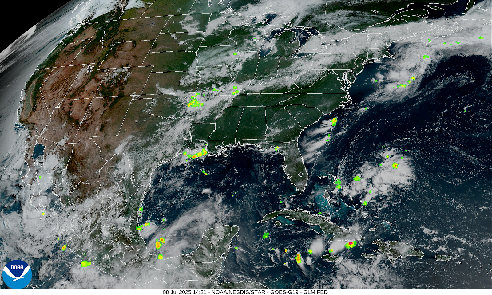
The current surface chart and radar Show location of the stall frontal boundary with not a lot of rain going on right now. Behind the front temperatures are cooler with less humidity; But out ahead of the front It is still hot and humid.


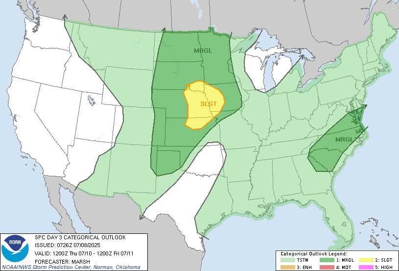
The stationary frontal boundary is going to slowly crawl south and east today. We will see a line of showers and thunderstorms develop. Join the afternoon We will see scattered rain showers and thunderstorms move into the hot and humid tropical air mass. With all the moisture in the air any of these thunderstorms will be capable of producing very heavy rainfall, these storms will be moving extremely slowly, So the risk for flash flooding is there. Some of the storms this afternoon and evening will be strong too severe with the biggest danger being strong damaging straight line winds, hail and frequent lightning.. The tornado risk is very low but it is never zero. The storm prediction center (SPC) has a Slight Risk for severe weather over New Jersey, southeast Pennsylvania back down into Delaware and Maryland, with a Marginal Risk over southeast New York State and southern New England.

This is going to make for a rough commune for places like the I-95 corridor. The satellite shows the clear skies over Southeast Pennsylvania, New Jersey, Maryland and Delaware All the Sun is going to make the atmosphere very unstable. All the sunshine is going lead to explosive development for thunderstorms. The best time for the severe thunderstorms will be around 2PM into 9 or 10PM. As the thunderstorms approach the coast they should start to weaken.
As I said yesterday The front is going to stall out again early Wednesday morning over Southern New England back down into Virginia. Then it will slowly slide south of the Mason Dixon.line. Here's a look at the SPC convective outlooks for day 2 and day 3

For Wednesday Those near the boundary will have a chance for scattered thunderstorms and rain showers Some of these could be strong to severe You are away from the front of boundary The less your chances of seeing any rain or storms. Most of New York State and New England will only have a chance for a few isolated rain showers. Like I said yesterday, the front is going to be meandering around a bit over the next several days. Thursday we will see a disturbance move along the frontal boundary, increasing the risk for rain showers and thunderstorms across the region. Friday into Sunday will feature the chances for rain showers and thunderstorms especially for those closest to the frontal boundary. Over the weekend we can expect some heat and humidity to move back into the region. Sunday into Monday a cold front will move through bringing the risk for scattered rain showers and thunderstorms across the region. The weather pattern looks to remain pretty much the same as we head through next week.
No comments:
Post a Comment
Thank you for taking the time to comment, I will answer as soon as I can.