
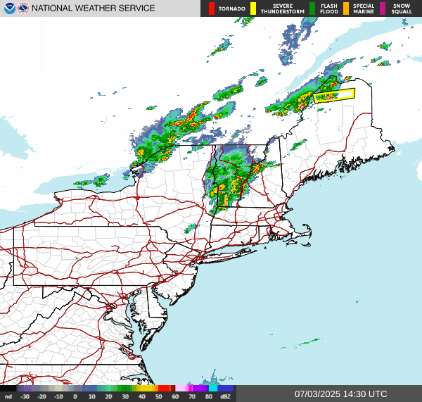
This week has been very active with quite a bit of severe weather including a couple of tornadoes. Both have been rated as EF0. The first occurred on Monday just after 1PM when a tornado with max sustained winds of 65 mph touched down near Frankford in Sussex County DE, the second occurred near Amity township in Berks County PA, when a tornado with maximum sustained winds of 70 mph touched down just before 5PM on Tuesday.
Here is the current surface chart.

We can see the cold front Up in Canada as well as a stationary front sitting near the coast. The stationary front is going to slowly drift south and east. The stationary frontal boundary Separating Higher humidity south and east of the front with less humidity north and west of the front. There is also a little bit of a temperature difference.

The tropics
We have a disorganized area of disturbed weather off the Southeast Coast, Along a frontal boundary north of the Bahamas. There are strong indications that this area is going to try to develop into a warm core coastal tropical or subtropical system for the end of the holiday weekend. The national hurricane center is giving this area a 7 day 60% chance for tropical development into a depression.
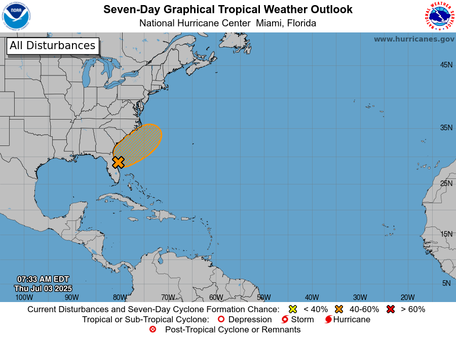
This looks to come up over the coast or just off the coast heading towards the Middle Atlantic before it gets shunted out to sea. There is no guarantee that even if a depression forms it will get a name. But if it does come up the coast it could bring some rain along the coast of the Middle Atlantic into possibly Long Island and southern New England on Monday. On Monday we're gonna have that cold front dropping in that will bring scattered rain showers and some thunderstorms into New York State and Pennsylvania. The cold front will continue dropping south and east during the day and night on Monday into Tuesday. We could see some severe weather over western and northern parts of New York State. The front is going to slow down and probably stall by Tuesday over New England back down into the northern Middle Atlantic. This will keep things unsettled For Tuesday. Wednesday we will be sitting under the trough So we can expect isolated showers and possibly some isolated thunderstorms. For Thursday we will see another cold front approaching the region. As I been saying, the idea of frontal systems coming through the Northeast frequently over the summer, With cold fronts possibly stalling out keep the temperature see sawing back and forth with numerous chances for rain over the summer. This is what I've been talking about not only in the summer outlook but also in several posts I posted on here.
No post tomorrow or Likely over the weekend. So I want to wish All Y'all a happy Independence day.
No comments:
Post a Comment
Thank you for taking the time to comment, I will answer as soon as I can.