Showing posts with label 2015 Spring Outlook. Show all posts

Wednesday, April 15, 2015

The 2015 Spring/Summer outlook.


I have received many requests for a 2015 spring/summer outlook. Long term seasonal outlooks are complex, and involve lots of research   A long range outlook isn't a forecast; it is to be used as a guide on how the season should unfold as a whole.  This being said, I am strictly making this forecast based on research from past weather patterns and climatology.  By comparing past years to this year, I put together a forecast in which makes sense to me. I did this same type of research for this current winter.  And if you read and followed it, you will see it worked out very well.  I predicted above average snowfall, below average temperatures, frequent small lake cutter and western runner snow storms, and more than a few coastal storms.  Anyway here goes

Over the last 6 weeks I've been talking and dropping lot of hints about the long term pattern. So a lot of this shouldn't come as a surprise.

Sea surface temperatures (SST)  play a major role on not only the weather in the Northeast, but also across the globe.  The ENSO Teleconnection is a big factor in the weather patterns.  La Nina is described as cooler than normal SST in the Pacific.  El Nino, warmer than average SST. Typically a wetter winter, with longer cold periods and more frequent storms.


The ENSO Teleconnection:

By the end of March 2015, weak El Niño conditions were reflected by above-average SST across the equatorial Pacific. As of the time of this writing, we still have a central based El Nino Modoki.  As we get closer to summer, I think the El Nino will become east based and strengthen a little becoming a weak to moderate El Nino. Then as we get into Fall 2015 will weaken a bit, and  the warmer SSTs will once again shift into the central Pacific. 


A majority of the models are favoring a moderate El Nino pattern. According to the National Weather Service, the chance of El Niño is at 70-60% , with values of the Niño-3.4 index equal to or greater than 0.5oC. There is an approximately 70% chance that El Niño will continue through the Northern Hemisphere summer 2015, and a greater than 60% chance that it will last through autumn.

This El Nino will most likely be moderate to strong....but I think based on the pattern it will reverse back to a central based El Nino (El Nino Modoki) as we get into Winter.

A big part of my long term seasonal outlooks deals with climatology. Looking at past years and comparing patterns allows me to see things that matches the current conditions.  Looking at all the data I found 15 years which had weak El Nino patterns that matched up to the current pattern.

1919, 1920, 1952,1953, 1958-1959, 1960-1961, 1969-1970, 1976-1977, 1977-1978, 1979-1980, 1986-1987, 1990-1991, 1997-1998, 2004-2005, 2005-2006, and 2006-2007.

I also looked at other teleconnections...the Pacific North American (PNA), North Atlantic Octillion (NAO), Western Pacific Octillion (WPO), and Eastern Pacific Octillion (EPO).

Again I found Years where these teleconnections behaved similar to this year. To spare you the details of all of these years. I will just say after comparing past years of all these teleconnections, I found they all contained the years 1919-1920 1977-1978 and 2004-2005.  

The winters of 77-78 and 04-05 matched up very close to winter 2014-2015. using these two years as a guide.... I think I have a good feel for what spring/summer 2015 will behave like.  

The pattern recognition skills I used, allowed me to predict how March and April were going to behave, long before other weather outlets keyed in on. 4-6 weeks ago I said,  once we got past April 10th the weather would feel much more spring like..... a few weeks ago, I also stated that this week would see above average temperatures, then we would see below average temperatures return as we end April and head into May. And then around the 2nd week of May into mid May we would see a giant warming, again well before most other outlets started to talk about it. Why do I say all of this? To give you confidence that my technique is sound and is accurate. No one can predict individual storms weeks and months ahead, but since I firmly believe weather and climate is cyclical, long range patterns can be predicted with some accuracy.    

1977-1978 saw March to July below average in the temperature department. That year also saw April and May drier than average ...then as we got into Summer precipitation picked up some..... becoming a little closer to average over the Summer.

Based on all of this...  I think we will see temperatures below average for April into August, become more seasonal past mid August...but I feel for the Northeast overall. Spring 2015 will end up below average in temperatures .  Precipitation will also be slow to start but by the time we get closer to Summer precipitation should increase closer to average levels, .

Overall this spring and summer will be a cooler than average, with below average precipitation.

A little on the severe and tropical season. 

We are at a near record low in the number of tornadoes in the U.S for this time and date.  While I do think we will see the tornado count pick up across the Continental United States ( CONUS).  I don't see any major outbreaks over the next 2-3 weeks... But 2004 was a very active year when it came to tornadoes.....So  once we get into the 2nd week of May, things could pickup in a big way. 

As for tornadoes and severe weather in the Northeast.... I expect to see a season similar to last year.  New York State and Pennsylvania will become active, I think the tornado count will end up slightly above average,  while New England won't be as active as NYS and PA...I do expect enough severe weather for a couple of tornadoes. The pattern that looks to setup would have the colder air just to our north in Canada with the warmer air over the Mid Atlantic and Southeast States....This could set up northern Pennsylvania, New York into New England in the battle zone between the cooler drier air trying to move south and the warmer moist air to the south. 

During El Nino the Atlantic typically sees a much less active season. This is due to unfavorable wind shear and increased dry and dusty air.  But no two El Nino's are alike..... when one looks at  my analog year ..... Hurricane activity is closer to average...... so we should end up with 10-12 tropical cyclones in the Atlantic basin this year...... I will come out with a hurricane outlook as we get closer to the tropical season.   

Sunday, March 22, 2015

First thoughts on the Spring 2015 outlook.


We've had a lot of cold in the Eastern US during winter 2014-2015, especially in the Great Lakes and Northeast.


I've been laying out the march pattern for quite some time on the Facebook page. on how the cold in the east is going to hang on until we get past Easter; Then we will see the eastern trough retrograde to the west.

March will see a constant battle between the warm and cold air.  This will lead so some melting, then more snow and ice, then more melting.  
The warm Sea Surface Temperatures (SST) off the West Coast and up into the Gulf of Alaska, are the result of the persistent positive PNA in the Pacific.  The PNA is the reason for the strong ridge over western North America.  The Trough over eastern North America, has allowed for record breaking cold for the February and March period. 

As we approach Mid April, we will see the eastern trough moving into the plains and Rockies. Because of this movement, the Atlantic ridge will retrograde west over the Eastern Seaboard.  With the Western ridge holding more or less in place.   
Cold air is very dense, and it can be very hard to dislodge.

We also have El Nino.... typically during El Nino's we see below average temperatures in the Northeast and Great Lakes.
 
The Atlantic Multi-decadal Oscillation (AMO) has a big impact on moisture distribution across North America. AMO also is one of the major contributors to air temperature in the Northern Hemisphere. There is a strong correlation that shows when the AMO is positive the eastern US is warmer, and when it's negative the East Coast is colder.

The most sustained number of low AMO levels was during the cold spell of 1902 -1925 and again from the mid 1960's to the late 1970’s.

The AMO typically has long duration phases that last for decades. This will aid the overall temperatures to be below seasonal averages for April, May and June.

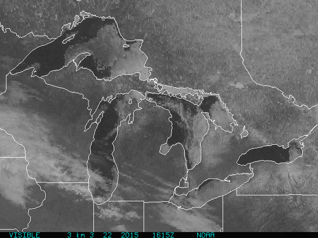
The Great Lakes saw a lot of ice this winter season. As of this writing, other than Lake Ontario, the four other Great Lakes still have a lot of ice on them.  Our inland lakes, rivers, and streams, have lots of ice as will.  The Chesapeake Bay waters and ocean temperatures are running cooler than normal after a brutally cold winter.


Let me first say that winter weather is not a good predictor of the upcoming June, July and August.  But, we do have some similarities between our current weather pattern and what we saw last spring. 


From what I see This spring is going to see April below average in the temperature department; this is partly due to the really below average temperatures in March.  But remember below average in April is not the same kind of cold that is below average in March.  So while Spring will have a slow start for the first part of April. once we get later into April and head for May, we will begin to see the pattern change to a milder one but slowly.  With the transition comes the increasing potential for severe weather. I will touch on the severe weather potential later in the outlook.


The signal is pretty strong for May to be our first warm month in a while. With the transition comes the increasing potential for severe weather, especially with a cold pool remaining in close proximity to our north. As we head into the end of April into the first part of May, temperatures look to become below average again. Then later in  May and June will see temperatures that are more seasonal. The Temperatures in June should be average to slightly just below average.  

The active southern pattern will lead to above average precipitation over the Mid Atlantic, Pennsylvania, and southern and central New England. While much of New York State and northern New England will see normal to below average precipitation. For the rest of March into the first 10-12 days in April, due to the active southern storm track and the abundance of arctic air that will linger and be slow to dislodge, storms will have to be watched carefully, due to the possibility of snow.   

Flood outlook:

New York State, and New England saw snowfall accumulations will above average. and while the Mid Atlantic was late to the party they too have ended up with above average snowfall.
The Tug Hill still has a deep snowpack; as does northern New England, especially in the higher elevations.  Western New York State and eastern New England have see significant snowfall accumulations. The lakes, rivers, and streams have thick ice.  


At my place on the Tug Hill there is still a very deep snowpack... with 10-14 inches of water locked in that snowpack.  The deep snowpack isn't just an issue for the high elevations western New York State and eastern New England have a deep snowpack that has 5-8 inches of water locked in.
With the cold winter, came the ice. As I said we have a lot of ice on the streams, rivers, and lakes. We winter hanging on into mid April, we will be very susceptible to late season ice breaking up on rivers in northern New York and northern New England, resulting in ice jam concerns.
NOAA has placed Central and Southern New England, as well as areas south of Lake Ontario at heightened risk for moderate flooding.  But all in all there isn't a huge risk for above-normal flooding , unless we see a quick warm up, The longer the cold stays in place the greater the likelihood of flooding. Let's hope for a gradual warm up.
 
Severe Weather:
The current pattern doesn't support severe weather.  But the pattern gets more advantageous once we hit the middle of April.
Typically in March we see an uptick in tornadic severe weather. That hasn't happen this year. In fact tornado activity this year is at near record low levels.  As of this writing, there have been no tornadoes this March. This is due to the persistent trough over the eastern half to the CONUS.  This hasn't allowed for instability to develop in the southern Plains and southern states. Strong instability is formed when warm/moist and cold/dry air is in close proximity.   


On average, around 1,300 tornadoes hit the United States each year.  The last couple of years have seen below average tornado activity.


The Gulf of Mexico (GOM) has very warm SST. In fact, the water temperatures in the GOM are well above average for this time of year.
Once we get past Easter, we're going to see the trough expand to the west, The ridge over the Atlantic will retrograde west as well.
Here is the current run of the GFS showing the pattern at the end of March. The GFS seems to have a good handle on this at this point, but I do think it is underplaying the cold in the Midwest and Plains.  However the GFS is mishandling the pattern as we get past Easter.  I've drawn a rough map showing how I think the ridging and trough will look in the April 7 -10 time period.


Once the trough retrogrades to the west, warmer air and GOM moisture will be able to advance north, The warm waters off the west coast aren't going to allow the ridge over the West Coast to move too far west.  So we're still going to see cold air slide down the eastern side of the ridge, only this time the trough will have be pushed back into Plains and eastern Rockies.  As the cold dry air and the warm moist air interact, it's going to. increase the instability of the atmosphere.
As I said, we've had a slow start to the severe season, with stable air hanging around longer into the spring season. However, once we get into the first part April, this will change in a big way.... Then I think we're going to have the tornadoes counts lessen for a few weeks.... But I do think once we're into  the spring season tornado activity will increase compared to the last couple of years, once we get past mid May and into June.   The focus of this will be over Dixie Alley and the Mississippi and Tennessee Valleys.


I can't predict which storms will be tornadic. But all the players will be in play that lead to their formation. I really do think the stage is being set for some decent severe outbreaks.
New York State and Pennsylvania, then followed by New England, see an uptick in our severe weather as we get closer to June. Many of our larger Northeast tornado outbreaks have occurred around Memorial Day. Too soon to say, how our severe season will be up here.
As always, I welcome your feedback and questions..