
Another day of rain showers and cool temperatures.
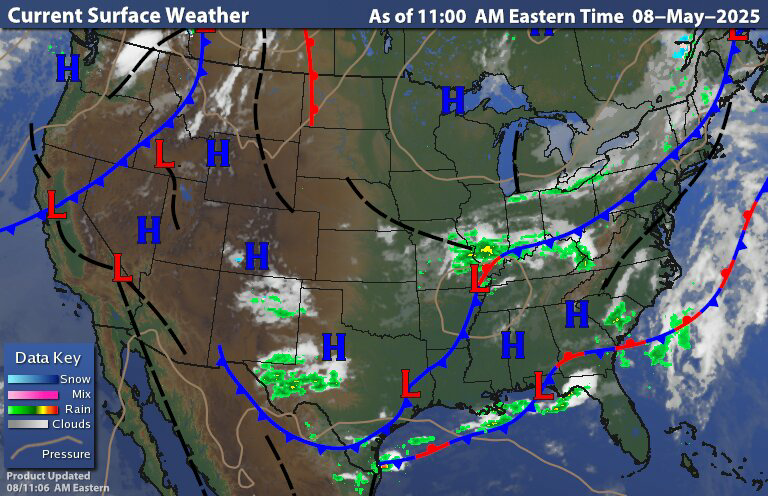
The surface chart shows at cold front that is slowly dropping south and east across the region. With the cold front we have some widely scattered rain showers along with some embedded rumbles of thunder. The surface chart also shows that area low pressure that is continuing to develop over the midwest.
As that midwestern low pressure continues to develop; we're going to see it continue to interact with the trough. This will lead to the development of yet another upper level low It will develop Near the Ohio valley or southwestern Pennsylvania. Then as this cold front Ends up stalling out The upper level and surface low is going to move along it Bringing widespread rain showers and isolated thunderstorms across the region, starting later this evening/tonight and through Friday.
Find the visible satellite image the cold front stands out very well with all the clouds behind it and scattered sun and clouds ahead of it.
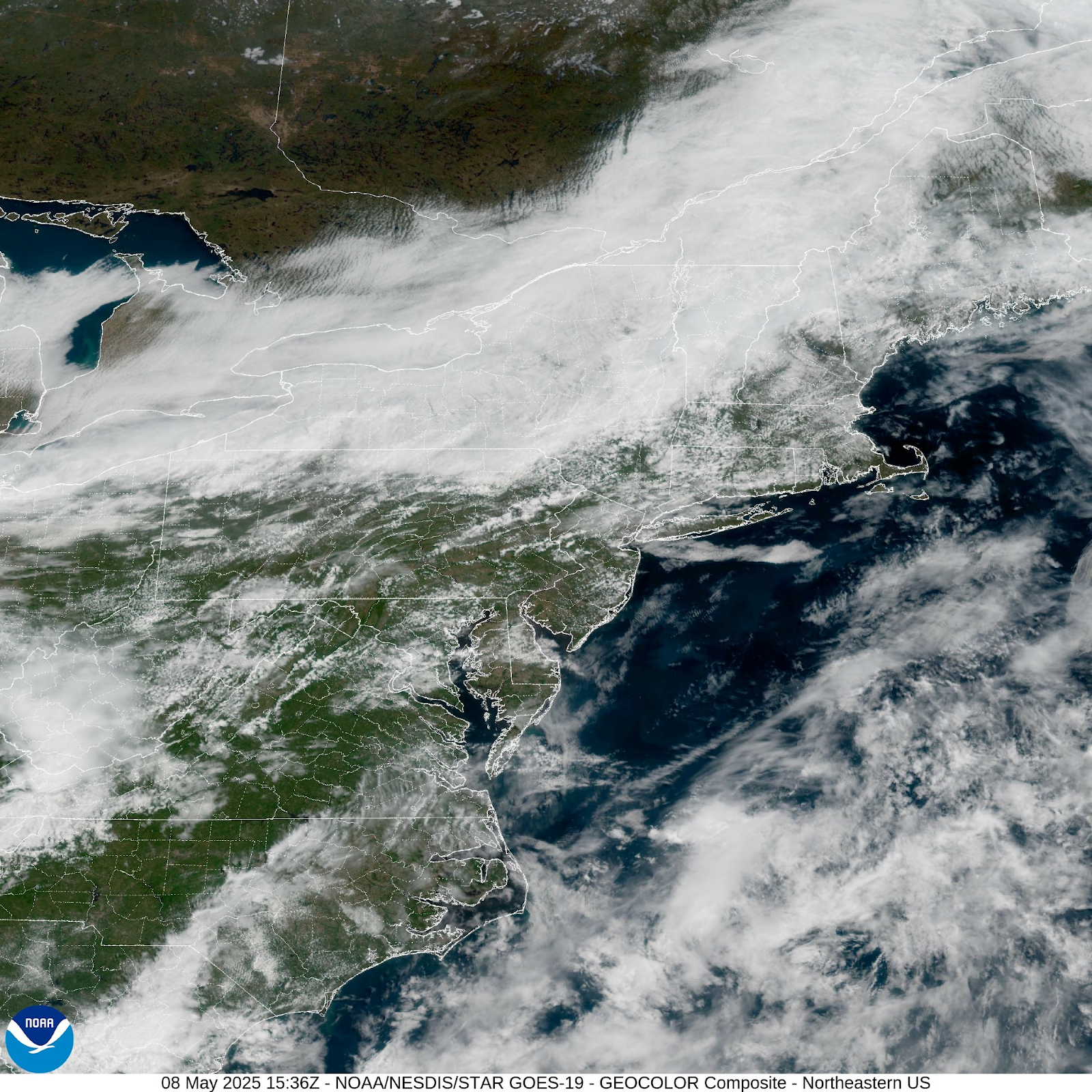

All the clouds will continue to build as the front continues to drop south and east.
The drizzle and widely scattered showers will continue to drift down towards the northern Mid Atlantic during the day. Today is a bit breezy. Then behind the front it will turn to the northwest and eventually into the southwest as at upper level low develops. Rain will become more widespread later today encompassing of region with moderate to heavy rain at times. Over the next couple of days Western New York back down to northwestern Pennsylvania Will see much less rain than the rest of the region; this is due to the location of and track of the low pressure as it tracks into The Mid Atlantic And then start heading towards New England with a track along or close to the coast. Tonight and Friday general rainfall amounts of 1-3 inches will lead to localized flooding issues This is especially due to the saturated ground from all the recent rain we've been seeing. We will also be dealing with isolated thunderstorms that will be capable of dropping heavy downpours.
I just posted the 2025 Atlantic Hurricane Outlook. So make sure you check that out.
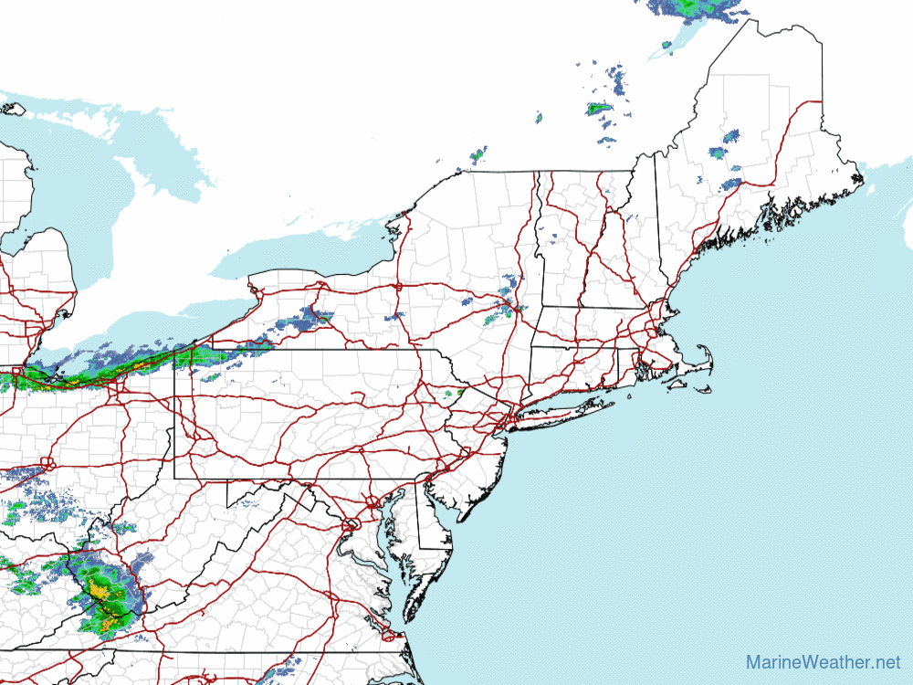
Thunderstorms have rolled into Central Massachusetts the last hour or so, some of which are vigorous.
ReplyDeleteThank you for the update
Delete