
The current surface chart and satellite infrared image.


The surface chart also shows that trailing cold front that is going to come through during the overnight and Saturday. This will be the beginning of a wet stretch of weather, that I was talking about In the last post. As the cold front comes through we are going to see widespread rain showers and isolated thunderstorms. Some of these thunderstorms could be strong to severe.
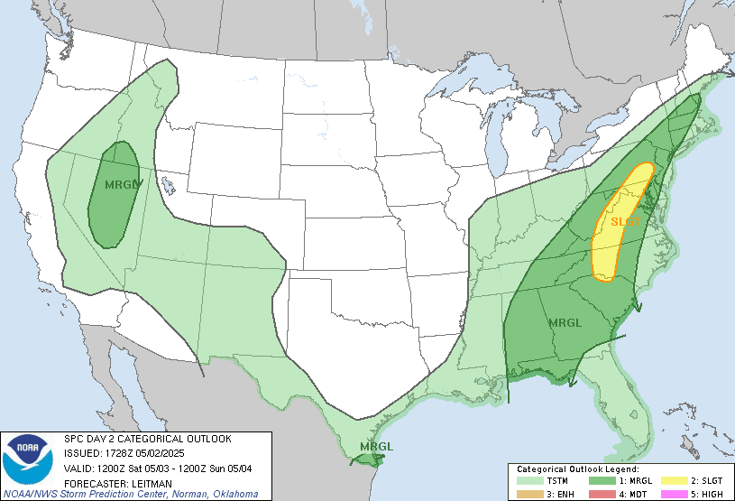
Rain could be heavy at times.Tomorrow night the cold front is going to stall, this will keep us unsettled heading into Sunday, on Sunday we're going to see low pressure get cut off from the main flow over the Southwest US at the same time we're going to have low pressure dropping out of the Upper Midwest and this is going to end up getting a cut off low to our south. Both of these are going to allow southern air and moisture to push into our region. This will keep us unsettled for the next four to five days at least.
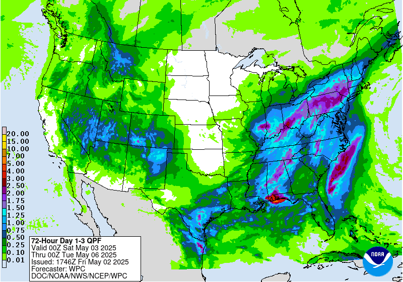
Tomorrow and at least the 1st half of Sunday, while not a complete washout, will be very wet. Then for the rest of Sunday, Monday and Tuesday we're going to see several waves move across the region keeping things unsettled during that time.
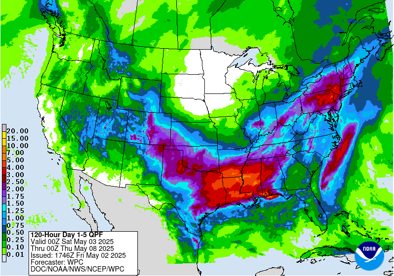
These charts from the Climate Prediction Center do show the northeast and mid Atlantic getting quite a bit of rain over the next 5 days. Those closer to where the cut off ends up setting up will see more rain than those to the north. But later Monday into Tuesday The cut off low is going to meander north and east heading towards the Great Lakes this will bring more widespread rain into northern parts of New York and northern to central new England. Then for Wednesday that cut off is going to meander a little bit to the east Away from the Great Lakes.
Then as we move from Sunday into Monday and Tuesday we are going to see several waves of energy move through that will keep the threat for scattered showers and isolated thunderstorms across the region.

While all of this rain is good news for those dealing with the dry and drought conditions It will also be good to negate some of the fire danger we've been experiencing the last few weeks. So while all that is good news, it also means that it's going to be very wet for those trying to get plants and crops into the ground. Here is a look at the current drought monitor, we can see that the northeast that the Mid Atlantic region into New England is still quite dry.

Later Wednesday The cold front toe system will finally Start to push things to the east. The cut off low looks to move off-shore on Thursday. But Thursday will not be completely dry; we will have a chance for isolated showers here and there Then on Friday another area of low pressure with a cold front will be approaching and moving through the region bringing more rain showers and a chance for isolated thunderstorms. Those with the greatest chance of seeing more in the way of widespread rain will be across eastern Pennsylvania, Maryland, Delaware, New Jersey into southern New England.
I want to wish all y,all a great weekend.
No comments:
Post a Comment
Thank you for taking the time to comment, I will answer as soon as I can.