
A really quick post for the week ahead.
The last couple of days have seen a lot of severe weather across the Northeast and Middle Atlantic. The system responsible for yesterday's severe weather is pulling away. But it's leaving a lot of cool weather in it's wake.
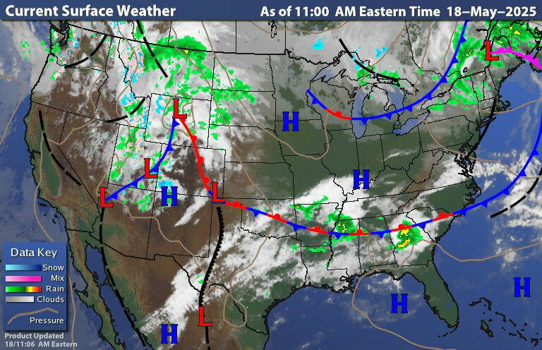

The surface chart and radar show the system slowly pulling away. We're dealing with the trough still over the region with lingering rain back over New York and New England. Tonight we'll see these lingering showers continue ahead of an approaching area of high pressure. The rain will slowly shift east as the high pressure moves in and sets up for tomorrow. Most of the regions should be dry tomorrow, but New England could still be dealing with some lingering showers due to the close proximity to the low. Maine could still see some of these lingering showers on Tuesday, but the region should be dry.
Tuesday night and Wednesday Low pressure will be approaching and moving through the region Southwest Pennsylvania will probably dealing with Some rain and isolated thunderstorms. Tuesday night, with the rain and storms moving north and east reaching Western New York State State by the afternoon on Wednesday. The rain looks to be reaching western New England Late in the day or early evening on Wednesday. At this point the the system looks to slow down, delaying the rain farther east. The rain should move in for places like Boston during a day on Thursday. For Maine it looks like the rain should hold off until later Thursday. During all of this rain will be heavy at times leading to the possibility of localized flooding.
This is going to be another slow moving upper level low with a surface low near the coast system. Southwestern PA should start clearing out on Friday The low is going to start to pull away from the region later friday; but we're still under the influence of the trough for a couple more days. So Saturday should feature scattered showers across the region. With slow clearing west to east Saturday night and Sunday,with rain lessening leading to more in a way of lingering showers across most of the region For Sunday. The further east east you are the longer you gonna hang on to the scattered rain for Sunday. Right now it's hard to tell if we are still be close enough to that trough to see a few rain showers on memorial day Monday but right now I'm going to keep the chance for rain in the forecast.

Image courtesy of tropical tidbits.
The entire week is gonna be cool with some areas dealing with frost issues at night; and could even challenge some record daytime lows for this time of year across the region.
Can't say I'm disliking this weathet.
ReplyDeleteRain is relenttless. Drought monitor must be happy. Thank you for your efforts
ReplyDeleteIt’s hard to get the outside work done with all the rain but I do like the cooler temps.
ReplyDelete