
Here is the 250 mb pattern over North America.
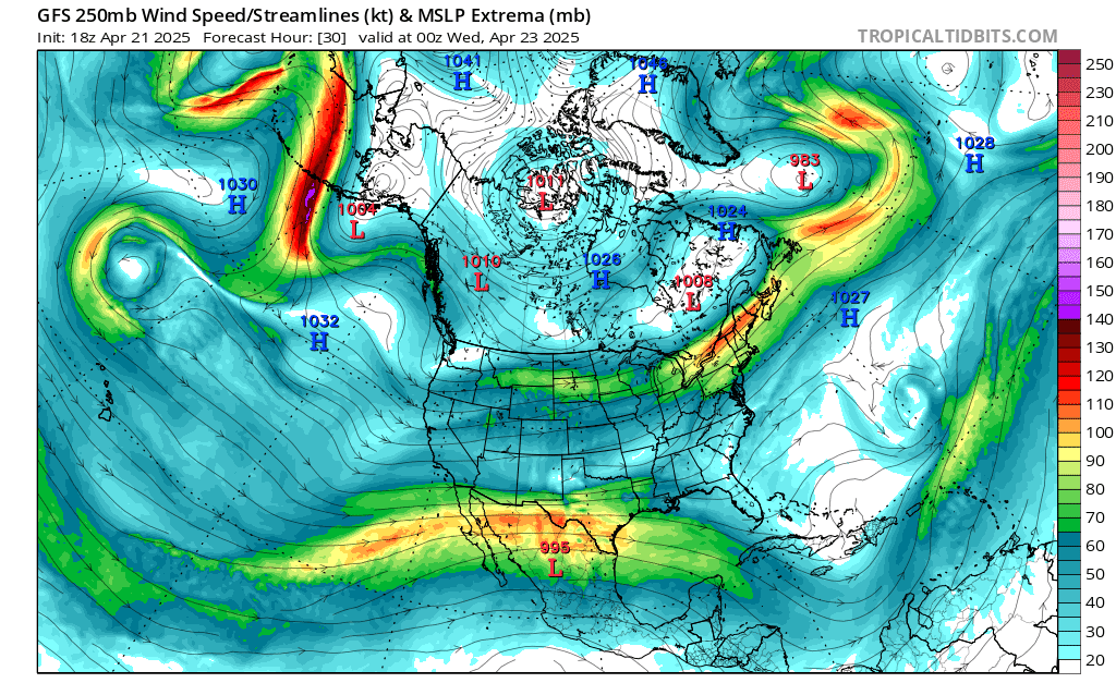
Courtesy of tropical tidbits.
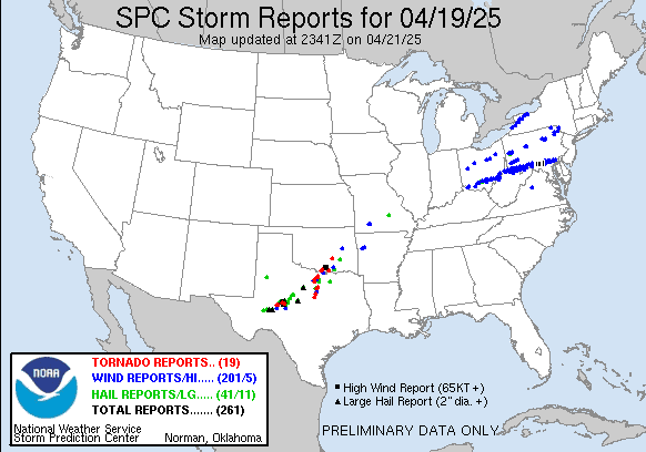
When we look at the upper atmosphere over the United States We need to look at the overall jet stream pattern right now our jet stream is actually Fairly quiet and weak. So we're gonna see more in the way of a zonal weather pattern where things flow from west to east. This should allow the current active severe weather pattern that has left several tornadoes and lots of wind damage over the last couple weeks. A lot of the severe weather Has been in the planes southeast and midwest, but Saturday there were dozens of reports of wind damage across Pennsylvania into parts of New York State.
The current jet stream pattern Should slow down the severe weather outbreaks quite a bit.

We have an area of low pressure up over the great lakes Along with a leading warm front; followed by a trailing cold front approaching from the west that will be sliding through the region, out ahead of the front we have scattered showers and isolated thunderstorms. Rain could be locally heavy at times. Due to high pressure off the east coast this front is going to continue to weaken as it pushes east, Show severe weather should be kept in check. Earlier today, there were more in the way of widespread thunderstorms across western parts of our region a few of these produce some damaging winds; There was also a tornado warning issued in western New York. The SPC did have a marginal risk for some strong severe storms over western parts of our region. Behind the front dryer air is moving into the region. show the upper atmospheric dynamics have changed and we no longer have a risk for severe storms.
During the overnight and tomorrow The cold front Will be moving through as as high pressure builds into the region, leading to slightly cooler temperatures but sunny weather. As the week goes on we will see a warming trend develop.
Thursday and Friday are going to be very warm as high pressure sets up overhead.when we get into friday another cold front will approach and then slide through Friday evening and Saturday. This will bring the chance for scattered rain showers and isolated thunderstorms. Severe weather potential will depend on the timing of the frontal passage. As the cold front slides in we will see temperatures cool off For the weekend. Sunday and Monday will see high pressure move in providing dry and tranquil conditions.
Next week The upper level pattern is going to reverse and I think we're going to see a big return of severe weather from the Plains into the East.
Tomorrow we're going to have the lyric Meteor shower .To view this Get away from city lights and find the constellation Lyra In the sky We could see 5-10 meteors per hour. We're also going to have a chance to possibly view the Northern Lights, especially over northern New York and northern New England.
Another weekend with rain or snow lol. I coach a university track team. Snowed out a week ago and rain every other weekend. Thank you for sticking with this. It's your passion, don't let anything dampen it. We are blessed by your insights
ReplyDeleteThe pattern has been wet. I get extremely busy; but I do enjoy meteorological related subjects.
DeleteThank you. Hope all is well.
ReplyDeleteYou're welcome, things are going very well
DeleteI love your forecasts. Keep them coming when you have time. It's almost time for the summer outlook. What what's going on with the enso?
ReplyDelete