
Today is very mild. Widespread rain and embedded thunderstorms are working there way across the region today.
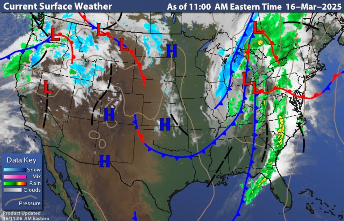

An
approaching cold front will bring the threat for strong winds and severe
thunderstorms. Those at the highest risk for seeing severe thunderstorms will
be south and west of Central New York State. Across the rest of the region
gusty thunderstorms will be possible, some of these could be on the strong
side. The main risk today will be damaging winds, with gust as high as 70 mph,
along with heavy rain. Hail and isolated
tornadoes are also possible; a Tornado Watch is in effect across western
Pennsylvania until 4 PM.

The SPC has
a Slight Risk for severe weather across part of Maryland (including DC),
western into central Pennsylvania and southwest New York State (including the
Finger Lakes), There is also an Enhanced Risk over all of western Pennsylvania
into extreme southwest New York State.
Wind advisories
and flood watches are up across parts of the region. With all the rain and extremely
mild temperatures, places like the Tug Hill region are at a high risk for
flooding due to runoff into streams and rivers. If you live near streams and
rivers, be aware of ice jams, there can be little to no warning if you’re going
to be hit by one.
Cold air is
going to come in behind the cold front, but it won’t last long. Tuesday into
Thursday will see a warming trend. The spring
equinox will arrive on Thursday at 5:01 a.m. ET.
No comments:
Post a Comment
Thank you for taking the time to comment, I will answer as soon as I can.