We made it to the last day of June and July is almost here.

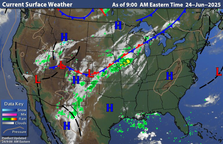
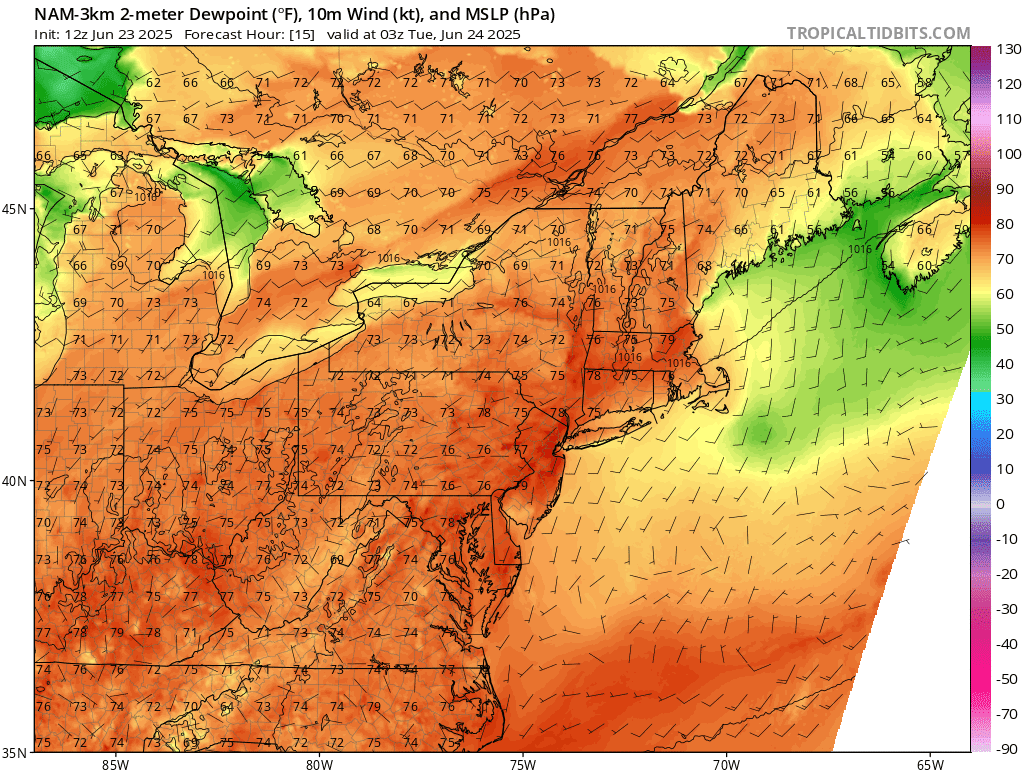
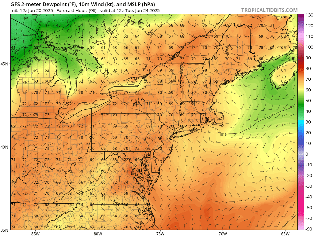
The surface chart shows high pressure sitting over the Northeast. The system moving into the Ohio valley, with the leading warm front. We also have that stationary front sitting over the northern middle Atlantic region Back in to Pennsylvania; that is going to start to move north today as a warm front. Ahead of the stationary boundary dew points are in the 60s; but south of the boundary we have a tropical air mass in place with dew points in the mid 70s.

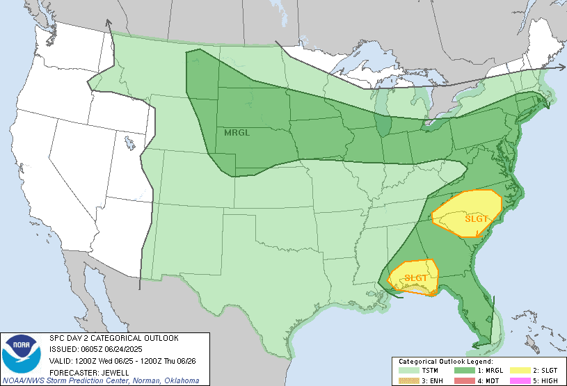
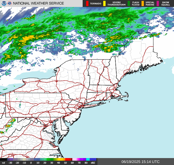
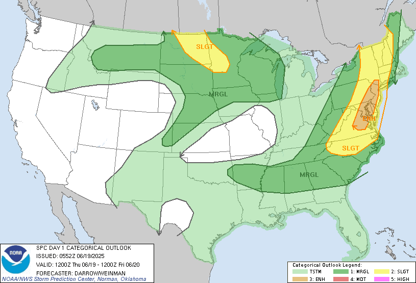
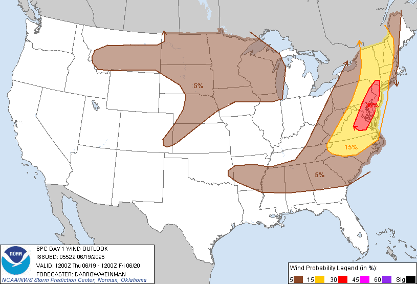
The radar shows rain showers ahead of the approaching warm front, we are gonna see rain breakout as that stationary boundary starts to slowly move north. Today we're going to have a southern flow that is going to pump the heat and humidity over the region. As these approach and through we will see scattered rain showers and isolated thunderstorms develop over Pennsylvania, Maryland, Delaware and New Jersey this afternoon, . Some of these thunderstorms will be strong to severe with the main danger being strong gusty winds, frequent lightning and heavy downpours. With the setup that is in place there will be a risk for localized flooding, due to slow moving thunderstorms. Here is a look at the Storm Prediction Center convective outlook, with a Marginal Risk for severe weather over Pennsylvania back down into the Middle Atlantic. Up over New York state and New England There will be quite a bit of sun, then clouds will start building late this afternoon into the evening as all this works its way north. New York State into New England can expect scattered showers and isolated thunderstorms this evening. I can't rule out a few of these being on the strong side, with gusty winds and heavy downpours the main danger. As the warm front advances the risk for a few thunderstorms will extend into and through the overnight. Temperatures won't cool too much tonight keeping it uncomfortable and muggy.

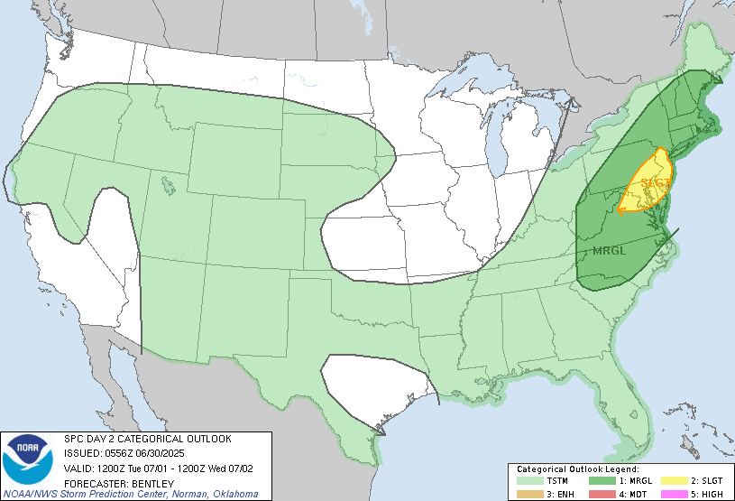
Tomorrow We'll start out hot then a prefrontal trough ahead.of the cold front will swing through, bringing scattered rain showers and thunderstorms. Some of these storms will be strong, with the risk being damaging winds, frequent lightning, very heavy downpours and maybe some hail. The tornado risk is low but not zero. Those with the greatest risk of seeing severe storms will be the eastern half of New York State into New England and the Middle Atlantic. The best timing for any severe weather will be during the afternoon and through the evening. Here is the convective outlook From the SPC on tomorrow's severe chances, we can see most of the region is under a Marginal Risk .But we do have a Slight Risk over the northern Middle Atlantic, including the I -95 corridor between New York City and Washington DC.
A cold front will swing through Wednesday. With the front we can expect isolated rain showers and thunderstorms. A secondary cold front will move through on Thursday Again this will bring the risk for rain showers and some thunderstorms. Behind the front, seasonal temperatures and lower dew points will move in for July 4th into the coming weekend. Sunday we will see an approaching cold frontal boundary. That will be dropped out of the Great Lakes and Canada. Ahead of the cold front there could be a few isolated rain showers over parts of northern New York State back down through western NYS and northwest Pennsylvania. The actual cold front will swing through on Monday with scattered showers and thunderstorms across the region.