
Cool cloudy and unsettled!

We have a warm front moving over western Pennsylvania into western New York State, along with a piece of low pressure sitting off the Mid Atlantic Coast, All of this is creating an onshore flow that's increasing the amount of clouds and adding to the showers. The radar image shows scattered rain showers and some embedded thunderstorms over New York State into New England, ahead of the warm front. As the rain continues to move north and east, rain will become much more isolated ahead of the front. The further away from the coast you are the better your chance of maybe seeing some sunshine breakout from time to time. For most of New York State, central and eastern Pennsylvania into the northern middle Atlantic this afternoon and evening should be mainly dry with the best chance for isolated showers up over New England, especially the further east you go.
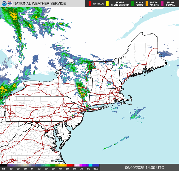
The surface chart also shows the trailing cold front approaching that's attached to the trough of low pressure that is over the Upper Plains and Great Lakes. Rain associated with the cold front is getting close to western parts of our region. Ahead of the front Isolated showers and thunderstorms will move into western Pennsylvania and western New York State later this afternoon. Some of the storms could be strong too severe. The storm prediction center has western Pennsylvania into the Finger Lakes at a Slight Risk For severe weather, with a Marginal Risk over western New York State and much of Pennsylvania.
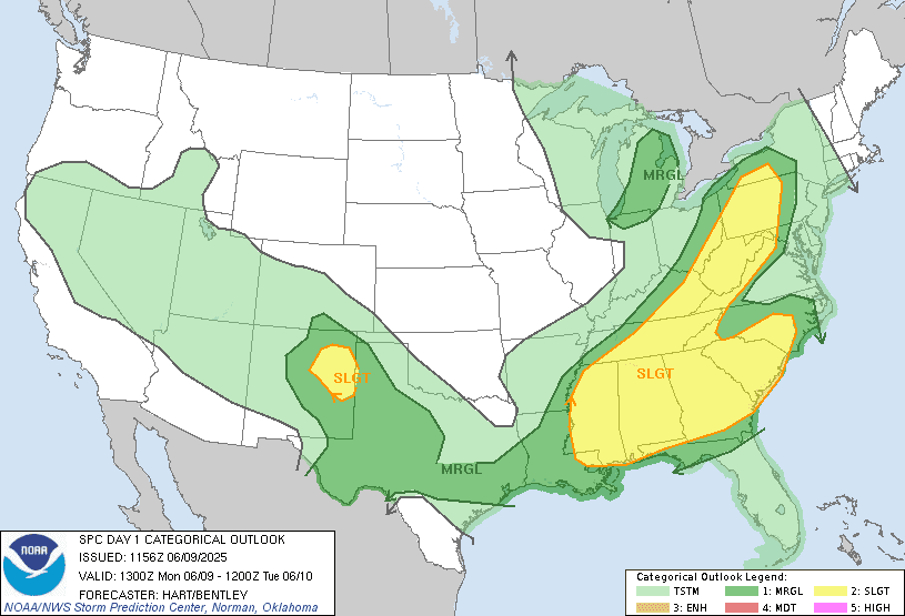
The biggest danger from the line of thunderstorms that could develop will be damaging wind, hail and heavy downpours. The tornado risk is low but not zero. The widespread steady rain will move into western areas this evening. As the rain moves eastward it should reach central parts of New York State late this afternoon into the evening. Again some of the thunderstorms could be strong to severe. We have an inversion layer overhead so some of the thunderstorms could be loud.
These fronts are slow moving So the rain should get into eastern New York state New England Maryland Delaware and New Jersey tonight and to tomorrow morning. Some of the storms could be on the storm too severe side The SPC has a Marginal Risk over part of the Middle Atlantic. Again the thunder could sound rather loud.
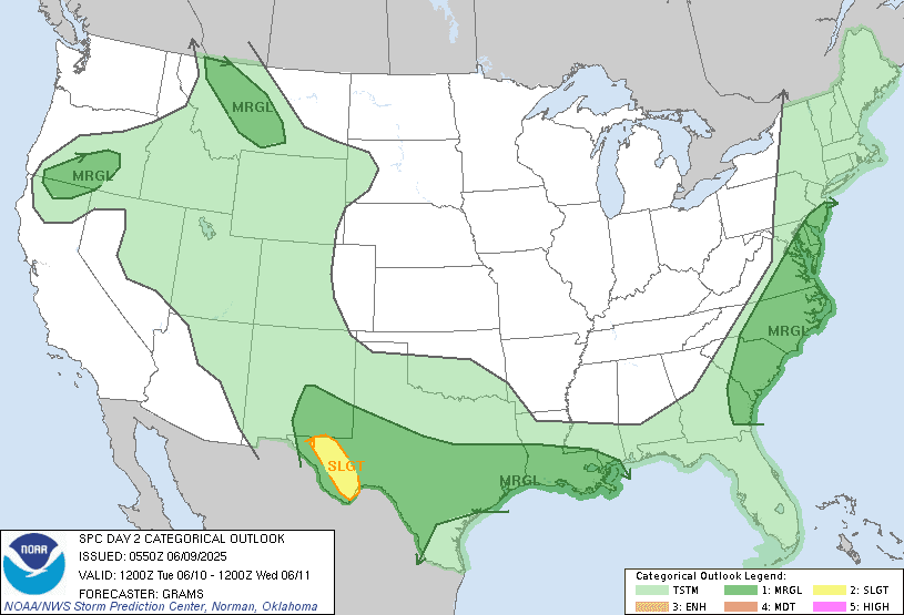
During Tuesday and Wednesday high pressure will be building into the region. As the cold front continues to push east we will see clearing develop Tuesday west to east with rain ending. For Wednesday Thursday and Friday temperatures will become warm but we will be dealing with a nearby frontal boundary that will be meandering around over New York State and New England will provide a chance for isolated rain showers But the vast majority of us shouldn't see too much in the way of rain. The closer you are to the boundary the greater chance of seeing rain.
On Saturday the frontal boundary will move south as a cold front Increasing the risk For scattered rain showers and thunderstorms for the Southern Tier of New York State, Southern New England into Pennsylvania and the Middle Atlantic. Sunday is looking to be mainly dry for most of us but those closer to where the front sets up will have a chance for some rain showers and thunderstorms. Then on Monday another area of low pressure will move through.Bringing rain showers and a chance for thunderstorms cooler weather to start next week.
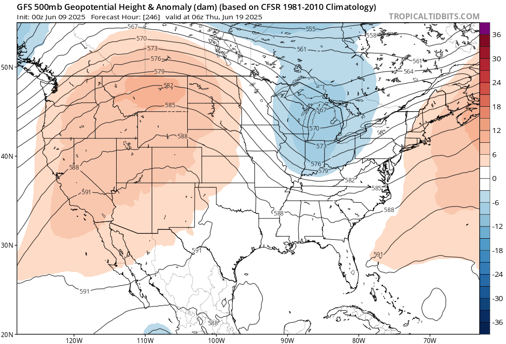
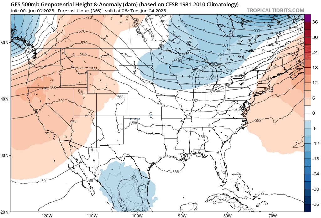
I've been asked when will we see prolonged heat? My answer is we might not see too much in the way of that type of heat. I touched on this in the summer outlook. Looking at the 500 millibar anomaly from tropical tidbits we can see these upper level lows and troughs continuing as we move through June. This is the pattern I was talking about in the summer outlook So the idea of staying somewhat relatively cool this summer shouldn't be a surprise. When I look ahead I see some heat that will stick around for a few days, then being followed by A few days to maybe a week or so of cooler than average temperatures. Given what the pattern looks like moving forward, heat waves might be hard to come by, as it may be hard to get three consecutive hot days.
No comments:
Post a Comment
Thank you for taking the time to comment, I will answer as soon as I can.