
I hope everyone had a nice Father's Day weekend.
When we look at the current surface chart.
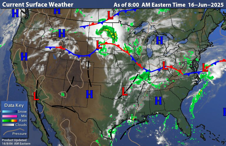
We can see we're still dealing with that stall out front of boundary just to our south.
So today is gonna be a carbon copy of what we saw yesterday. So expect New York state and new England To be mostly dry With partly cloudy skies with only a chance for stray shower here and there. Across Pennsylvania Maryland Delaware into New Jersey expect cloudy to mostly cloudy skies isolated rain showers and drizzle. Radar is deceiving cause it's not picking up all the drizzle.

But rain could be moderate to heavy at times for this reason there are flood watches out for Southwest Pennsylvania and western Maryland. These are the same areas that we're dealing with flash flooding over weekend.

A disturbance in the upper midwest and northern plains is going to head towards the Great Lakes. This will be responsible for a lot of severe weather in the central/northern Plains into the midwest today and tomorrow. The severe threat will be moving into the Tennessee and Ohio valleys on Wednesday.


The second half of this week into next week is going to see the heat and humidity start to push back into our region.
Precipitable Water (PWAT)
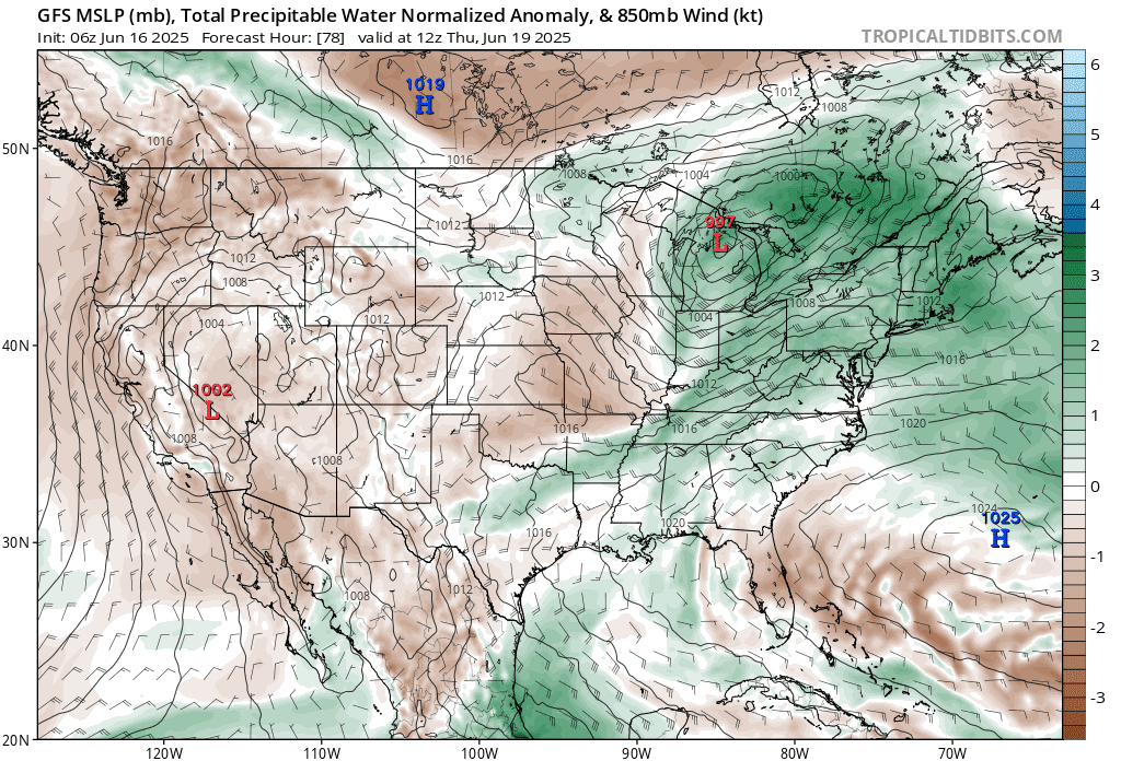
It's a way of determining the amount of atmospheric moisture at a certain point and time.
PWAT is very important when forecasting. But what is? It is the depth of a specific volume of water vapor in a column of air, if it were to become completely condensed, and how much of that would fall as condensed precipitation. It would be like if you squeezed a sponge that was completely saturated with water and how you would see all that water fall to the ground. So it gives us an idea where the heaviest rain and chance for flooding exist.
On Thursday we will see a cold front associated with the disturbance over the Great Lakes move into the region. This cold front will be moving into a very warm and humid air mass. Temperatures look to be in the mid to upper 80s and low 90s with dew points in the 70s.
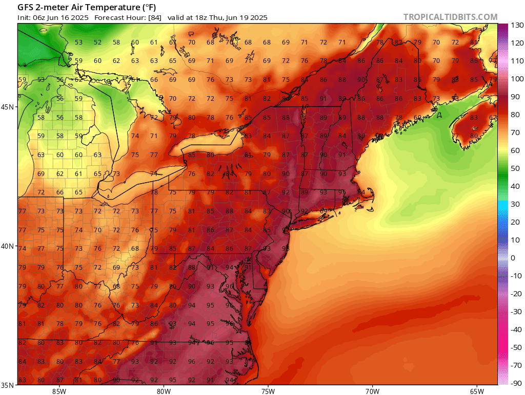
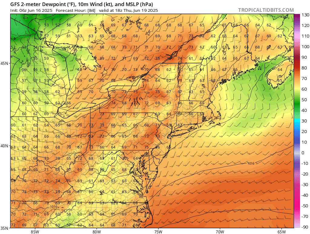
This will create an unstable air mass overhead. The timing of the cold front will be critical as to who sees any severe weather. Based on what the speed looks like right now. There's gonna be a good chance for severe weather across central and eastern Pennsylvania into New Jersey, Delaware and Maryland. There is a chance this severe weather could make it into southeast New York State but I'm not sold on the idea yet. The prime time For any severe weather would be roughly 2-9 PM. Based on how things look right now the biggest danger is going to be strong straight line damaging winds and the chance for heavy downpours. The storm prediction center (SPC) has outlined a rare 15% on Day 4 for a chance for severe weather.

Behind the front we will clear out and temperatures will cool off for Friday and Saturday As a secondary trough moves across the region .Then on Sunday we're going to see a strong ridge building in from the south with hot temperatures for a large part of the region for Sunday, Monday into Tuesday. Wednesday could still be hot but temperatures should be starting to decline.

No comments:
Post a Comment
Thank you for taking the time to comment, I will answer as soon as I can.