
The heat is on the way!
If you've been waiting for the heat you will be happy. But if you haven't then you better find some air conditioning.
We're going to have a very strong monster ridge built into the region. But before we can get there we have to go through a couple of days of rain and storminess, as a series of fronts are going to move through region.
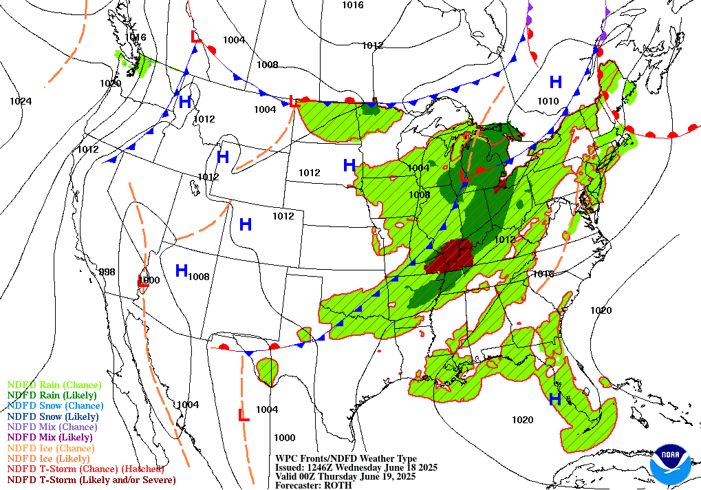
Here's a look at the current surface chart and radar.


Looking at the surface chart, we see that shortwave trough moving ahead of that frontal boundary that started moving north last night. The radar shows the rain showers and thunderstorms moving along and ahead of the frontal boundary. This warm front will continue to push north today and tomorrow. There will be a big temperature difference on the both sides of the boundary. To the north temperatures will be cooler. But those on the southern side of the boundary will see much warmer temperatures with rising humidity.
As the warm front lifts through Pennsylvania clouds will be giving way to some partial sunshine during the day. So scattered showers and isolated thunderstorms will be breaking out along and ahead of the front, It's possible some of these will make it into southeast New York State. How severe these storms get will depend on how much sunshine we see. Later in the afternoon a line of storms could form over Southeast Pennsylvania into New Jersey, Maryland, and Delaware. Some of these could be strong too severe. The main danger will be strong damaging wind gust (maybe even some microburst) and heavy downpours, There will also be a risk for some hail and frequent lightning. The tornado risk is low.
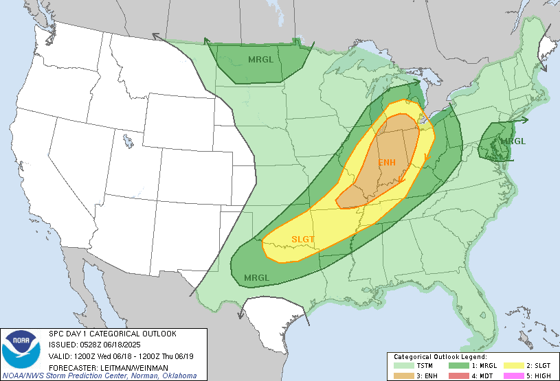
The storm prediction center SPC has a marginal risk for severe weather over parts of the northern Middle Atlantic.
They also have a marginal risk over western Pennsylvania and New York State. This afternoon into the evening Scattered showers and isolated thunderstorms Are gonna move over Lake Ontario and Lake Erie, then they're going to the move into New York state and Pennsylvania.Some of these storms could be strong too severe, with the main danger being strong gusty winds. But heavy rain Small hail and frequent lightning could also be an issue in some of the storms.
Tonight it's going to be very warm and humid.
For Thursday we're going to see Low pressure moving into Canada Along with a cold front approaching. As this slams into the hot and muggy air mass over the region; We will see widespread rain showers and scattered thunderstorms. Some of these storms will be strong to severe. The storms will start in western parts of region late tomorrow morning tracking east during the day and evening. Across Pennsylvania into the Middle Atlantic the main danger is going to be strong damaging winds, vivid lightning and heavy downpours.The tornado risk is low but not zero. But up over parts of New York State into New England in addition to the risk for damaging wind gust, frequent lightning and heavy downpours; there will also be a greater tornado risk as they will be closer to the area of low pressure to the north; this will create enough windshear (twisting) in the air to cause a slightly better chance for a few tornadoes to appear. With the high moisture content in the air the rain will be very heavy at times This will lead to a chance for some localized flooding. This will be especially true over southwest Pennsylvania into Maryland where they've been seeing a deluge of rain over the last few days.
Currently the storm prediction SPC has a Slight Risk for severe weather over the northern Middle Atlantic, eastern Pennsylvania Eastern and central New York State into New England. The Marginal Risk covers the rest of the region.

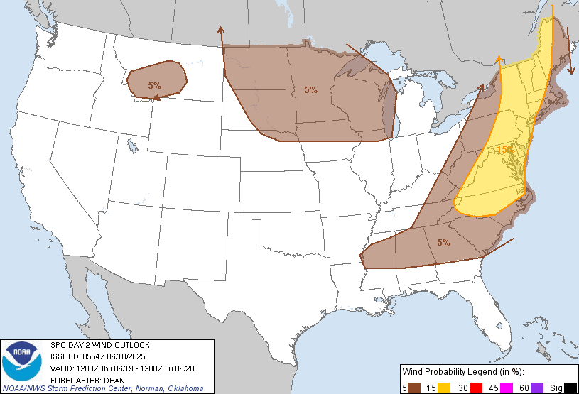
The Hail, Wind and Tornado risk From the SPC.


The front should be exiting main By the early afternoon.Behind it we will see clearing with sun breaking out from west to east.
For Friday into Saturday we will have a northwest flow that will temporarily bring in cooler (seasonal) temperatures and drive the humidity out here.
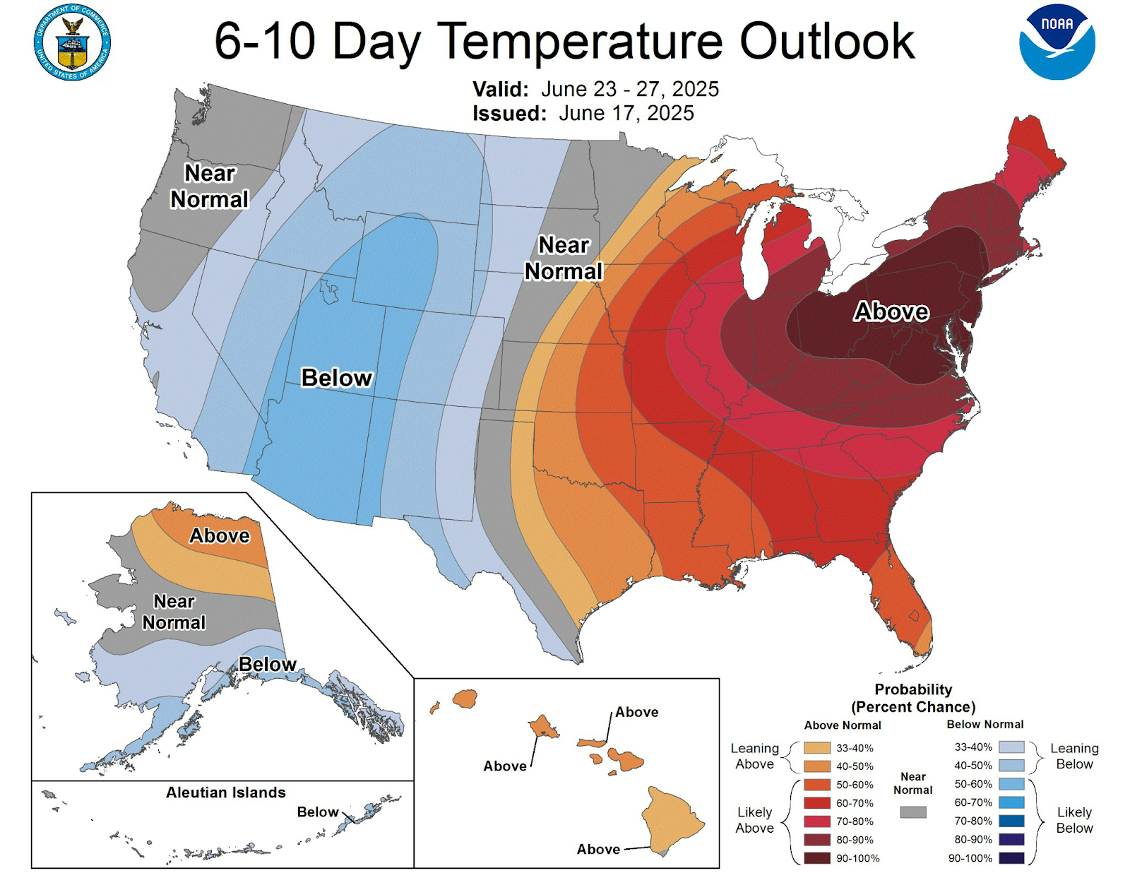
Next week we're going to have That monster ridge built into the region. The eastern half of the CONUS is going to get quite warm. It's going to be downright hot over the Middle Atlantic and Northeast. I've been talking about the coming heat for quite some time so it shouldn't be a big surprise.

So if you haven't run the air conditioning yet this year. You might want to put it in or check it out to make sure it's working. Because you're likely to need it.
Starting Sunday temperatures are really going to start to climb and humidity levels are going to get very high. The heat and high dew points are going to continue to climb for Monday into Wednesday. The heat for Monday and Tuesday is going to be near record to record breaking high temperatures, for this time of year. Temperatures will be in the mid to upper 80s into the 90s with dew points in the 70s as well. Pennsylvania and the northern Middle Atlantic region will likely see a heat wave out of this, which means at least three consecutive days of 90 °F or higher temperatures. By Tuesday Parts the I-95 corridor between Washington DC and New York city could see air temperatures up around 100°F. With the high dew points heat indexes of over 100°F are likely for many of us. So remember to drink plenty of water and remember your hot weather safety rules. New York State and New England will also see very high temperatures It will depend on how long the temperatures hold into Wednesday for to be considered an official heat wave. But regardless it's gonna be very hot and muggy. Wednesday night and Thursday should see a cold front bringing in cooler temperatures and drive the humidity out of here.
During this time we will have systems rotating around this ring of fire that could cause a few rain showers and maybe isolated thunderstorms for far northern parts of the region during this time period.
I will be posting later today, my current thoughts on the start of summer along with the drought outlook and how we got here.
No comments:
Post a Comment
Thank you for taking the time to comment, I will answer as soon as I can.