
This will dovetail into some of my points in the daily post.
This post is going to go over the the drought conditions and how we got to this point, with all the rain as well as touch on some of my thoughts When the deals will summer Pattern.
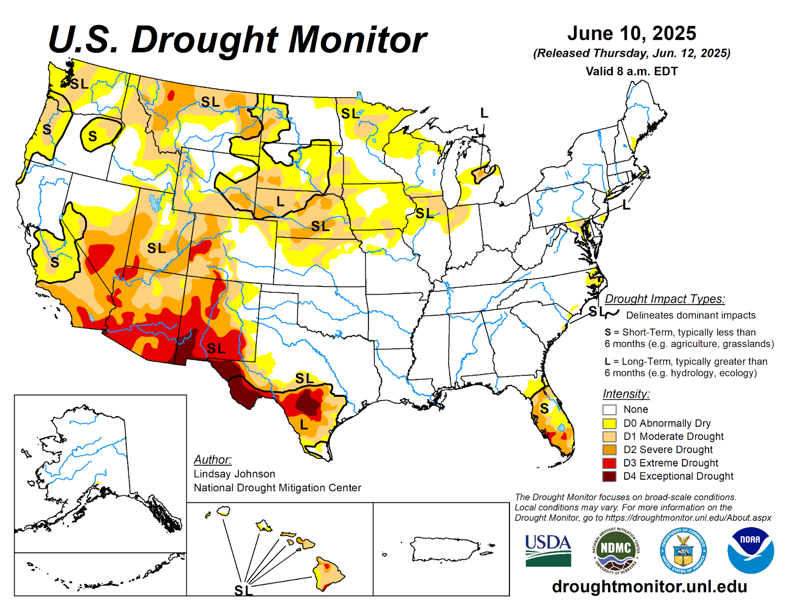
Back in March this was the drought conditions across the United States and Northeast.


The Bermuda High has been very expansive extending from the central Atlantic into the southeast United States.This has pumped a lot of moisture to stream north out of the gulf of Mexico and southeast United States, keeping the The southern Plaines and East Coast very wet for the last few months.


All of this has to do with sea surface temperatures (SST) in the Pacific and the Atlantic.

There have been four prominent high pressure ridges in the Northern Hemisphere, one over Eurasia, one in the north Pacific, one in the Gulf of Alaska and one in the northern Atlantic (Bermuda High)


On the above 925 mb we can see the predominant high pressure ridge in the Gulf of Alaska along with the Bermuda High sitting out in the Atlantic and how all this has translated to the surface.

June has seen the north pacific into the gulf of Alaska And North Atlantic including along the East Coast heat up a lot.
For June into July the pattern looks to have that strong high pressure ridge in the Gulf of Alaska which should looks keep the northern flow active with several short waves moving along it. The Bermuda high also looks like it's not going to be moving a heck of a lot. so I expect to see this moisture stream moving around it over the Atlantic Caribbean and Gulf then up Into Midwest and up the East Coast. This will likely lead to a general zonal flow Over the next few weeks with the moisture streaming northward the storms will have moisture to work with resulting in at least moderate amounts of rain.
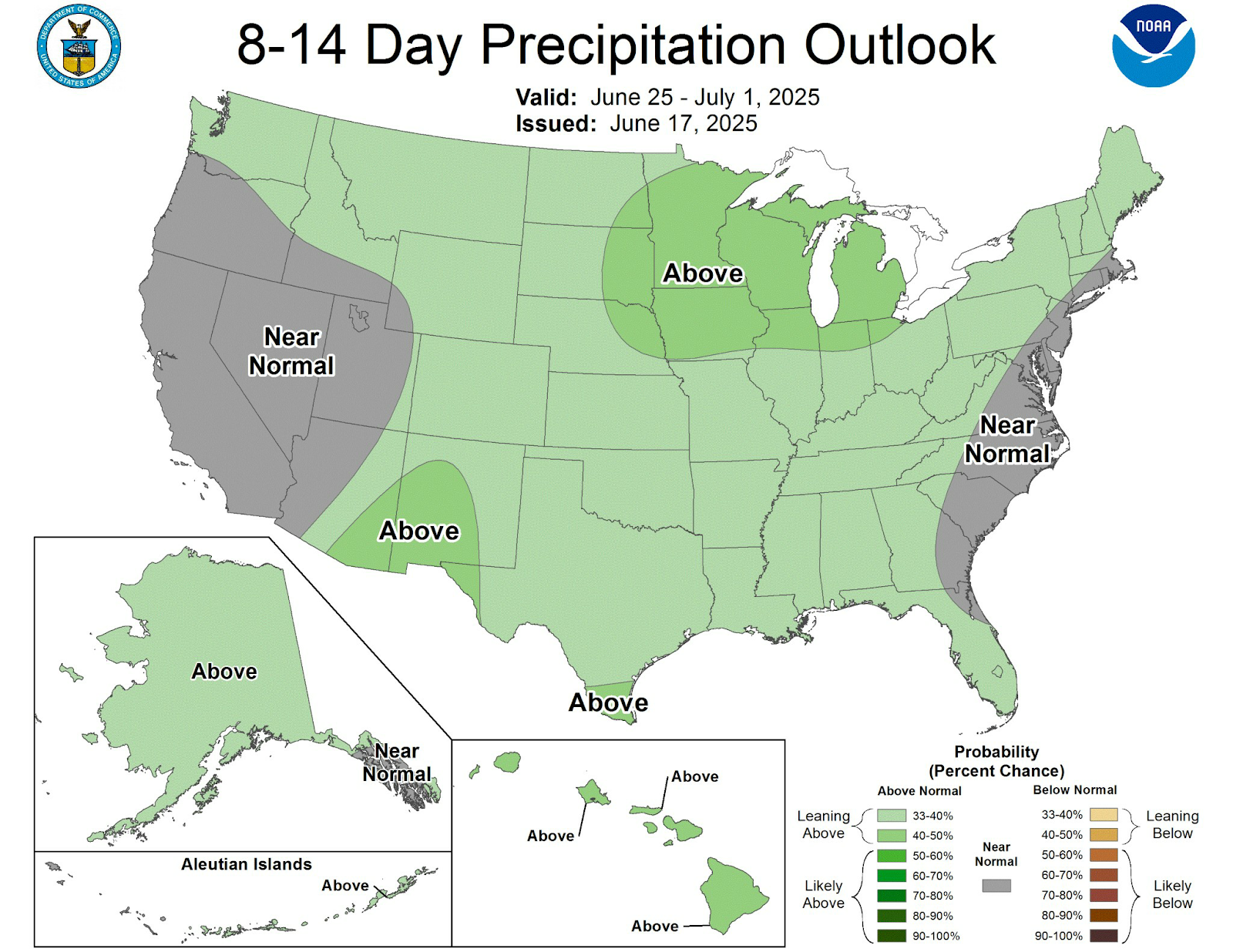
The climate prediction center (CPC) 8-14 day outlook shows much of our region in the Northeast back thru Pennsylvania see above average precipitation; with areas in the Middle Atlantic and southern New England closer to the coast seeing precipitation amounts of around average. This would correlate to the pattern I've been talking about for the last few weeks and the information I went over in this post.
Here are the 3 months seasonal out books From the CPC.


I still do think the CPC is overestimating the amount of warmth we're going to see over the next 3 months. But things like the one I discussed here, could make us a little warmer than I originally thought in the summer outlook I put out a few months ago. The CPC precipitation summer outlook, I do agree more with it. I think we will see enough rain to hold off any real wide spread drought issues as we head towards the fall. But there are going to be targeted areas that might become a little dry to abnormally dry over the summer time.
No comments:
Post a Comment
Thank you for taking the time to comment, I will answer as soon as I can.