
The current drought monitor Is showing the vast majority of our region is not experiencing any drought issues We do have some moderate drought conditions around cape cod and a few areas that are abnormally dry but that's about it.

This summer we have seen some heat and plenty of humidity. The humidity has kept our overall nighttime temperatures quite warm.
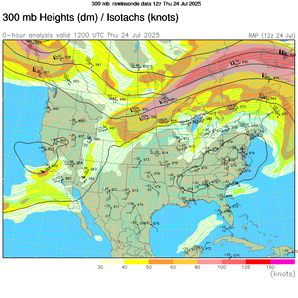
The pattern over North America this summer has been the result of a persistent high in the northern Pacific and a persistent strong Bermuda High in the Atlantic, The northeast has also had to deal with the trough up over eastern Canada And the southeast ridge flexing its muscles. This has led to an over all zonal flow with the jet stream. The warm sea surface temperatures off the southeast coast And in the Gulf of America has resulted in three tropical storms. The behavior of the jet stream and the southeast ridge has aloud a lot of moisture to stream out of the Gulf of America and off the southwest northern Atlantic. All of this has led to a lot of rainfall over parts of the Plaines into the Midwest along with The Northeast and northern Mid Atlantic; which has led to a lot of flooding events and quite a bit of severe activity here in the Northeast.
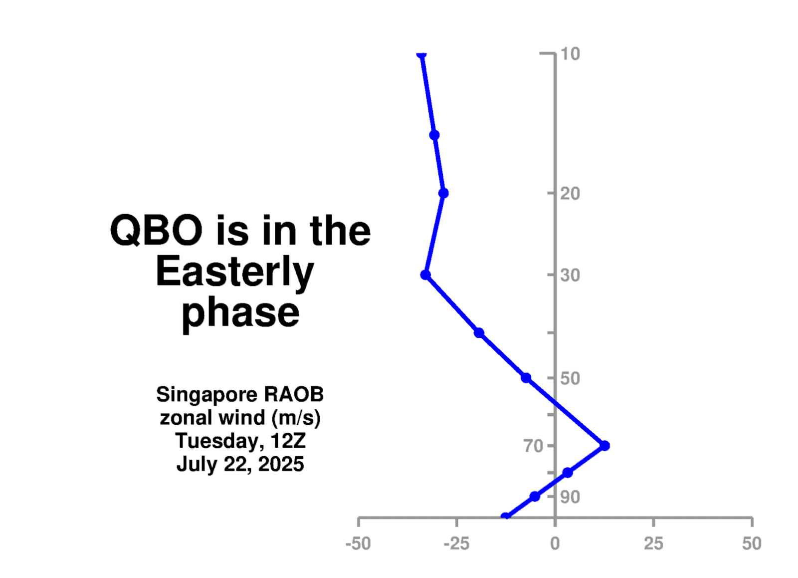
During august we typically see the pattern start to adjust to a fall winter pattern. This typically means we will see The polar air masses become slightly stronger. But the overall pattern still looks to continue We have a negative Eastern pacific Eastern pacific oscillation (EPO). The Quasi-Biennal oscillation (QBO) is in the easterly phase a Phase and the Madden Julian oscillation (MJO) looks to remain overall weak.

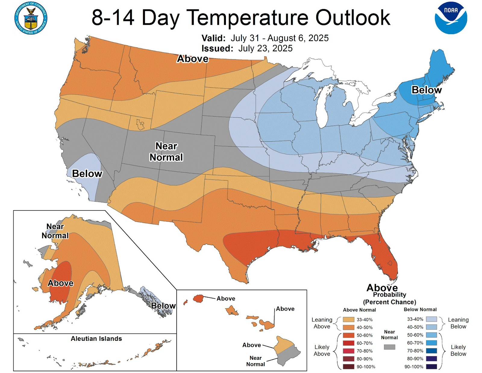
This is all indicating tropical forcing is going to remain rather weak during August. The climate prediction centers Overall then we have been seeing 8 to 14 Day temperature outlook is showing The Northeast and northern Middle Atlantic being cooler than it has been.
Looking forward we could see the Bermuda high kind of weaken and move north and east. If this occurs it would have an impact on August temperatures and precipitation patterns. So there are signs that we could see a cooler temperature swing as we get into August. But I know some of you are model huggers and I do want to caution you that I think the models are having a hard time with this transition from the summer to fall pattern. So they are overdoing it in terms of overall coolness. I think overall August is going to consist of a gradual change from what we've been experiencing here in July. But I still think we're going to see these swings in temperatures and humidity levels. But there might be a longer time in between these two changes. By that I mean We will likely see cooler temperatures and drier air come in for a few more days than we've seen Followed by a few more days of slightly warmer temperatures and higher levels of humidity. Overall I expect to see slightly below average temperatures to start out August and then we will transition to an average to slightly above average temperature pattern. But overall August could end up slightly below average. As far as rainfall I expect we will continue to see quite a bit of rain as we move through August.
Eastern Rensselaer County is drying up quickly. All of the rain in June is but a memory now. Outside of a thunderstorm early in the month, we have only .17 inches of rain so far in July. Hoping for more (any) rain in the next 4 days.
ReplyDeleteHopefully you will get some today
ReplyDelete